Earthquakes
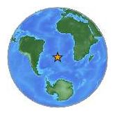
Saturday, December 25, 2010 at 13:16:37 UTC
Sunday, December 26, 2010 at 12:16:37 AM at epicenter
Time of Earthquake in other Time Zones
Location:
19.775°S, 167.895°E
Depth:
12.3 km (7.6 miles)
Region:
VANUATU REGION
Distances:
145 km (90 miles) W of Isangel, Tanna, Vanuatu
195 km (120 miles) N of Tadine, Loyalty Islands, New Caledonia
230 km (145 miles) S of PORT-VILA, Efate, Vanuatu
1740 km (1080 miles) ENE of BRISBANE, Queensland, Australia
The quake occurred at a depth of 63 miles south-southwest of the capital of San Juan, according to the U.S. Geological Survey.
Blanca Saez, Ports Authority spokeswoman, told the Associated Press that the international airport is operating as usual. She said six ceiling panels fell at the American Airlines terminal, but that no one was injured.
The earthquake was centered just a couple of miles from the central mountain town of Aguas Buenas.
Emergency officials and police told local media that no damage or injuries have been reported.
Heriberto Sauri, emergency management director, told El Nuevo Dia newspaper that crews would inspect buildings at daylight if necessary.
While such a magnitude is rated as "minor" on the Richter scale, the quake seized the attention of experts because it reached a strength that is very rare for the area.
Residents of the Wiesbaden and Mainz were startled by the deep rumbling that one observer likened to "a train or a truck were driving past the house."
Another observer compared the noise of the quake to "a railway train ... approaching," followed by a dull boom.
The quake occurred at 2:36 am and lasted a few seconds.
Thursday, December 23, 2010 at 14:00:33 UTC
Thursday, December 23, 2010 at 04:00:33 AM at epicenter
Time of Earthquake in other Time Zones
Location:
53.175°N, 171.218°E
Depth:
22.2 km (13.8 miles)
Region:
NEAR ISLANDS, ALEUTIAN ISLANDS, ALASKA
Distances:
137 km (85 miles) WNW (286°) from Attu Station, AK
407 km (253 miles) ESE (121°) from Nikol'skoye, Komandorskiye Ostrova, Rus.
838 km (521 miles) E (84°) from Petropavlovsk-Kamchatskiy, Russia
3125 km (1942 miles) NE (42°) from TOKYO, Japan
Wednesday, December 22, 2010 at 21:49:39 UTC
Thursday, December 23, 2010 at 07:49:39 AM at epicenter
Time of Earthquake in other Time Zones
Location:
26.780°N, 143.635°E
Depth:
11 km (6.8 miles)
Region:
BONIN ISLANDS, JAPAN REGION
Distances:
145 km (90 miles) ESE of Chichi-shima, Bonin Islands, Japan
320 km (200 miles) NE of Iwo Jima, Volcano Islands, Japan
1050 km (650 miles) SSE of TOKYO, Japan
Tuesday, December 21, 2010 at 17:19:41 UTC
Wednesday, December 22, 2010 at 03:19:41 AM at epicenter
Time of Earthquake in other Time Zones
Location:
26.866°N, 143.739°E
Depth:
14.9 km (9.3 miles)
Region:
BONIN ISLANDS, JAPAN REGION
Distances:
155 km (95 miles) E of Chichi-shima, Bonin Islands, Japan
335 km (210 miles) NE of Iwo Jima, Volcano Islands, Japan
1050 km (650 miles) SSE of TOKYO, Japan

The quake struck late Monday and was felt hardest in mostly rural, relatively sparsely populated areas of Kerman province.
Felt as far away as the Pakistan-Afghanistan border, the quake was particularly strong between the cities of Zahedan and Bam. It struck late at night and hardest in mostly rural, relatively sparsely populated areas of Kerman province, officials said. "Considering the dimensions of the damage, the death toll is expected to rise," the governor general of Kerman was quoted as saying by the IRNA news agency.
Citing eyewitnesses, another state-run news agency IRNA reported that scores of people are trapped in debris of buildings that have been destroyed. Many such sites are in hard-to-reach locations, making any rescue operations even more difficult. Additionally, at least seven aftershocks struck in the four hours since the 6.5-magnitude quake hit at 10:12 p.m. Monday night, according to the Iranian Seismological Center, based at the University of Tehran, and the U.S. Geological Survey.
Javad Kamali, a deputy governor for Kerman province, told the IRNA that the tremor knocked down phone lines throughout the region. Military and law enforcement workers could communicate only using wireless technology, he added. Relief and recovery teams, some from outside the area, have converged around the village of Hosseinabad, between the towns of Fahraj and Rigan, Kamali said.
The Ethiopian Addis Abeba university published a report that the earthquake occurred in and around Hossana and had a Magnitude of 5.3. It happened at 3:15 local time.
Following ENA (Ethiopian News Agency) the earthquake lasted 19 seconds and was felt very well in the greater Hossana area.
Some traditional old earthen houses were demolished as a result of the earthquake
Some houses erected with modern materials were left with cracks in the walls.
No people were killed and it is uncertain if people have been injured.
Here are a few of the reports from our readers (they can also be read below our main article published shortly after the earthquake)
At 22:11 (10:11 PM) a very powerful and shallow earthquake occurred in the Iranian desert close to Road 93. Some smaller villages are located at a distance of 10 to 20 km from the epicenter.
These villages are: Kaskuh, Darundeh, Dulab, Nemetabad, Sangabad and Bagerabad.
Due to the kind of fault lines Iran earthquakes and the building methods exceeding M 6 are extremely dangerous. It will take a little before the Iranian press will publish more details on this earthquake (our experience based on many prior earthquakes).
The epicenter location has an error margin of 14.6 km.
USGS has calculated that about 735 people will endure a MMI VIII (Severe shaking). 19,000 people a VII, very strong shaking.
The city of Bam, destructed almost completely in another earthquake in a recent history, will get a V MMI shaking today.
Monday, December 20, 2010 at 18:41:59 UTC
Monday, December 20, 2010 at 10:11:59 PM at epicenter
Location:
28.439°N, 59.098°E
Depth:
12.4 km (7.7 miles) set by location program
Region:
SOUTHEASTERN IRAN
Distances:
213 km (133 miles) SW (236°) from Zahedan, Iran
283 km (176 miles) SE (136°) from Kerman, Iran
310 km (193 miles) ENE (63°) from Bandar-e Abbas, Iran
538 km (334 miles) N (5°) from MUSCAT, Oman
Comment: From USGS website: