Earthquakes
S


Cloud Lightning

SOTT Focus: Cyclones, Earthquakes, Volcanoes And Other Electrical Phenomena

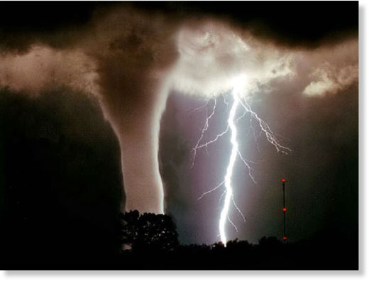
Tornado and Lightning
© Unknown
Recent events provide us with a great case study of the cosmic forces that may lie behind large storms such as cyclones, hurricanes, blizzards and much more. The recent events I speak of include the major blizzard that swept across the Midwestern and Eastern US as well as the punishment Cyclone Yasi inflicted on eastern Australia earlier last week. Both of these storms grew to enormous sizes during a time period that coincided with the Earth being lashed by a solar storm just following a New Moon. As strange as this may sound, this isn't the first time that celestial alignments along side of solar activity have spurred such events. If a correlation between these factors exists, as we suspect, then this overturns much of what is commonly believed about Earth weather and, as we'll see, even geology.

To understand how this all works, let's start with the sun. On January 31st a massive coronal hole opened up on the sun, hurling another sledgehammer of charged particles in the direction of Earth. This was due to impact us sometime between February 2nd and February 4th. Not only this, but we recently passed through a new Moon on February 2nd. But why is the Moon of any significance here, one might ask?

As James McCanney explains in an interview he did for Spectrum Magazine in 2003:
The [New] Moon moves in front of Earth, breaks that electrical flow [between the sun and Earth], and then moves out of the way. It gives us tremendous bombardment after that Moon moves out of the way, the first and second day after the New Moon. That's the condition that has been identified as being one of the leading causes of kicking-off major hurricanes and storms. What it does is: The Moon is interacting with the solar electric field. It's that CHANGE which causes the storms, and causes the environment around Earth to change, and thus affects Earth weather.
So the picture we're painting is this: The sun blasts a massive front of solar wind in the direction of the Earth. As the New Moon moves out of the way of the sun and Earth, this, by itself, creates a significant increase in charged particles hitting the Earth. With the excess of charged particles from this solar storm hitting us near simultaneously, all of this excess charge ends up in the radiation belts surrounding the Earth. The Earth then finds ways to discharge this imbalance such as these two major storms we've seen. One storm takes the form of a massive blizzard covering about half of the US. The other takes the form of a cyclone storm, Yasi, that pounds the already flooded east coast of Australia. Increased volcanic and earthquake activity was also noted during this time as well.
Bizarro Earth

Myanmar - India Border: Earthquake Magnitude 6.4

Myanmar-India Quake_040211
© USGSEarthquake Location
Date-Time
Friday, February 04, 2011 at 13:53:47 UTC

Friday, February 04, 2011 at 08:23:47 PM at epicenter

Time of Earthquake in other Time Zones

Location
24.616°N, 94.740°E

Depth
88.8 km (55.2 miles)

Region
MYANMAR-INDIA BORDER REGION

Distances
85 km (50 miles) ESE of Imphal, Manipur, India

130 km (80 miles) SSE of Kohima, Nagaland, India

690 km (425 miles) ENE of Kolkata (Calcutta), West Bengal, India

1800 km (1120 miles) E of NEW DELHI, Delhi, India

Smoking

Phivolcs: Taal Volcano shows increased activity

Taal Volcano in Batangas showed heightened activity anew after at least 10 volcanic quakes around it were recorded in the last 24 hours.

In its 8 a.m. Wednesday bulletin, the Philippine Institute of Volcanology and Seismology (Phivolcs) said the alert level at Taal remains at "1."

"Taal Volcano's status at Alert Level 1 means that a hazardous eruption is not imminent. However, the public is reminded that the Main Crater should be strictly off-limits due to sudden occurrence of steam explosions and accumulation of toxic gases," it said.

Phivolcs said the northern rim of the Volcano's main crater - in the vicinity of Daang Kastila trail - may also be dangerous when increased steam emission is reactivated along existing fissures.

Phivolcs reminded the public that the entire Volcano Island is a Permanent Danger Zone (PDZ), and permanent settlement in the island is strictly not recommended.

Bizarro Earth

US: Earthquakes rattle Wyoming

Image
© USGS
Minor earthquakes have rattled two areas of Wyoming.

The U.S. Geological Survey says a temblor with a magnitude of 3.0 struck early Tuesday about 25 miles northwest of the ghost town of Jeffrey City.

The quake comes almost a week after another minor earthquake struck Wright. A 3.2 magnitude earthquake struck at 10:16 p.m. Thursday. It happened just 7 miles northeast of Wright, about 5 miles underground.

At first the USGS thought it might be a mine blast, but later deemed it a genuine earthquake.

David King, Campbell County's emergency management coordinator, said the county sits on several fault lines which have caused 10 recorded earthquakes since 1967.

Thursday's quake is the county's fourth quake since 2000. Quakes in 2009, 2008 and 2004 all occurred about 17 miles underground away from Gillette at a magnitude of about 2.5.

The county's largest earthquake occurred in September 1984 west of Gillette by the Johnson County line at a magnitude of 5.1. There were two other earthquakes in the county that year - a magnitude 5 and 2.5.

There are no recorded earthquakes in Gillette.

Bizarro Earth

US: Earthquake Magnitude 3.1 - Idaho

Image
© USGS
Geologists say a small earthquake has rattled a remote and unpopulated area west of the central Idaho town of Salmon.

The U.S. Geological Survey reports a quake with a magnitude of 3.1 was detected Tuesday at 4:25 a.m. in rugged, mountainous terrain 29 miles west of Salmon near the former mining town of Cobalt.

The quake was first detected by staff at the Earthquake Studies Office at the Montana Bureau of Mines and Geology. Director Mike Stickney says a 3.1 magnitude is barely enough to cause people to notice and it's not likely the tremor caused any serious damage to the landscape.

Stickney says it's not uncommon for small quakes to jolt the vast, mountainous backcountry north of Salmon and Challis.

Bizarro Earth

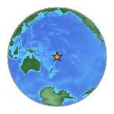
Tonga - Earthquake Magnitude 6.0

Tonga Quake_310111
© USGSEarthquake Location
Date-Time
Monday, January 31, 2011 at 06:03:26 UTC

Monday, January 31, 2011 at 07:03:26 PM at epicenter

Time of Earthquake in other Time Zones

Location
21.943°S, 175.510°W

Depth
68.6 km (42.6 miles)

Region
TONGA

Distances
95 km (60 miles) SSW of NUKU'ALOFA, Tonga

360 km (225 miles) ESE of Ndoi Island, Fiji

400 km (245 miles) SSW of Neiafu, Tonga

1905 km (1180 miles) NNE of Auckland, New Zealand

Bizarro Earth

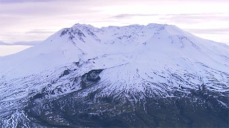
Swarm of nine earthquakes at Mount St. Helens

Mount St. Helens, Washington - A series of nine small earthquakes shook an area near Mount St. Helens over the weekend.

mt.st.helens
© Susan Wyatt/ KING 5 News
Seismologists at the University of Washington have been monitoring the quakes.

A 2.6 quake occurred at 2:26 p.m. on Saturday about six miles north of the volcano. Another quake, a 2.5, occurred at 2:44 p.m. in the same area. The depth for both quakes was two miles. Another quake occurred six miles north-northwest at 10:48 p.m. That measured 2.2 and was 2.2 miles deep.

Smaller quakes, ranging from magnitude 1.3 to 2.2, occurred on Sunday.

Bizarro Earth

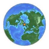
Jan Mayen Island Region: Earthquake Magnitude 6.1

JanMayen Quake_290111
© USGSEarthquake Location
Date-Time
Saturday, January 29, 2011 at 06:55:26 UTC

Saturday, January 29, 2011 at 06:55:26 AM at epicenter

Time of Earthquake in other Time Zones

Location
70.965°N, 6.778°W

Depth
9.5 km (5.9 miles) set by location program

Region
JAN MAYEN ISLAND REGION

Distances
560 km (350 miles) ENE of Ittoqqortoormiit (Scoresbysund), Greenld

710 km (440 miles) NNE of Neskaupstadur, Iceland

975 km (600 miles) WNW of Tromso, Norway

2010 km (1250 miles) NE of NUUK (GODTHAB), Greenland

Bizarro Earth

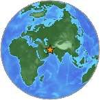
Southeastern Iran: Earthquake Magnitude 6.0

Iran Quake_270111
© USGSEarthquake Location
Date-Time
Thursday, January 27, 2011 at 08:38:28 UTC

Thursday, January 27, 2011 at 12:08:28 PM at epicenter

Time of Earthquake in other Time Zones

Location
28.185°N, 58.968°E

Depth
10.7 km (6.6 miles) set by location program

Region
SOUTHEASTERN IRAN

Distances
241 km (150 miles) SW (232°) from Zahedan, Iran

287 km (178 miles) ENE (67°) from Bandar-e Abbas, Iran

296 km (184 miles) SE (141°) from Kerman, Iran

509 km (316 miles) N (4°) from MUSCAT, Oman

Bizarro Earth

Shallow 3.9-Magnitude Quake Rattles Southern Idaho

A shallow earthquake with a magnitude of 3.9 has rattled parts of southern Idaho near the Wyoming and Utah borders.

The United States Geological Survey says the temblor struck Tuesday night about 9 miles southwest of Georgetown.

USGS says the epicenter was less than a mile underground.

Bear Lake County Sheriff's dispatcher Gene Perkins says no reports of damage or injuries were reported. He says he felt his chair "move just a hair" as he was sitting at home at the time of the quake.