Earth ChangesS

Sun

Famine fears as worse drought in decade hits North Korea

North Korea DMZ
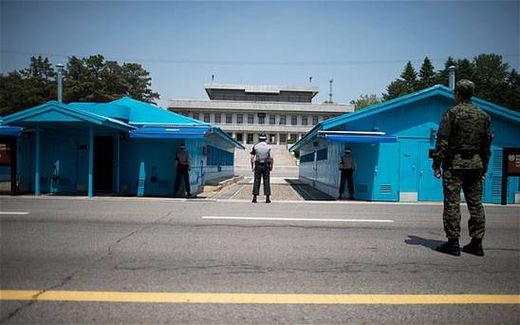
© Ed Jones/ Getty ImagesSouth Korean soldiers face the Northern Korea border, in the Demilitarized Zone (DMZ) between North and South Korea on 14th May 2014.
North Korea's rivers, streams and reservoirs are running dry in a prolonged drought, state media has said, prompting the isolated country to mobilise some of its million-strong army to try to protect precious crops.

The drought is the worst in North Korea for over a decade, state media reports have said, with some areas experiencing low rainfall levels since 1961.

Office workers, farmers and women have been mobilised to direct water into the dry floors of fields and rice paddies, the official KCNA news agency said.

In the 1990s, food shortages led to a devastating famine which killed an estimated million people but gave rise to a fledgling black market that in some areas now provides the food the government can no longer supply.

Butterfly

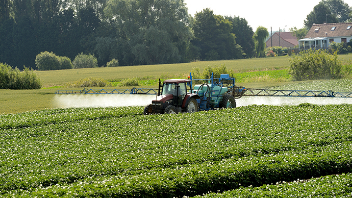
Neurotoxic pesticides linked to honeybee decline are affecting other species, scientists say after four-year assessment

Pesticide spraying
© AFP Photo / Denis Charlet

Neurotoxic pesticides blamed for the decline of honeybees is also harming butterflies, worms, fish, and birds, and contaminating habitats worldwide which are crucial for food production and wildlife, scientists have concluded after a four-year assessment.

Societal regulations have not stopped habitats from being poisoned, said the analysis, despite neurotoxic pesticides already being held responsible for the global collapse in the bee population.

"Undertaking a full analysis of all the available literature (800 peer reviewed reports) the Task Force on Systemic Pesticides - a group of global, independent scientists has found that there is "clear evidence of harm sufficient to trigger regulatory action,"
a press release accompanying the report noted.

Twenty-nine scientists from four different continents conducted the study, which found the unmistakable evidence of the link.

Bizarro Earth

Second Greeley, Colorado earthquake halts injection site work

Colorado oil and gas regulators have halted work at a Greeley wastewater injection site after a second small earthquake was detected in area on Monday.

The Colorado Oil and Gas Conservation Commission, which regulates the oil and gas industry, ordered High Sierra Water Services to stop injecting wastewater into the site for 20 days while researchers try to determine if the site is the epicenter of recent seismic activity in the area.

Preliminary reports indicate the magnitude 2.6 earthquake, recorded at 12:27 p.m. Monday, struck approximately 5 miles northeast of Greeley, or 15 miles due east of Windsor, the United States Geological Survey said. It struck at a depth of approximately 5,000 meters.

A May 31 earthquake registered at 3.4 on the Richter scale and was felt across that same area of Weld County. That shaker, at nearly 8,000 meters below the surface, rekindled a debate over oil and gas activity's impact on earthquakes. Earthquakes are relatively rare along the plains and areas of Northern Colorado.

Wastewater injection sites dispose of water used in the hydraulic fracturing process, a oil and gas extraction technique that also injects chemicals into shale formations. Some water used in this process is later returned to the Earth, and is typically injected into depths well below aquifer levels.

Colorado has some history of wastewater injection sites triggering quakes. In 2011, Trinidad was shaken by a flurry of unusual earthquakes later connected to a nearby wastewater injection project, according to USGS studies.

In wake of that earthquake, a group of Boulder scientists planned to dispatch study groups to the Greeley area to further study the incident.

There are approximately 30,000 earthquakes with a magnitude between 2.5 and 5.4 across Earth every year. There are more than 900,000 reports of seismic activity worldwide with a magnitude of 2.5 or less.
Snowflake Cold

Killing freeze predicted for U.S. Midwest this Fall

simon atkins weather
Simon Atkins
An early freeze in the Great Plains may cut corn production by 8%, according to Simon Atkins, CEO of Advanced Forecasting Corporation, who presented his long-range forecast in a webinar on Monday.

The cause: above-average volcanic eruptions around the world for the last nine months, including three in the last month - in Eastern Russia, Alaska and Indonesia. The release of sulfur into the atmosphere from volcanic eruptions reflects sunlight back out to space.

The meteorologist predicted cooler-than-normal summer temperatures "because of well-above-normal volcanic eruptions going back to the fall of 2013. We are not going to see many hot periods. Sure, there will be a few days here and there where temperatures reach 100 degrees in Oklahoma, but it's not going to be very common."

"What's going to be more common is more moisture coming in off the Eastern seaboard of the U.S., and it will be pushing frontal boundaries from east to west, cooling down even parts of the Midwest in July and August," he continued. "We think the first two weeks of September will be warmer. But then it will be getting quite a bit colder toward the end of September, and even into October."

These cooler temperatures could damage the corn crop, Atkins explained.

"We think there's going to be an early frost [in the Plains west of Kansas], which could reduce the number of bushels per acre of corn - maybe by around 8%, our current rate of prediction," he said. "It will be a killing freeze, at least 10 to 15 days earlier than normal."

Meanwhile, Atkins expects flash flooding in the Midwest this week, from Nebraska down to Arkansas, even reaching into parts of the Tennessee River Valley. "Some of these winds will reach 80 miles per hour with hail, producing lots of flash flooding. Some fields in the Midwest will suffer from too much rain," he said.

Comment: As happy as the increase in rainfall will make some farmers in the short term, this is one of the precursors of the onset of a new Ice Age. The increase in rainfall, coupled with temperatures that don't reach expected summer highs, means that winter snows never really go away. This increases the reflection of solar radiation away from Earth, further causing the temperature to fall. The cycle is self-reinforcing. Add to that the reflecting properties of volcanic eruptions, and the cycle speeds up even more.

Fire and Ice: The Day After Tomorrow
Volcanoes Played Pivotal Role In Ancient Ice Age, Mass Extinction
Forget warming - beware the new ice age


Windsock

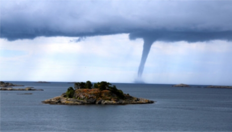
Series of rare mini-tornadoes stun southern Norway

Image
A succession of rare 'mini tornadoes' have drawn crowds in the city of Arendal as they circled dramatically above the Skagerrak strait between Norway and Denmark.

"It looked like the sort of thing you'd see on an American documentary or something," Espen Bierud from Norway's Institute of Marine Research, which faces onto the sea, told The Local. "Many people standing around me said they'd never seen anything like it in Norway."

He said that work at the Institute had ground to a halt as the researchers made their way outside to enjoy the spectacle.

"It didn't take too many seconds before everyone at the Institute was down at the balcony or on the dock taking pictures," he said. "It lasted for about 20 or 30 minutes, and there were at least four different tornadoes."


Snowflake

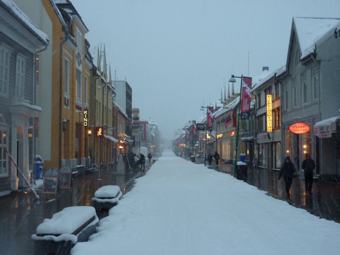
First June snowfall in Tromso, Norway since records began

Image
The northern Norwegian city of Tromso experienced a freak summer snowfall on Monday after freezing wind from the North Pole saw temperatures plummet.

It was the first time since records began that the city had seen snowfall in June. Local meteorologist Trond Lien said that sleet and snow showers hit the city on Monday night, and there has even been some snow lying on the ground. He said that the situation was "very rare", noting that it must have been a long time since it snowed on 16 June. He added that he had found records showing that Tromso had experienced snowfall in July, but he could find nothing to indicate snow in June.

Motorist Odd Arne Thomassen told reporters that he was driving over roughly four centimetres of snow when he was in Kvaenangsfjellet, in North Troms, early on Monday morning. He explained that it was not bad enough to make him feel he needed his chains on, but that there was certainly about four centimetres lying on the ground.

Yr.no, the weather forecasting venture between the Meteorological Institute and TV station NRK, predicted that other areas of the country would also experience snowfall. It said that high-lying areas of western and southern Norway would likely see snow, despite the fact that the capital Oslo is lapping up temperatures in excess of 20C.

Bizarro Earth

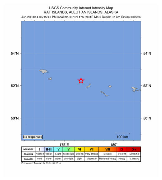
USGS: Earthquake Magnitude 6.6 - 52km E of Buldir Island, Alaska

Buldir Quake_240614
© USGS
Event Time
2014-06-24 03:15:41 UTC
2014-06-24 15:15:41 UTC+12:00 at epicenter

Location
52.307ยฐN 176.693ยฐE depth=35.0km (21.7mi)

Nearby Cities
52km (32mi) E of Buldir Island, Alaska
1220km (758mi) E of Petropavlovsk-Kamchatskiy, Russia
1237km (769mi) E of Yelizovo, Russia
1237km (769mi) E of Vilyuchinsk, Russia
3035km (1886mi) W of Whitehorse, Canada

Scientific Details

Snowflake

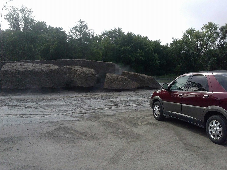
Minnesota still has snow on the ground from last winter

Image
© Chris Kuball, ABC 6
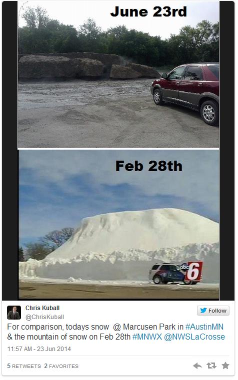
There is still snow on the ground in southern Minnesota.

You read that correctly. ABC 6 Meteorologist Chris Kuball tweeted a photo of a snow pile, that looks more like a rock, at Marcusen Park in Austin, Minnesota, Monday morning.

The park is a dumping site for snow in the area, Kuball says, and on June 23 there was still a pile of snow that was about 10 feet tall, 50 feet long and 30 feet wide, Kuball said in a Facebook post.

Check out this then-and-now photo:
Image

Comment: Many areas have been experiencing the lingering effects from last winter.

See related:


Attention

8.0-Magnitude Alaska earthquake prompts tsunami advisory for Pacific Coast

Image
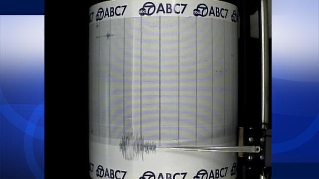
© ABC7The ABC7 Quake Cam shows an 8.0-magnitude earthquake that struck Alaska on Monday, June 23, 2014.
An 8.0-magnitude earthquake struck at 1:53 p.m. in Alaska, prompting a tsunami warning for the U.S. Pacific coast. A preliminary report indicated the quake was a 7.1 magnitude. That was revised minutes later to 8.0 by the U.S. Geological Survey.

The warning for Southern California was downgraded to a tsunami advisory by the National Weather Service.

The NWS reported that water was leaving the harbor of the city of Adak, Alaska, at 3:23 p.m. The Adak city manager confirmed to ABC News that water in the harbor was receding and people in that area were heading for higher ground.

The earthquake struck 244 miles southeast of Attu Station in Alaska, about 15 miles off Little Sitkin Island.

The earthquake occurred at a depth of 71.1 miles, according to the USGS.

Comment: The Aleutian volcanoes in Alaska are waking up and showing more activity than has been seen for decades in an already volatile region. The Pacific Ring of Fire has been quite active this year and will certainly be something to watch.

See related:


Bizarro Earth

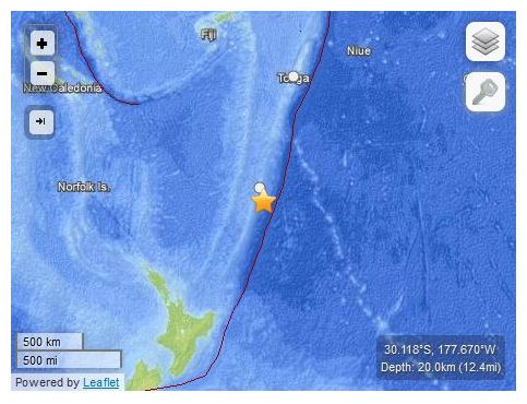
USGS: Earthquake Magnitude 6.9 - 96km SSE of Raoul Island, New Zealand

Raoul Island Quake_230614
© USGS
Event Time
2014-06-23 19:19:16 UTC
2014-06-23 07:19:16 UTC-12:00 at epicenter
Location
30.118ยฐS 177.670ยฐW depth=20.0km (12.4mi)

Nearby Cities
96km (60mi) SSE of Raoul Island, New Zealand
973km (605mi) NE of Whangarei, New Zealand
999km (621mi) NNE of Whakatane, New Zealand
1014km (630mi) NE of Tauranga, New Zealand
1025km (637mi) SSW of Nuku'alofa, Tonga

Scientific Details