Earth ChangesS


Bizarro Earth

Nigeria: Dormant Volcano Stirring?

Nigeria
© Wayfaring Info
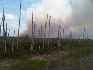
Some rather strange reports from Nigeria seem to suggest some kind of volcanic activity in Gombe State in the north-east of the country: emissions of some kind, possibly including toxic/environmentally harmful gases, have apparently been taking place in the Abaduguri range in Funakaye Local Government Area. North-eastern Nigeria does have a history of active volcanism (although how recently the area was active is not known) so the idea isn't intrinsically unlikely. Descriptions of the supposed current activity, however, are rather baffling.

The Nigerian Observer quotes the National Environmental Standards and Regulations Enforcement Agency saying that 'the rock, which has been emitting smoke in the past seven months, was a sign of "a dormant volcano which may erupt in future"', while a scientist from the Centre for Geodesy and Geodynamics of the National Space Research and Development Agency called the activity 'a result of the impact of an earthquake that occurred in Pindiga formation, Gombe State, hundreds of years ago'.

Elombah.com reports that 'Local communities living around the Ndanijam Kargo Hill in Funakaye Local Goverment Area and the surrounding villages in Gombe State of the North-Eastern part of Nigeria have been advised to relocate as a result of smoke emission at Abadaguri rocky range because the dormant volcano in the area is likely to erupt any time from now'. The gas has apparently been 'gushing out from the rocky area' for seven or eight months, and has 'an odour of burning plastic'.

Phoenix

Washington, US: Transformer fire at Redmond substation cuts power; oil, foam spilled

Image
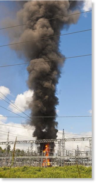
© Mike Siegel / The Seattle TimesA fire at a Puget Sound Energy substation in Redmond on Willows Road put up a column of smoke visible from Seattle and all over the Eastside.
A transformer caught fire at a Puget Sound Energy substation in the Redmond area at midday Thursday, sending a tall plume of black smoke into the sky and causing 25,000 Puget Sound Energy customers to lose power.

Then late Thursday afternoon, the substation flared again for a couple of minutes. Redmond firefighters were keeping a water hose on the damaged transformer to keep it cool and prevent it from flaring up again, PSE spokeswoman Dorothy Bracken said.

There were no reports of injuries, PSE spokeswoman Allison Stanford said, and all power was restored by about 3 p.m. or shortly thereafter.

However, some oil from the transformer and foam used to smother the fire did enter storm drains that link to a creek that eventually joins the Sammamish River.

It's too soon to know whether there was any ecological damage, but the state Department of Ecology was to return Friday to continue advising contractors doing cleanup.

The fire knocked out power for some users from Bellevue to Everett. A half dozen buildings on the Microsoft campus went dark as well.

In Redmond, six intersections were without working signals, causing traffic tie-ups in the area, Redmond spokeswoman Marta Gronlund said.

Comment: Yet another addition to the growing list. Read Exploding Transformers - More than meets the eye?


Bizarro Earth

US: Winds spread wildfire, more flee near Arizona city

Image
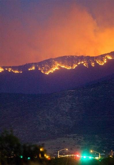
© David Sanders / APThe Monument fire burns north toward Sierra Vista, Ariz., on Wednesday, June 15. Forty homes were destroyed or damaged three days into the fire.
Residents on the outskirts of Sierra Vista, Ariz., were told to evacuate Thursday, after 40-foot flames jumped a highway and high winds briefly grounded an air attack.

The wildfire in southern Arizona's Coronado National Forest is within 10 miles of Sierra Vista, population 40,000, and has destroyed or damaged at least 40 houses and 10 other structures over 14 square miles, or 9,500 acres.

Hundreds of residents in canyon areas outside the city had evacuated over the previous two days and more than 500 firefighters are attacking the blaze.

During the peak burning time Thursday afternoon, the fire is "probably going to look like a bomb went off," said fire information officer Dale Thompson. The next three days will be tough on the fire lines because of the winds gusting up to 40 mph, he said.

Officials on Thursday closed off a 12-mile stretch of State Route 92 due to the conditions. One county official driving along a still open section of SR 92 said he saw flames as tall as 40 feet on either side of the highway Thursday afternoon.

Winds and searing temperatures also were to move into New Mexico, where firefighters battling a blaze that surrounded Carlsbad Caverns National Park had it 70 percent contained and it was no longer threatening the park's visitors center and employee housing. The fire started Monday, charred about 30,500 acres of desert scrub and forced the park to close.

Interstate 25 reopened at 4 a.m. Thursday after being closed for four days because of the wildfire near Raton, N.M. However, Exit 454 in New Mexico and exit 2 in Colorado were to remain off limits Thursday because of the blaze burning on about 26,000 acres. Some nearby residents were able to return home Wednesday.
Attention

Ash Cloud Spreads From Erupting Nabro Volcano In Eritrea

Nabro volcano, Eritrea
© ESA/NASANabro volcano, Eritrea, next to the border with Ethiopia.
The Anabro (Nabro) volcano in the Northern Red Sea Region of Eritrea has erupted sending an ash plume more than 13.5 kilometres into the sky and disrupting air traffic across eastern Africa.

Part of the Afar Triangle, the stratovolcano is one of many volcanic caldera complexes in the north easternmost part of the East African Rift valley region. Nabro is located in the Danakil Depression, close to Eritrea's border with Ethiopia and north of Djibouti, and has not erupted in at least 150 years. It is the most prominent of 3 large volcanoes (Nabro, Dubbi, Mallahle) in the region, each containing a large summit caldera.

The volcano erupted at 2103 GMT Sunday evening. The Volcanic Ash Advisory Center (VAAC) said Monday that the 5,331 ft volcano has resulted in a large ash plume of up to 13.5 kilometres (8 miles) high. The scale of the eruption, compared to the ongoing eruption in Chile and 2010′s eruption at Eyjafjallajökull in Iceland, remains unclear.

Comment: And June 12th, we had these earthquakes: Eritrea/Ethiopia Region: Earthquake Magnitude 5.1 and 9 subsequent large aftershocks


Bizarro Earth

US: Earthquake Magnitude 5.2 - Alaska: Kenai Peninsula

Image
© USGS
Date-Time:
Thursday, June 16, 2011 at 19:06:05 UTC

Thursday, June 16, 2011 at 11:06:05 AM at epicenter

Time of Earthquake in other Time Zones

Location:
60.765°N, 151.048°W

Depth:
57.4 km (35.7 miles) set by location program

Region:
KENAI PENINSULA, ALASKA

Distances:
13 km (8 miles) ENE (61°) from Nikiski, AK

24 km (15 miles) NE (37°) from Salamatof, AK

25 km (16 miles) NNE (23°) from Kenai, AK

84 km (52 miles) SW (236°) from Anchorage, AK

Attention

90,000 Still Homeless in Japan After Quake

Japan quake homeless
Tens of thousands of people are still living in shelters in Japan, three months after a powerful earthquake and the ensuing tsunami devastated the country's northeastern coast.

The National Police Agency said on Saturday that over 90,000 people remain displaced in Japan as a result of the twin disasters in March.

Cloud Lightning

US: Rain Helps Put Out Florida Brush Fire

Miami-Dade brush fire
© Tiffani Helberg / CBS-4A raging western Miami-Dade brush fire can be viewed from Okeechobee Road. By Saturday the raging flames had destroyed at least 58,000 acres.
A massive brush fire that has been burning for nearly a week is almost extinguished thanks to some heavy rain.

Since last Sunday, fire crews have been trying to put out the brush fire, which consumed more than 58,000 acres in the Everglades. Krome Avenue, from Southwest Eighth Street to Okeechobee Road was blocked off as fire rescue crews battled the fire.

Attention

India: Heavy Rains Sweep Away Jassidih-Deogarh Bridge in Jharkhand

Jassidih-Deogarh bridge
The bridge over Dadhva river was today swept away following heavy overnight rains in Deogarh, the police said.

The 700-foot bridge connecting the pilgrim town of Deogarh from Jassidih was swept away around 5 am, disrupting road traffic.

Cloud Lightning

Over 100 Dead in China Floods

More than 100 people have been killed in flooding in central and southern China. Some of the dead were killed after being struck by lightning.


Days of torrential rain has caused landslides and forced over 55,000 people to flee their homes. Dozens of people are still missing. In the central Chinese province of Hubei, the local river rose by five metres.

Cloud Lightning

Heavy Downpours to Hit Central, South China Again

China flood damage Ningguo city
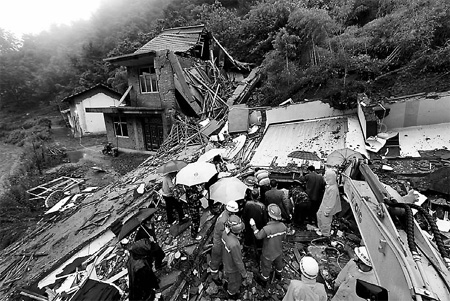
© Li Xiaohong / XinhuaFirefighters carry out rescue work in a village hit by landslides triggered by rainstorms in Ningguo city of Anhui province on Wednesday. Two villagers were killed in the accident.
A new round of downpours is set to batter central and southern China in the next several days, local authorities said on Monday.

According to the flood control and drought relief headquarters of Hunan, torrential rain will sweep the central province from north to south from Monday evening and will last to Friday.