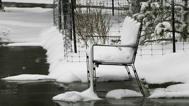
After beginning the week with some of the first 30-degree weather of the year, the mid-summer like heat quickly gave way to tumbling temperatures, setting the scene for a much more wintry end to the week. Snowfall and freezing rain warnings spanned Alberta and Saskatchewan through Friday morning, with difficult travel being reported on some major highway routes.
As much as 10-20+ cm of snow was forecast through the hardest hit areas, as temperatures hovered close to the freezing mark -- a 30-degree drop for most places from Monday. Persistent freezing rain has also taken a toll across parts of southern Saskatchewan, snapping tree branches and resulting in local power outages.
The good news is, conditions will gradually improve through Saturday, as temperatures attempt to rebound to more seasonal values. Some of the warmest weather will actually be felt across northern Alberta, with daytime highs reaching the lower 20s by Sunday.
"Meanwhile, southern Alberta will stay in the single digits, with widespread rain developing as a system develops over Montana and tracks north into Saskatchewan and then east into Manitoba," says Dr. Doug, a meteorologist at The Weather Network.
Rainfall totals from Sunday through Tuesday will be variable across the region, with the heaviest totals of 25-50+ mm stretching from southern Alberta to central Saskatchewan.
Here's a look at the snowy start to the May long weekend for parts of the Prairies.
WINTRY START TO THE 'SUMMER-LIKE' WEEKEND ON THE PRAIRIES
25.5cm of snow along Hwy 6 in Waterton Park, and it's still snowing! 😮
— Kyle Brittain (@KyleTWN) May 21, 2021
6:35PM #abstorm @weathernetwork pic.twitter.com/0AuZHqTie9
Ice covered flowering crab. Hope this doesn't do permanent damage. #skstorm #ReginaBeach pic.twitter.com/c6Ry6T37jM
— 🌱Dianne☀️ (@_Simply_Dianne) May 21, 2021
14cm of snow at Seven Persons AB pic taken by Dustin Vossler #abstorm pic.twitter.com/DrrjMjVApu
— Brandon Houck (@HouckisPokisewx) May 21, 2021
Porcupine Hills, Alberta this afternoon!
— Kyle Brittain (@KyleTWN) May 20, 2021
Forgot my skis. #abstorm @weathernetwork pic.twitter.com/zjmjomRVK6
May 21, 2021 (8:50 am) - freezing rain causing some chaos in my backyard in #Yorkton sk.
— Ryan Crouse (@ryancrouse1) May 21, 2021
Still no power. (5+ hours now and guessing will be more) #skstorm pic.twitter.com/P51lPaVNjM
May 21, 2021. Everything is covered in ice. All the tree branches look odd because they are being weighed down by the weight of the ice. Just north of @Pilot_Butte Crazy! #skstorm pic.twitter.com/73BfjLNzMf
— Cam Parisien (@CameronParisien) May 21, 2021
Ongoing ice storm in SE Saskatchewan. I have many dump trailer loads of large trees to clean up all over my acreage that snapped. They're still snapping right now. @PrairieChasers pic.twitter.com/h0uVCeFGbK
— Sean Schofer (@SeanSchofer) May 21, 2021
My poor lilacs. Nothing like snow for May Long. #abstorm pic.twitter.com/ShOSTRPDst
— Cassie Donnelly (@cassdrocks) May 20, 2021
Buried in snow at Warner AB pic taken by Debi Figenshau #abstorm pic.twitter.com/lmgpeHo20h
— Brandon Houck (@HouckisPokisewx) May 20, 2021
Maybe this is Alberta's 'best spring ever'? #abstorm #nwcalgary #yycweather #yycwx pic.twitter.com/csOktUiKlQ
— Rob Tripp (@RobertBTripp) May 20, 2021
Lots of snow at Medicine Hat AB pic taken by Tim Johnson #abstorm pic.twitter.com/0VINPl9WGJ
— Brandon Houck (@HouckisPokisewx) May 20, 2021


Reader Comments
to our Newsletter