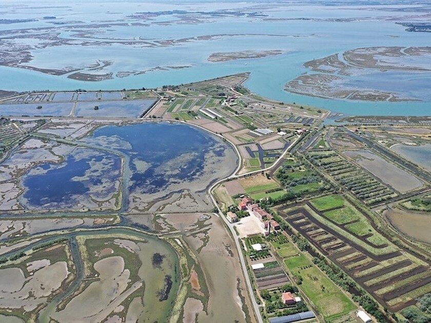
© A. CipolatoAerial image of the North Lagoon, Venice
The fact that Altinum had to be equipped with a port was taken for granted in consideration of
the commercial role of the Roman city, a role well testified by the ancient authors and also by the material evidence found during the excavations.
Altinum was a centre for commerce coming from the north, through the Via Claudia Augusta, and from the Po Valley hinterland, as well as from maritime routes.
Wood, oil and wine certainly passed through it, but the city itself was famous for the production of goods to be exported, such as wool. The reconstruction of its port system, however, has only recently been achieved and owes much to the impressive images from aerial and satellite photos and to geophysical investigations.
Non-invasive research is, in fact, providing a clear picture of the appearance of the urban port, while underwater investigations are making it possible to interpret Roman-era structures in
the northern lagoon belonging to an extensive port system.

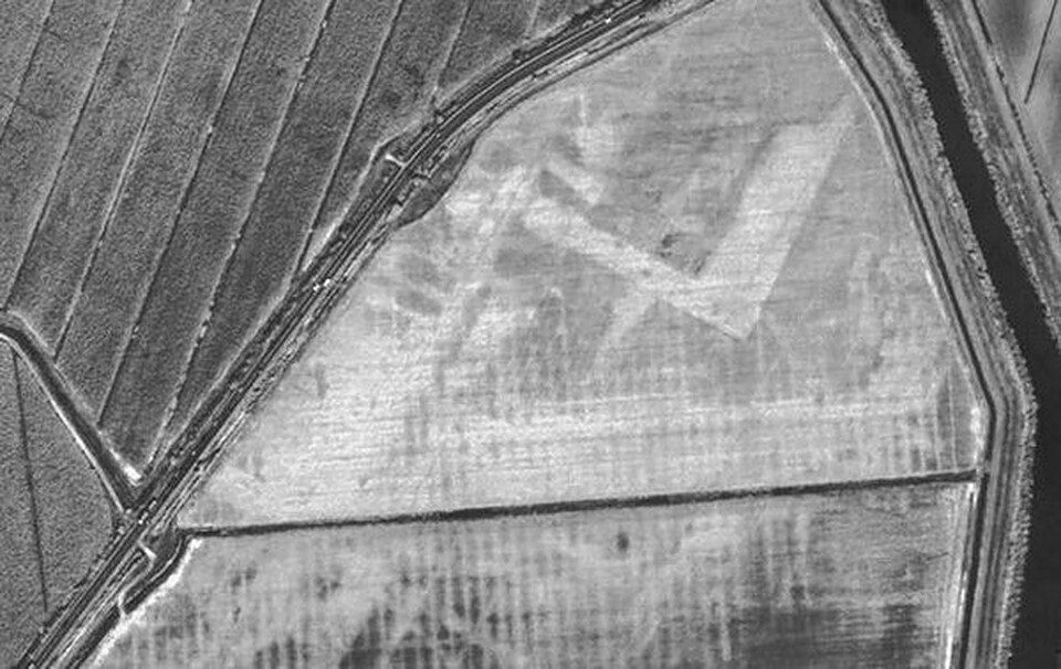
© Paolo Mozzi, University of PaduaSatellite image
A team coordinated by Carlo Beltrame, professor of maritime archaeology, is following the traces discovered by Paolo Mozzi, geologist of the University of Padua, who is also involved in the project, on a satellite photograph, published in 2009 in the journal Science, which shows
a large L-shaped dock, almost one hectare in area, to the west of the urban centre of Altinum.
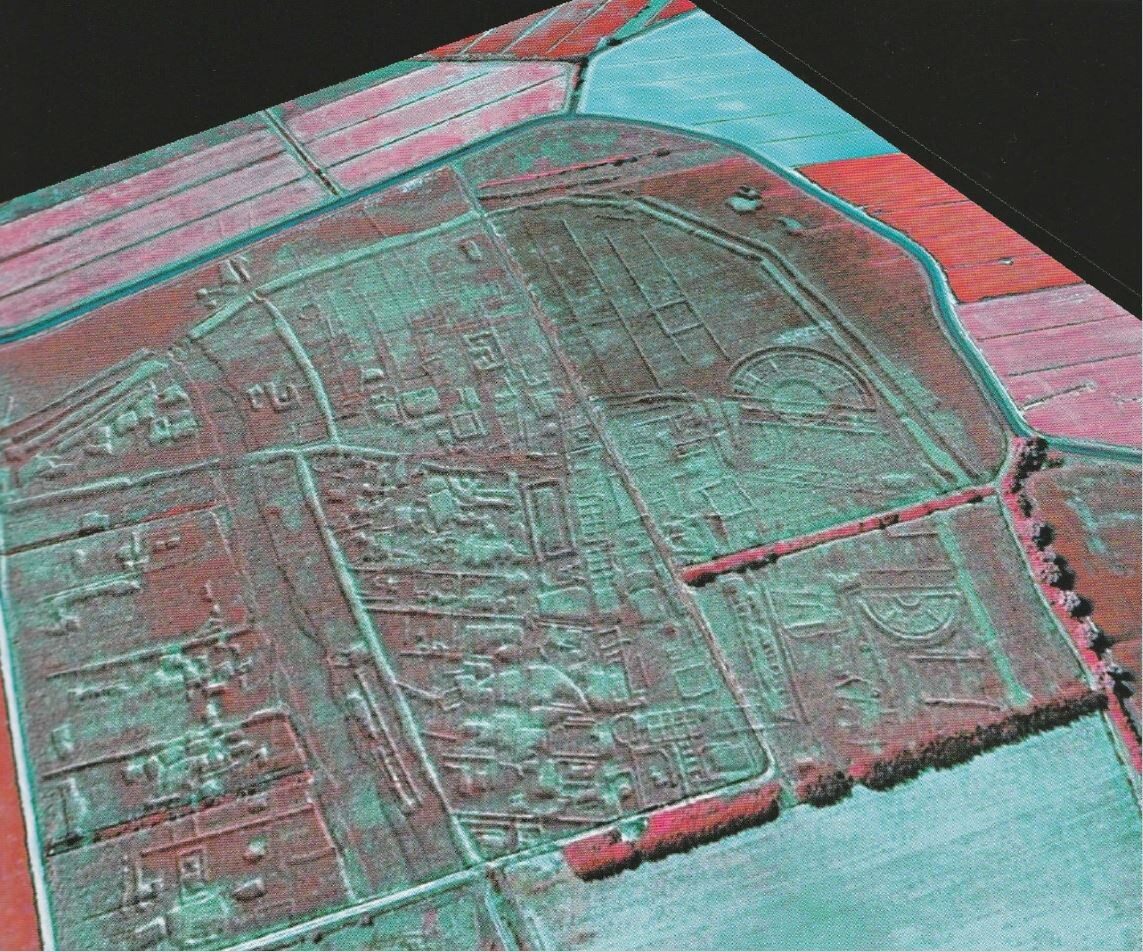
The urban centre has also been revealed in its entirety, by the same images taken from above. The dock itself is perfectly inserted in the orthogonal mesh of the city blocks, following a clear urban design, and is connected by a narrow channel, bordered by poles, to the present Siloncello Channel.

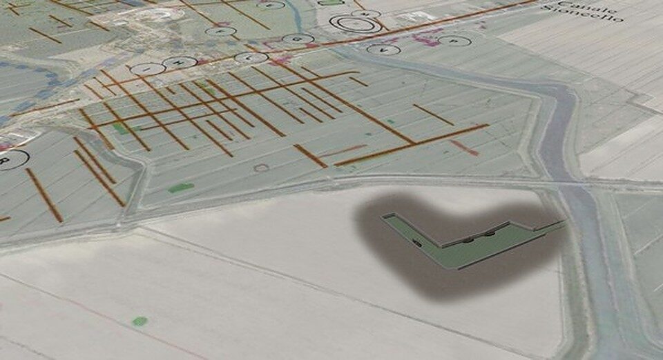
© Elisa Costa, Ca 'Foscari University of VeniceHypothetical rendering of the port
Thanks to the collaboration of the Soprintendenza Archeologia, belle arti e paesaggio for the Municipality of Venice and the Lagoon and the availability of the land, currently under cultivation, the project has already obtained information by means of surface collections, core drilling, radiometric analysis of wooden structures and geomagnetic surveys. The latter, in particular, have made it possible to obtain a fairly clear image of the port area,
revealing numerous buildings located around the dock of which there was no knowledge and which could not be seen from aerial photographs.
The underwater and terrestrial investigations carried out during the summer with photogrammetric surveys, geoelectric surveys, cores and sampling, are making it possible to verify
dates, generally about the first century AD.

© Altino, The Invisible CityGeomagnetic survey map of ancient Altinum Altino
with the intention of reinterpreting them and refining the dates, which are in any case confirmed to be
from the Imperial Roman period. These well known sites were presumably located along an inland navigation route in a direction that led from the sea to the port of the ancient city.The investigations carried out permit the reconstruction of the levels of use in the Roman age, offering data of great interest also for studies on lagoon subsidence.
R.C.