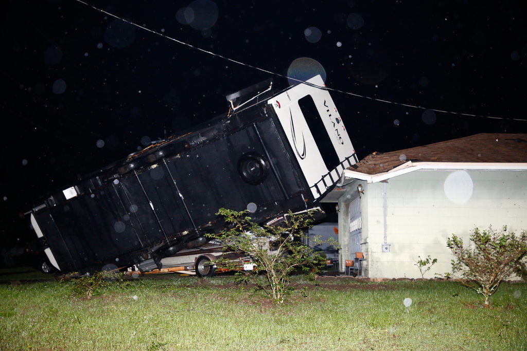
A tornado touched down near Seminole, Fla., about 15 miles west of St. Petersburg, around 9:20 p.m. on Friday, the National Weather Service said. A mobile home park was damaged and no injuries were reported, it said.
Another tornado, with winds up to 120 m.p.h., touched down in Hillsborough County, which includes Tampa, around 11:30 p.m. on Friday and crossed into neighboring Polk County, where it damaged at least 50 homes and businesses, the Weather Service said.
For about 45 minutes, the tornado tore through the county, Paul Womble, the director of Polk County Emergency Management, said on Saturday.
"We were lucky and very blessed to not have any injuries," he said.
The tornado overturned an 18-wheel vehicle onto a sport utility vehicle. The occupants of both vehicles escaped injury, The Tampa Bay Times reported. It also caused severe damage to a middle school, prompting administrators to cancel classes for Monday and Tuesday.
A third tornado, with winds of nearly 100 m.p.h., struck Lee County in western Florida, on Saturday morning, damaging at least a dozen homes. The Cape Coral Fire Department said on Facebook that there were no reported injuries.
Photos and videos on social media showed a roof torn off a middle school, fallen power lines and vehicles damaged by uprooted trees. Damage estimates were not available on Saturday.
By 11 a.m. on Saturday, the National Hurricane Center said the storm had been downgraded to a post-tropical cyclone. Still, forecasters warned of life-threatening storm surges of up to four feet along the Florida Gulf Coast, and strong winds, tornadoes and isolated flash flooding across the southeastern United States.
The storm left some roads flooded and officials said it was expected to produce two to four inches of rain this weekend across the southeastern United States, with isolated amounts of up to eight inches.
The storm formed in the Gulf of Mexico and became a tropical storm on Friday, the Weather Service said.
Its remnants made landfall at St. Vincent Island, Fla., about 75 miles southwest of Tallahassee on Saturday, and was forecast to head through Georgia, South Carolina and North Carolina. It was expected to reach North Carolina's coast and move into the Atlantic by late Sunday, officials said.
A post-tropical cyclone is classified as a former tropical storm that no longer "possesses sufficient tropical characteristics" but can bring with it heavy rains and high winds.
The storm produced beach hazards along the Gulf Coast on Saturday, according to officials, who warned swimmers of dangerous rip currents, high surf and coastal flooding.
Tallahassee officials encouraged residents to report power failures and blocked roads.
"While impacts may be less than anticipated, any impact close to home matters," the city said on Twitter on Saturday.


The algae blooms red-tides, and concurrent fish and dolphin kills around here are because they decided to start pumping rainwater (fresh) that should go into the St. Johns river basin, back over our 'Eastern Divide' and into the Indian River (which is brackish). That lowers the salinity and allows for such blooms which steal the oxygen from the water, et al.
Why do that? Because downriver - all the way to Jacksonville - homes are built in the St. Johns River Floodplain. SO to save those houses they kill our fish/dolphins, et al. Those buildings, (like the repeatedly flooded ones in the video) could NOT get real insurance; hence no buildings at street level. But instead, they get federally 'subsidized' 'flood insurance' (sic) - like those in St. Marks video that should never have been built - and wouldn't have been built but for the Federal Flood 'Insurance' program
R.C.
*Better called "40 year or 20 year' flood plains.
RC