Comment: This quote appears to be taken from a local attorney who was present at a Porter Ranch town hall meeting on January 22nd.
If this continues, multiple massive explosions are very likely to take place once the methane comes into contact with the pilot light of a stove, or hot water heater. This could set off "rolling explosions a few hundred feet in the air, knocking down all the houses and buildings nearby as it goes!"
Worse, toxic benzene is now also confirmed to be coming out of the ground and entering the atmosphere in such large quantities, that people can be killed merely from walking through it. Benzene can be absorbed through the skin. Once a sufficient amount enters the body, there is no treatment and no cure; all the person can do is wait to die.
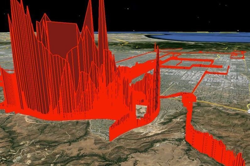
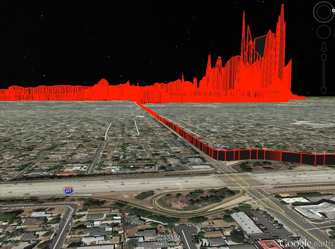
The graphic above was made from actual measurements of Benzene; the higher the red color goes, the worse the concentration. Fatal levels are the highest ones near the well and gas field.
The photo at the top of this article shows the explosive gas cloud over hundred of homes as part of it blows toward downtown Los Angeles. If this detonates, the destruction and carnage will be unimaginable.
The Leak
The largest natural gas leak ever recorded is happening now in a wealthy suburb of Los Angeles. The leak is from an old oil well being used to store natural gas under high pressure. It is the largest natural gas storage facility west of the Mississippi.
A pipe inside the well has cracked and so much gas is gushing out:
- It's increasing California's emissions by 25%
- 10,000 local residents have been evacuated, up to 5 miles away from the leak
- Planes aren't allowed overhead for fear they'll blow up
The Researchers
Boston University Professor Nathan Phillips and Bob Ackley of Gas Safety drove a high precision GIS-enabled natural gas analyzer down the roads around the gas leak (Jan. 8th to 13th, 2016) to create the video above. The red shows where they drove. The level of natural gas is shown by the height of the peaks. Where the gas spreads depends enormously on the direction and speed of the wind. These are just a few snapshots in time of the gas (see more images).
Phillips and Ackley are experts in natural gas analysis, having mapped the gas leaks in numerous cities such as Washington (DC), Boston, Cincinnati and Manhattan. They will post their data soon, making everything open source for researchers and reporters.
Early Results
So far, the early results show natural gas levels are elevated 2 to 67 times the background level found in the area. Local residents are complaining of nausea, headaches and nosebleeds. No one knows if there will be long term health effects from the volatile organic chemicals found in the gas.


>
> A catastrophic disaster is now taking place outside of Los Angeles
> endangering hundreds of thousands of people. officials say they have
> "entirely lost control of the entire (gas) field" meaning explosive
> methane gas is now leaking from "many places."
>
> Workers at the scene of the Porter Ranch gas field in the Aliso Canyon
> say some of the leaks are so loud, the hissing sound can be heard 1/2
> mile away. If this continues, multiple massive explosions are very
> likely to take place once the methane comes into contact with the pilot
> light of a stove, or hot water heater. This could set off "rolling
> explosions a few hundred feet in the air, knocking down all the houses
> and buildings nearby as it goes!"
>
> Worse, toxic benzene is now also confirmed to be coming out of the
> ground and entering the atmosphere in such large quantities, that
> people can be killed merely from walking through it. Benzene can be
> absorbed through the skin. Once a sufficient amount enters the body,
> there is no treatment and no cure; all the person can do is wait to
> die. The graphic below was made from actual measurements of Benzene;
> the higher the red color goes, the worse the concentration. Fatal
> levels are the highest ones near the well and gas field.
>
> The photo at the top of this article shows the explosive gas cloud over
> hundred of homes as part of it blows toward downtown Los Angeles. If
> this detonates, the destruction and carnage will be unimaginable.
>
> The Leak: The largest natural gas leak ever recorded is happening now
> in a wealthy suburb of Los Angeles. The leak is from an old oil well
> being used to store natural gas under high pressure. It is the largest
> natural gas storage facility west of the Mississippi.
>
> A pipe inside the well has cracked and so much gas is gushing out: It's
> increasing California's emissions by 25%, 10,000 local residents have
> been evacuated, up to 5 miles away from the leak, Planes aren't allowed
> overhead for fear they'll blow up. The leak first started in October
> and the company responsible says it can't be fixed until March.
>
> [Link]