A ferocious blizzard blasted the southern Plains with heavy snow and high winds Monday, burying much of the Texas and Oklahoma Panhandles under more than a foot of snow, wreaking travel havoc on the roads and in the air.
Overnight Monday and through the day Tuesday, the storm will slowly slog to the north and east, bringing a swath of snow across Kansas, Missouri, Illinois, Wisconsin and Michigan, the National Weather Service reported.
"This storm will have a huge impact, with additional heavy snows likely over portions of eastern Kansas and northern Missouri which received very heavy snowfall amounts last week," weather service meteorologist Robert Oravec wrote in an online bulletin.
The storm is being blamed for two deaths on Monday. In northwest Kansas, a 21-year-old man's SUV hit an icy patch on Interstate 70 and overturned. And in the northwest town of Woodward, Okla., heavy snow caused a roof to collapse, killing one inside the home.
Among the big cities that will see accumulating snow Tuesday are Kansas City, Chicago, Milwaukee and Detroit, according to AccuWeather. The heaviest snow is forecast Tuesday around Kansas City, which should easily see a foot of snow. Chicago should receive about 3-6 inches of snow.
The storm will continue to dump snow across the Lower Great Lakes region Tuesday night and into northern New York State and northern New England on Wednesday, Oravec says.
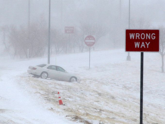
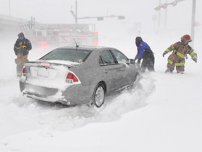
The storm forced road closures in Texas on Monday. Paul Braun, a spokesman for the Texas Department of Transportation, said whiteout conditions and drifting snow had made all roads in the Texas Panhandle impassable. Interstate 40 was closed from Amarillo to the Oklahoma state line Monday.
"It's just a good day to stay home," Braun said. "This is one of the worst ones we've had for a while," he said. "And we kind of know snow up here."
Air travel was also affected: Both the Amarillo and Lubbock airports closed Monday, and airlines are pre-emptively canceling flights and waiving fees as the storm moves across the central U.S.
U.S. carriers have canceled about 1,300 flights since the storm began affecting travelers Sunday. And with the storm expected to bring wintry precipitation to Chicago's two big airports by Tuesday afternoon, flight schedules may take another hit.
This week's snowstorm comes on the heels of another storm that walloped the region with heavy snow last week.
The weather service had issued blizzard warnings and watches Monday in New Mexico, Texas, Oklahoma, and Kansas as the storm tracked northeast across the region. In all, some form of winter storm watches and warnings were in effect late Monday all the way from eastern New Mexico to eastern Michigan, a distance of almost 1,400 miles.
By late afternoon, 19 inches of snow had fallen in Amarillo, Texas, where forecasters said up to 20 inches could fall. This made it Amarillo's second-greatest 24-hour snowfall on record, and the weather service reported that the city's all-time 24-hour snowfall record of 20.6 inches could be broken.
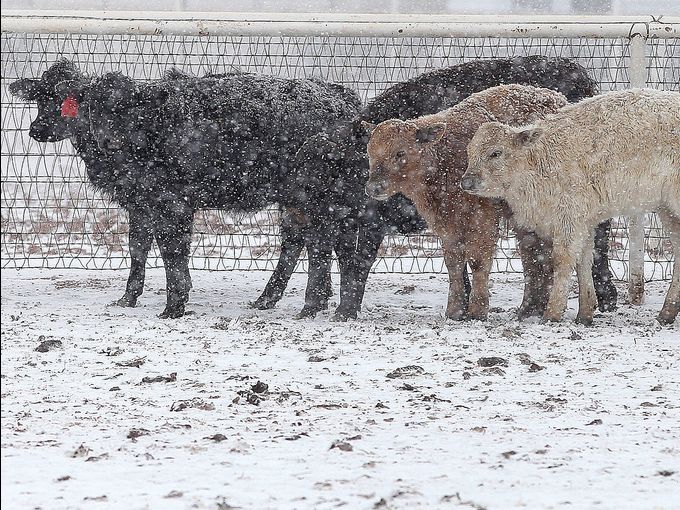
Along with the snow, a weather station in Pantex, Texas, reported a wind gust Monday morning of 77 mph. A wind gust of 84 mph was reported near El Paso, well south of the snowstorm.
In the Oklahoma Panhandle and counties along the Kansas border, the weather service warned that travel in the area would be "very dangerous" until Tuesday morning with near zero visibility and drifting snow.
The Oklahoma Highway Patrol closed all highways in the Panhandle, citing slick roads and limited visibility. Trooper Betsy Randolph said the patrol advised its non-essential personnel to stay home until Wednesday.
Forecasters also warned of possible severe weather in the Southeast, part of the same massive storm that's pounding the Plains with snow. The Storm Prediction Center has placed parts of eastern Texas, southern Arkansas, southern Mississippi, all of Louisiana, and northern Florida under a tornado watch until 8 p.m. ET. This includes the cities of New Orleans, Baton Rouge, Jacksonville and Gainesville, Fla.
AccuWeather reported that a possible late-afternoon tornado damaged vehicles and downed power lines near East Houma, La.
In the drought-stricken Plains, thirsting for moisture, the storm could help replenish the groundwater. Climatologists say 12 inches of snow is equivalent to about 1 inch of rain, depending on the density of the snow.
"Is it a drought buster? Absolutely not," Victor Murphy with the weather service in Fort Worth, Texas, said. "Will it bring short-term improvement? Yes."
The Weather Channel has named the storm "Rocky." No other federal or private forecasters are using this name.
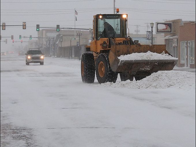
"We may not get the roads cleared until midday Tuesday if we get the expected amount of snow and wind. As it's falling, in the blizzard-like conditions, we just won't be able to keep up," Lehenbauer said late Sunday.
The weather service warned of similar high winds and upward of a foot of snow across south-central Kansas. Kansas Gov. Sam Brownback amended a state of emergency declaration to include the new weather.
"This storm has the potential to be more dangerous than last week's storm," Brownback said. The storm late last week dumped more than a foot of snow in some places, closing airports and leading to several deadly traffic accidents.
Brownback urged motorists to "stay off the road unless it's absolutely critical," adding that drivers who must travel should pack charged cellphones and emergency kits containing food, water, blankets, road flares and shovels.
"It would have been nice if we'd had a few days to recover, to do some equipment rehab," Joe Pajor, deputy director of public works in Wichita, told The Wichita Eagle. The city saw its second-highest snowfall Thursday with 14.2 inches.
Wichita could see its snowiest single month on record if the city receives 6.4 inches from this storm, according to weather historian Christopher Burt of the Weather Underground.
The southern Kansas town of Zenda saw 18 inches of snow last week, while 17 inches fell in Hays, Kan., about 13 inches in northeast Missouri and 12 inches in parts of Kansas City.
Pajor warned that sand and salt supplies were low after last week's storm and that the city's strategy might just be to plow snow into the center of arterial streets and cut traffic to one lane in each direction. He said the city wouldn't begin to use its limited sand and salt supply until the snow stopped falling and plowing was under way.
The incoming storm sent Amarillo residents running out for last-minute supplies. Mario Delgado, 57, needed milk.
"I got all the good stuff like soup and peanut butter the other day," Delgado told the Amarillo Globe-News. "We're used to it here."
He added: "As long as you got plenty of clothes and the right kind of shoes, you'll be alright."
Contributing: Ben Mutzabaugh, USA TODAY; Associated Press



Reader Comments
to our Newsletter