"It's textbook. A textbook storm," said Dennis Feltgen, spokesman for the National Hurricane Center in Miami, Fla.
The weakening storm, packing winds of about 50 mph (80 kph), is heading northeast, away from the United States, and looks like it will weaken significantly in the coming days.
However, Feltgen said, forecasters didn't know that for sure until they got word back from the plane that was flying through Sean's thunderstorms and high winds.
"If the storm has any possible threat to land at all, a hurricane-hunter aircraft is going to go into it - that's a given," Feltgen told OurAmazingPlanet, "and this storm is threatening Bermuda."
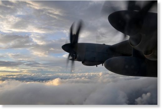
At 7:30 a.m. local time yesterday (Nov. 10), a massive WC-130J aircraft took off from Keesler Air Force Base in Biloxi, Miss., the operations hub of the Air Force Reserve's 53rd Weather Reconnaissance Squadron, better known as the Hurricane Hunters. [Images: Hurricane Hunters in Action]
After a 3- to 4-hour flight to reach the storm, the giant flying weather station, packed with instruments and a small crew, spent 2.5 to 3 hours flying a series of triangle-shaped patterns through the storm.
"We were going to stay out longer, but once we got in and started taking measurements they didn't see anything favorable for development," said Maj. Sean Cross, one of the pilots on the mission, which finally touched down around 4:30 p.m. local time.
Peering into a storm
Cross said that once inside Tropical Storm Sean, they maintained an altitude of 5,000 feet (1,500 meters) above the ocean, "so we were right in the [storm] environment itself." Using a suite of instruments, including tiny sensors attached to parachutes that hurtle down through the clouds and allow researchers to essentially take a CT scan of the storm, the flight confirmed Sean's location, internal pressure and wind speed.
"It was a pretty mild storm today - there wasn't much to it," Cross told OurAmazingPlanet not long after the mission's completion. However, he said, some storms that appear deceptively docile can shake a plane with sudden, and sometimes severe, turbulence.
"Every storm has its own personality," Cross said. "They're all different, so as crew members we can never let our guard down."
Feltgen said that although the United States won't feel Sean's direct effects, the storm is creating powerful and dangerous rip currents along the southeastern U.S. coastline. The high winds push narrow channels of water rushing toward the shore, shoving the water in the shallows out of the way and sending it surging out to sea.
"Even the best swimmers can't fight that, so they tire out and end up drowning," Feltgen said. "The best advice is, don't fight it, let it carry you out, and then swim parallel to the shore until it's not pushing you back out," he said.
Rip currents, on average, annually kill more people in Florida than hurricanes, tropical storms, tornadoes, severe thunderstorms and lightning combined, according to the National Weather Service.
Many storms, but far away
Feltgen said this has been a remarkably active year for hurricanes in the Atlantic. So far, 2011 is in fourth place - and tied with 1969 - for most hurricanes, in a record that stretches back to 1851, he said. (The busiest season on record was the 2005 season, which saw 28 named storms, including Hurricane Katrina.)
"This was a busy season," Cross said. "You talk to people on the streets and they think it's been pretty quiet because nothing's bearing down on the Gulf Coast, but there were a lot of storms that just didn't make land fall."
And, he said, his team has stayed busy. Just this week, the Hurricane Hunters were sent to investigate a winter storm in addition to Tropical Storm Sean.
Feltgen said that Sean isn't expected to intensify, and will likely sputter out within the next 48 hours. As the storm moves north, over the cool mid-Atlantic Ocean, it will be deprived of its main fuel source: warm, tropical waters. In addition, forecasters expect that conflicting winds at high altitudes will essentially blow the top of the storm off, further sapping it of strength.
Although there aren't any storms on the horizon, Feltgen said hurricane season doesn't end until Nov. 30, so there's still a possibility that another storm could start brewing. "We don't see anything behind Sean," he said, "and that's not to say something couldn't form, but with each passing day the odds get lower."


Reader Comments
to our Newsletter