OF THE
TIMES
I've had enough of someone else's propaganda. I'm for truth, no matter who tells it. I'm for justice, no matter who it's for or against. I'm a human being first and foremost, and as such I am for whoever and whatever benefits humanity as a whole.
Data shows very clearly that CO2 follows temperature, albeit with a slight lag. The science is already settled, 'global warming', 'climate...
Perhaps some people may understand now why the Zionists have said long ago: constant remembrance of the holocaust is necessary in order to bring...
This should pinpoint some things [Link]
Well the Israelis are doing a pretty good job of chanting slogans Like Kill all the Gazan's and kill all the Iranians. What's the difference. The...
"To The Last Ukrainian" Sep, 2023 . [Link]
To submit an article for publication, see our Submission Guidelines
Reader comments do not necessarily reflect the views of the volunteers, editors, and directors of SOTT.net or the Quantum Future Group.
Some icons on this site were created by: Afterglow, Aha-Soft, AntialiasFactory, artdesigner.lv, Artura, DailyOverview, Everaldo, GraphicsFuel, IconFactory, Iconka, IconShock, Icons-Land, i-love-icons, KDE-look.org, Klukeart, mugenb16, Map Icons Collection, PetshopBoxStudio, VisualPharm, wbeiruti, WebIconset
Powered by PikaJS 🐁 and In·Site
Original content © 2002-2024 by Sott.net/Signs of the Times. See: FAIR USE NOTICE

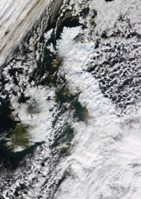
Damn the Ravages of Global Warming must be freezing The British Isles - at least a rare White Christmas is on the way!