The Catlin crew was picked up this week, after completing less than 50% of their planned journey to the North Pole and coming up about 500km short. Immediately upon their return, The Guardian reported :
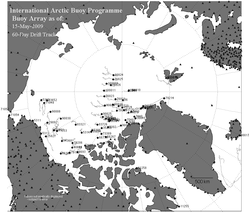
After 73 days, the Catlin Arctic Survey has come to an end. Pen Hadow's team of British Arctic explorers have battled to the North Pole through freezing conditions collecting data about the ice en route.This reminds me of the legend of "bringing the mountain to Mohammed." The crew reported traveling over 400km, a non-trivial percentage of which was due to floating along with the Arctic drift. See this map of Arctic buoys and their drift patterns:
Given the polar drift, one has to wonder how much ice was actually traversed, and how many measurements were taken near the same spot on the first year ice. The Catlin Crew reported in The Telegraph :
Arctic explorer Pen Hadow has warned that the polar ice cap he has been examining to gauge the extent of climate change appears far thinner than expected after trekking more than 250 miles to the North PoleFrom the Catlin web site:
Expedition Leader Pen Hadow revealed that initial Survey results show the average ice thickness in the region to be 1.774m.1.774m is fairly thick for first year ice (and requires a very accurate tape measure.) They started their expedition in March on ice which NSIDC had already identified in February as first year ice - so why were they surprised to find first year ice?
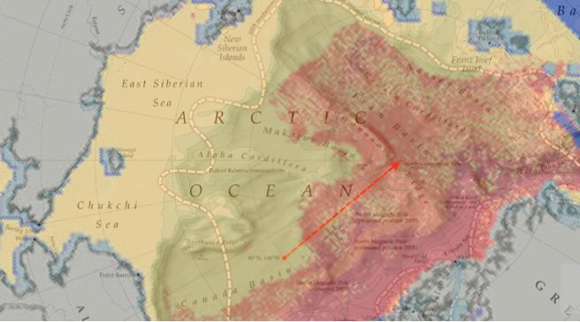
The NSIDC February map showed multi-year ice as shades of red and orange, and their start point (red dot) was more than 100km away from the edge of the multi-year ice. The crew also reported that their data is biased by a pragmatic choice of route across flat (first year) ice.
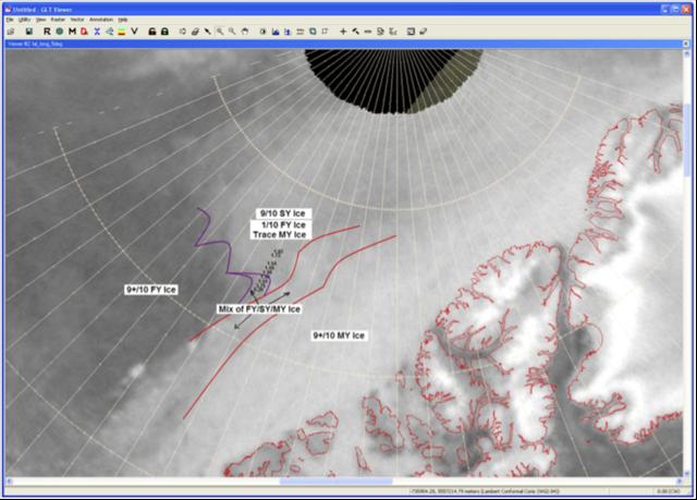
One further consideration, when interpreting the ice thickness measurements made by the CAS team, is navigational bias. The team systematically seeks out flatter ice because it is easier to travel over and camp on.According to the Catlin web site, there was plenty of second year ice - but apparently the cold weather and lack of progress kept them from reaching it. Note in the map below that second year ice (SY) is not considered multi-year (MY) ice. The AGW world has recently redefined the word "multi-year" as meaning greater than two years. (Next year it may need to be defined as greater than three years.)
In summary :
- Due to horrifically cold weather, hypothermia and frostbite, they made it less than half way to the pole.
- Some of the distance they did travel was due to polar drift. They reported crossing the 85th parallel "in their sleep."
- They started on ice which was already known to be first year ice, yet were "surprised" to find that it was first year ice.
- They stayed on first year ice for most of the truncated journey.
- Their ice measurements tell us that the first year ice this year is fairly thick.
- Their ice measurements tell us very little or about the thickness or "health" of multi-year ice.
- They will no doubt get an invite to St. James Palace for tea with Prince Charles.
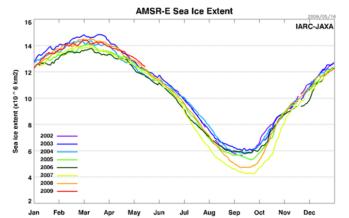
May, 2009 shows the greatest ice extent in the AMSR-E record, which seems to contradict Hadow's highly publicised remarks about Arctic ice health.


Reader Comments
to our Newsletter