|
| ©Charles Foley
|
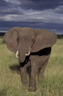
| In a recent paper in The Royal Society's Biology Letters, conservationists with the Wildlife Conservation Society and the Zoological of London found that the oldest matriarch elephants may retain valuable memories of permanent sources of food and water and their that become crucial in times of drought.
|
A recent study by the Wildlife Conservation Society and the Zoological Society of London (ZSL) suggests that old female elephants - and perhaps their memories of distant, life-sustaining sources of food and water - may be the key to survival during the worst of times.
In particular, experienced elephant matriarchs seem to give their family groups an edge in the struggle for survival in periods of famine and drought, according to a recently published paper in
The Royal Society's Biology Letters.
"Understanding how elephants and other animal populations react to droughts will be a central component of wildlife management and conservation," said Wildlife Conservation Society researcher Dr. Charles Foley, lead author of the study. "Our findings seem to support the hypothesis that older females with knowledge of distant resources become crucial to the survival of herds during periods of extreme climatic events."
Comment: Usually turkeys run away too, they are fairly timid. And they only fly short distances. Usually only to roost. Turkeys eat insects, berries and seeds. Not animals the size of a cat! Or a human! So what's going on here?
Maybe it was a turkey, maybe not. As the wildlife official said, without a picture you can't really identify it.