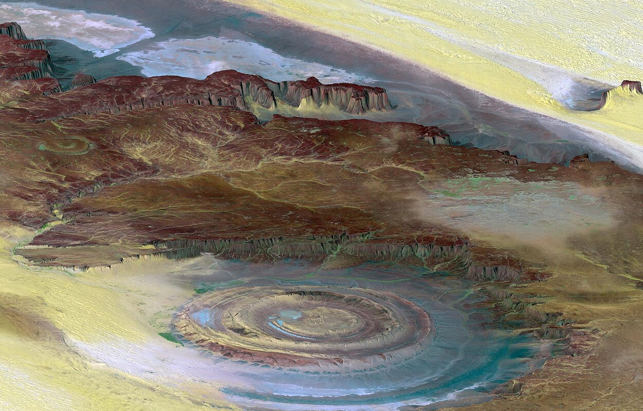
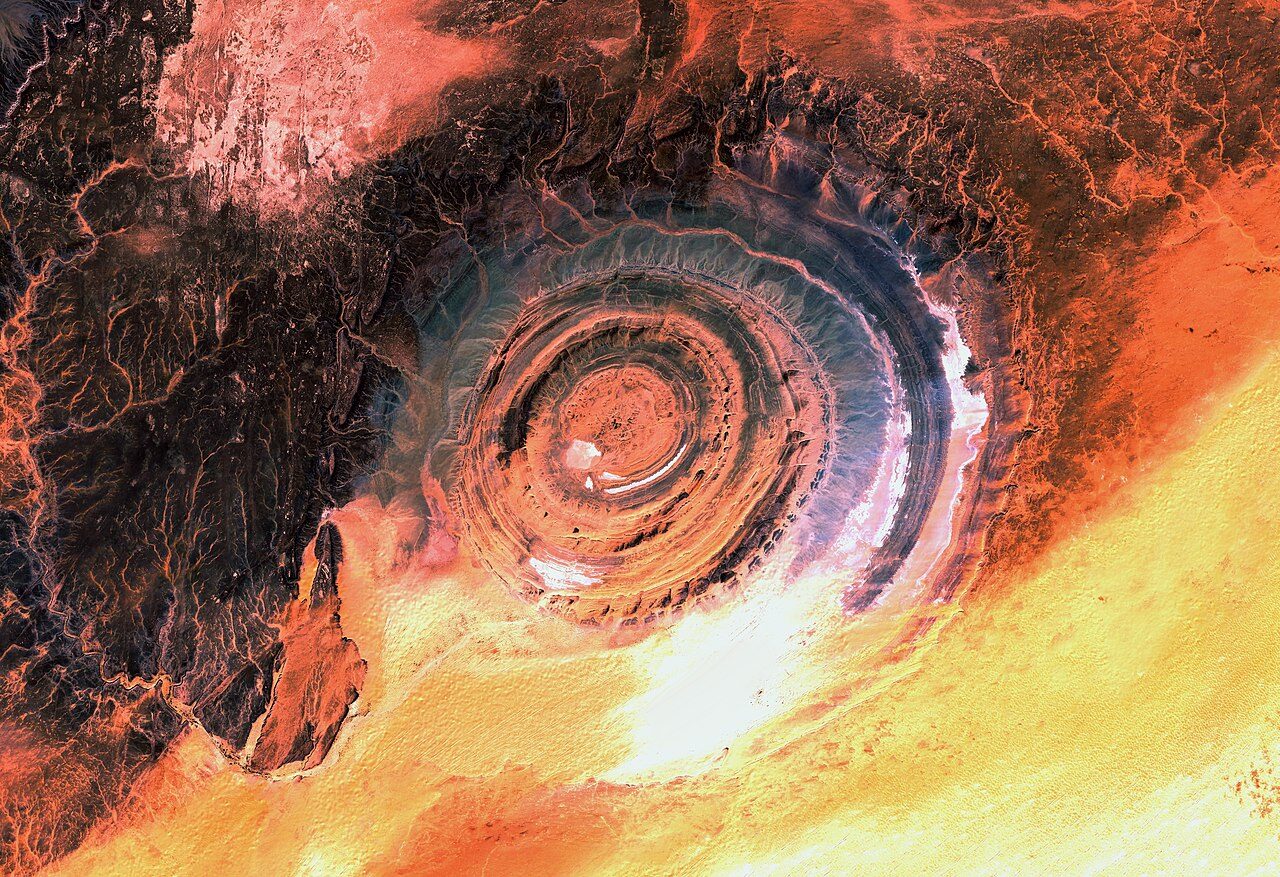
THE EYE OF THE SAHARA, ALSO KNOWN AS THE RICHAT STRUCTURE AND THE EYE OF AFRICA, IS A GEOLOGICAL FEATURE IN THE SAHARA DESERT'S ADRAR PLATEAU, LOCATED IN WEST-CENTRAL ISLAMIC REPUBLIC OF MAURITANIA.

© NASA – Public DomainEye of the Sahara.
The structure is an eroded elliptical dome of sedimentary rock, that ranges in age from the Proterozoic (2500 to 538.8 million years ago) within the centre, to Ordovician (488.3 to 443.7 million years ago) sandstone around its periphery.
The dome has a diameter of 40 kilometres (25 mi), with an interior comprised of intrusive and extrusive igneous rocks, including rhyolitic volcanic rocks, gabbros, carbonatites and kimberlites.
The rhyolitic rocks have been interpreted as lava flows that are part of two distinct eruptive centres formed from the remains of two maars, a low-relief volcanic crater caused by a phreatomagmatic eruption (an explosion caused when groundwater comes into contact with hot lava or magma).

© CC BY-SA 3.0 IGOEye of the Sahara, taken by the Sentinel-2 Satellite.
The gabbroic rocks form two concentric ring dikes, the inner ring dyke is 20 metres in width and lies 3 kilometres from the centre of the structure, while the outer ring dyke is 50 metres in width and is located 7 to 8 kilometres from the centre.
The processes that formed the structure has been theorised to be the result of either a meteoric impact, or a deep magmatic intrusion, the latter of which is supported with high-resolution airborne magnetic data and gravity data to reinforce the intrusion hypothesis.The Eye of the Sahara was first identified during the 1950's from aerial photographs, leading to ongoing studies by geologists until as recently as 2008. This latest study, explained that the ridges and valleys we see today are formed by the differential erosion of alternating hard and soft rock layers, uplifted as a dome by an underlying alkaline igneous complex of the Cretaceous age.
Archaeological research at the structure has revealed evidence of human activity, with numerous deposits of pre-Acheulian and Acheulian artefacts, characterised by the distinctive oval and pear-shaped "hand axes" normally associated with
Homo erectus and derived species such as
Homo heidelbergensis.Acheulean tools were produced during the Lower Palaeolithic era across Africa and much of West Asia, South Asia, East Asia and Europe, first developed about 1.76 million years ago and derived from the more primitive Oldowan technology associated with
Homo habilis.Research by archaeologists have found Acheulean sites located along wadis that occupy the outermost annular depression of the structure, where outcrops of quartzite were sourced to provide the raw materials for tool manufacturing. Tool types found in Acheulean assemblages include pointed, cordate, ovate, ficron, and bout-coupé hand-axes (referring to the shapes of the final tool), cleavers, retouched flakes, scrapers, and segmental chopping tools.
The geographic distribution of Acheulean tools - and thus the peoples who made them - is often interpreted as being the result of palaeo-climatic and ecological factors, such as glaciation and the desertification of the Sahara Desert.
The climate of the region has undergone enormous variations between wet and dry periods over the last few hundred thousand years, believed to be caused by long-term changes in the North African climate cycle that alters the path of the North African Monsoon.
During the African humid period (AHP), much of the Sahara desert was covered by grasses, trees and lakes, where the people of the Lower Palaeolithic lived an existence as hunter-gatherers.
Evidence of Neolithic activity has also been found, with sparse, widely scattered spear points and other artefacts located northwest of the outer ring, although generally absent in its innermost depressions of the structure.
Due to the lack of middens or identifiable evidence of sustained occupation, this has led to the interpretation that the structure was only used for short-term hunting and stone tool manufacturing.
A pseudo theory by Fractal Source Research (FSR), proposes that the structure is the remnants of an advanced Antediluvian civilisation, namely the lost city of Atlantis, based on a comparison of measurements from the structure with the descriptions given by Plato.
Reader Comments
Similiar to a lightning, but just bigger and and of longer duration.
* no codis , not a strip club
Well, the structure was clearly stripped along with most of the geography east to west by massive floods. There is irrefutable evidence for this.
By the way, there is such a kind of club a few miles from here, but I did not yet manage to escape my wife's monitoring long enough
Just don't have the time for such monkey business ...
to escape you wife's monitoring you will have to follow the bible's instructions where it says:
you can give a man a fish but if you learn to fish you can escape from your wife for a an entire day !
i feel almost everyone has this potential but it is dismissed as irrational by the very institutions that educate - the irony eh !
I still like his Dilbert comics, though I could try the old and approved trick if I needed to - calling from work, announcing "overtime requirements". I did not even once up to now.
But the good thing about not being in my teens/twens anymore is, the testosterone levels jhave now normalized. I still can whenever I want or need, but never feel an urge that turns off my senses ...
: )
They sit on the footprint of previous civilizations whose scale of building was on a different scale, its the stonework beneath the Pyramids that's of interest.
Sounds plausible to me.
The Pyramids ARE NOT UNIQUE, far from it.
The Age of the Global Pyramidic era was in fact the last links to technology, language and information now LOST.
I Provide a link that i hope you find insightful.
Regards Winternights3
[Link]
We are left in the dark about our history.
There is no great mystery just one HUGE cover up.
according to a greek philosopher
That area of the sahara hasnt seen an "sea" , or so they say
I mean i wasnt there but most stories point to other, more likely locations for atlantis.
Imo it was caused by off planet forces.
But again , what do i know. It sure is fun to theorize this stuffs.
Way better than politics
Personally I'm unsure of its true origins and having so much pigging sand in the surrounding areas doesn't help either.
It is I believe unique and sits in a area of increasing interest, so its a matter of time before it gives itself up.
"But again , what do i know. It sure is fun to theorize this stuffs. " Wow thanks for adding nothing to the conversation.