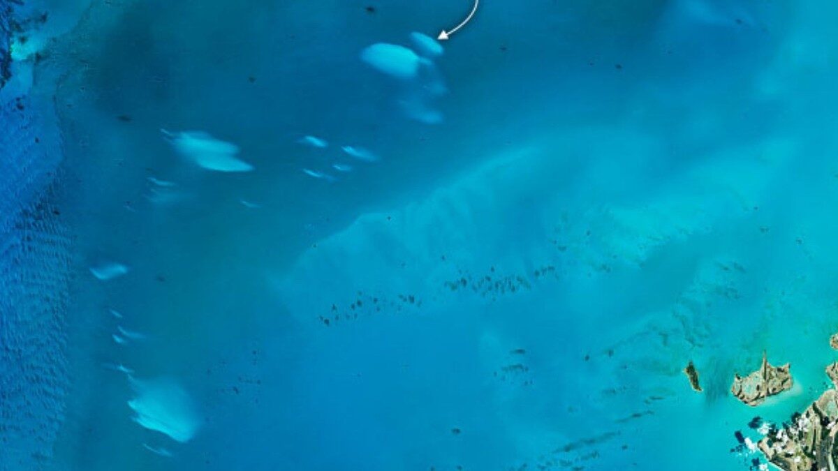
© NASA
Scientists have spotted a
mysterious uptick in the appearance of unexplained patches of white water in the shallow waters off the coast of the Bahamas, reports a new study based on satellite observations.
For almost a century, people have observed these so-called "whiting" events, which typically cover an area equivalent to a few hundred football fields, but nobody knows the exact cause of this phenomenon. Samples show that the discoloration is caused by fine-grained calcium carbonate that floats over the Bahama Banks, which are carbonate structures that surround the archipelago, but
it's not clear why the grain clouds sporadically appear in the ocean.To shed light on this enigma, researchers from the University of South Florida compiled the longest and most detailed space-down view of the Bahama Bank whiting events using observations captured by NASA's Aqua satellite between 2003 and 2020.
The team also trained a machine learning tool to analyze the images, an approach that revealed a "mysterious increase" in whiting events over the past decade, which peaked in 2015, as well as seasonal patterns in these discolorations,
according to a recent study in the journal
Remote Sensing of Environment.
"In a changing climate with decreased pH (i.e., ocean acidification) and increased temperature, one would expect slow, continuous change in whiting events," said Chuanmin Hu, an oceanographer at the University of South Florida who co-authored the study, in an email to Motherboard.
"The former would lead to decreased events while the latter would lead to increased events, at least according to theory," he added. "However, what we observed was truly a surprise with a 10-year episode of increased whiting events."
In addition to spotting these long-term patterns, the team found a large range of sizes and timeframes for the whiting events. Some patches vanished after a few days, while others stuck around for as long as three months. And while the smallest events cover a mere fraction of a square mile, the white discoloration regularly extended across more than 150 square miles from 2014 to 2015, an area roughly equivalent to the city of Detroit, Michigan.
Those huge white patches represented the zenith of an overall increase in the total area of the whiting events that occurred from 2003 to 2015. After 2015, the occurrence of such large patches gradually tapered off, reaching an average size of about 10 square miles by 2020.
The seasonal and decadal patterns revealed by the study are certainly tantalizing, but they haven't yet unlocked the origin of the events. Though scientists have speculated that the phenomenon could be related to sporadic flourishing of microorganisms in the ocean, or to currents that drag calcium carbonate particles to the surface, these milky splashes in the Bahamas are still an unsolved riddle, at least for now.
"More field work is required to continuously monitor the ocean properties and processes as well as whiting events in order to have a better understanding," Hu concluded.

Reader Comments
INFILLED BLUE HOLES ON THE BAHAMA BANKS AS POTENTIAL POINT SOURCES FOR WHITING ORIGIN [Link]
“Ocean blue holes are tidally active features, with strong inflow and outflow currents. At depth, they are commonly linked to lateral conduits of fracture guided passages. We hypothesize that sediment- filled blue holes should also be connected to lateral conduits and be tidally active, such that water would be brought up by diffuse flow from deep within the banks. During subaerial exposure, island carbonates develop greater horizontal hydraulic conductivity (Kh) over time, however vertical hydraulic conductivity (Kv) decreases, so blue holes would act as preferential flow paths for water given their higher vertical permeability relative to the carbonate host rock. Deep water is cooler, and because of depth pressure, should contain additional CO2 compared to bank surface water. Once this deep-seated water rises to the bank top, it would degas and warm, therefore driving precipitation of CaCO3.We hypothesize that this process might be the driving force in the formation of whitings. Whitings have been studied extensively over the past 60 years, and no satisfactory model has yet been established. Using three existing blue hole databases from Bahamian island and coastal locations, an extrapolation was done to estimate the number of sediment-filled blue holes on the shallow Bahama banks. Great and Little Bahama Bank should have 2250 infilled blue holes, with an average density of 0.05/km2 on these shallow banks. This number is a minimum estimate, as not all blue holes can be assumed to be in the database. The description of whitings as being point source in origin, the hydraulic and water chemistry constraints, and the blue hole number extrapolations implicate infilled blue holes as the potential cause of whitings.”