Tropical Depression Imelda might not have the same ring as Hurricane Imelda, but the impacts of the storm are for real. The National Weather Service has issued a civil emergency warning as a flooding crisis unfolds in the region rocked by Harvey's historic floods just two years ago.
Upwards of 40 inches of rain have fallen along the Texas Gulf Coast over the past 72 hours with the highest total of 41.81 inches reported so far. That makes Imelda the fifth wettest tropical cyclone to hit the Lower 48 on record, and it could rise in the record books in the coming hours.
Embedded within the heavy rainstorm totals are shocking bouts of downpours. That includes nearly 30 inches of rain falling over a 12-hour period in Mayhaw Bayou, a weather station located about 60 miles east of Houston. Multiple locations have also reported one-hour rainfall in excess of five inches, which is, meteorologically speaking, a crap-ton of rain.
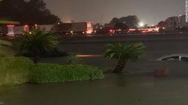
The widespread heavy rain has led to dangerous flash flood conditions as creeks overflow and stormwater management systems back up. Water rescues are already underway in parts of the greater Houston area with boats using flooded out highways to reach stranded citizens. Harris County's sheriff tweeted that emergency managers were receiving a "high volume of calls for high-water rescues at homes and for stranded motorists," and things will continue to deteriorate as Imelda crawls inland.
The National Weather Service (NWS) also put out a civil emergency message on behalf of local counties' emergency managers, a rare move for the agency. The message urged residents to shelter in place as floodwaters rise throughout the day and "call emergency personnel for evacuation rescue" if needed. Houston Bush Airport also went into a full ground stop due to the heavy rain and reported that roads around the airport were closed due to flooding.
Here's more from the NWS flash flood warning issued this morning (caps theirs):
"Multiple roads and highways are impassable. Water is rising into residential buildings. Please do not travel unless you have to and seek higher ground in emergencies...
"THIS IS A PARTICULARLY DANGEROUS SITUATION. SEEK HIGHER GROUND NOW!"
The flooding from Imelda is like a terrible #tbt to Harvey, which inundated Houston a little more than two years ago. That storm went on to become the wettest tropical cyclone (the catch-all term for hurricanes, tropical storms, and tropical depressions) to ever hit the contiguous U.S. It dropped a record 60.58 inches of rain. While Imelda might not beat it, it has joined Harvey in the record books and also shares the label of a 1-in-1,000 year rainfall event.
Research published in the wake of Harvey shows that climate change boosted the odds of its monster rainfall totals. While no research exists about Imelda (yet), the storm is almost certainly being influenced by climate change. Heavier downpours are one of the hallmarks of climate change. The warmer atmosphere holds more water, which means it can also let loose more ferocious rainfall. Every region of the U.S. has seen an uptick in heavy rainfall since the 1950s. A localized analysis by Climate Central shows that Houston has seen an increase in the number of days with extreme rainfall as well.
In this light, it's not a huge shocker Imelda — which made landfall as a weak (wind-wise) tropical storm — is dumping such a copious amount of rain. It's also why maybe we should reconsider our hurricane scale as the planet keeps warming and the odds of intense rain rise.


Reader Comments
Climate change is real, but:
- The climate changed and changes all the time. Nothing new.
- Temperature is driven by the sun, not cow farts or exhaled CO2.
- The accelerated water circulation is caused by agriculture, which inevitably destroys top soil.
Duh....