This month, Saskatchewan has been plagued with daily extreme cold warnings. Temperatures have dipped into the minus 40s, with wind chills so frigid that forgetting your tuque can mean frostbite in minutes.
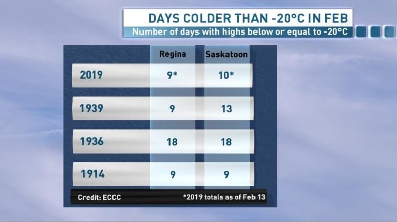
As of Wednesday, Regina had 9 days where the temperature had not warmed up past -20 C. Temperatures overnight have been brisk - in the minus 30s or even minus 40s - but there has not been much recovery in temperatures during the daytime.
Saskatoon has fared even worse, with 10 days with daily highs below -20 C. To put that in perspective, a normal year would have us seeing daily highs in the minus single digits and lows in the minus teens, so these conditions are 10 to 20 degrees below normal in many areas.
This kind of cold stretch has not been seen in 80 years
Though we saw a stretch of cold conditions last February with temperatures stalling in the minus teens for weeks, this stretch of -20 C degree weather this late in the season has not been seen in Saskatchewan for quite some time.
According to Environment and Climate Change Canada, the last time we saw a stretch of similar February temperatures in Regina was in 1939. During that year, starting on the Feb. 6, there were nine days in a row where daily highs did not make it into the minus teens.
In Saskatoon that year, temperatures plummeted into the minus 20s for 13 days, making it a comparable year to this one.

Before 1939, these February cold stretches were a little more frequent. In 1936 these sorts of frigid temperatures dominated the month, with 18 days in Regina and Saskatoon below minus 20.
Similar runs of cold were seen in February of 1914, 1909, 1887 and 1885 in Regina.
Why has it been so cold
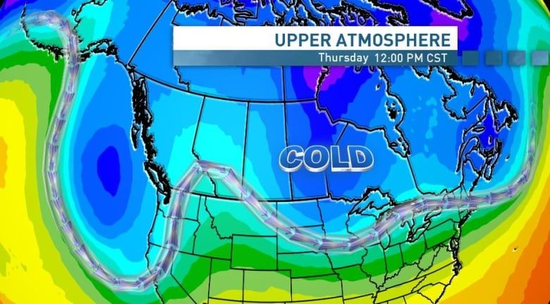
We have seen a large trough set up in our jet stream, pushing that band of fast moving air in the upper atmosphere further south.
That allows cold Arctic air to spill southward into the prairies. Though there has been some slight shifting around, this undulation in the jet stream has dominated for most of the month, allowing day after day of extremely cold weather.

It looks like we are in it for the long haul in Saskatchewan. Though temperatures will likely break into the minus teens this weekend and through next week, it doesn't look like we'll warm to seasonal during this forecast period.
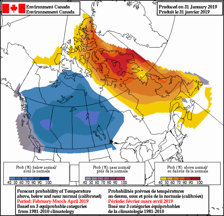
As for our seasonal outlook heading into spring, forecasts are calling for this below-normal trend to continue over the next few months. That doesn't necessarily mean -20 C weather until April, but it does point to temperatures averaging out below monthly normals for those three months.


Reader Comments
to our Newsletter