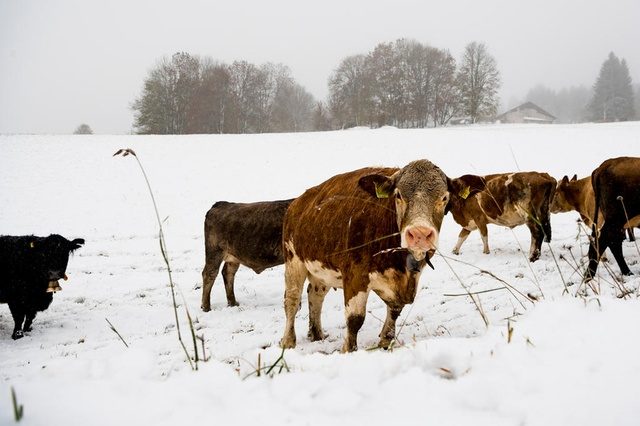
The eastern Alps were affected in particular, where it snowed to quite low altitudes, the Swiss weather service MeteoSwiss told Keystone-SDA.
Parts of the eastern canton of Graubünden saw 30-70-centimetres of snow at over 1,200 metres above sea level.
This tweet from Swiss public television SRF's weather service shows the difference in Davos, a Graubünden resort, between Saturday and Sunday.
Wer findet den Unterschied zwischen gestern und heute? #Schnee #Wintervorfreude ^tk pic.twitter.com/gVDLlnssA4
— SRF Meteo (@srfmeteo) October 27, 2018
Arosa recorded the highest snowfall at 72 centimetres.
Snow fell down to around 500 metres in some places, such as below.
Im #Sarganserland #Schnee bis ins Tal. In Chur/GR 10 cm #Neuschnee, in Elm/GL 22 cm, in Davos 42 cm, in Disentis/GR 55 cm und in Vals/GR sogar 68 cm. #WinterImHerbst ❄️☃️❄️ ^jz pic.twitter.com/8MkpnBbwSi
— SRF Meteo (@srfmeteo) October 28, 2018
Zurich airport also reported a few flakes in the night. However, snow need to fall at over 700 metres above sea level to really stay. Other places seeing snow were southern Valais (20-30 centimetres of powder snow) and the Jura.
Some local rail services in the Engadine region have been temporarily halted as were some in the Jura overnight.
Ticino deluge
But the snow is not likely to stay. Meteorologists said that the snow line was likely to rise to over 2,000 metres during the day.
Rain will continue to fall heavily south of the Alps, bringing with it some risk of flooding and mudslides.
Italian-speaking canton of Ticino has been issued with a level 4 weather warningexternal link (out of 5): around 200 litres of precipitation per metre squared is expected by Tuesday - normally the Ticino town of Locarno would expect 140 litres per m² during the whole of October.


Reader Comments
to our Newsletter