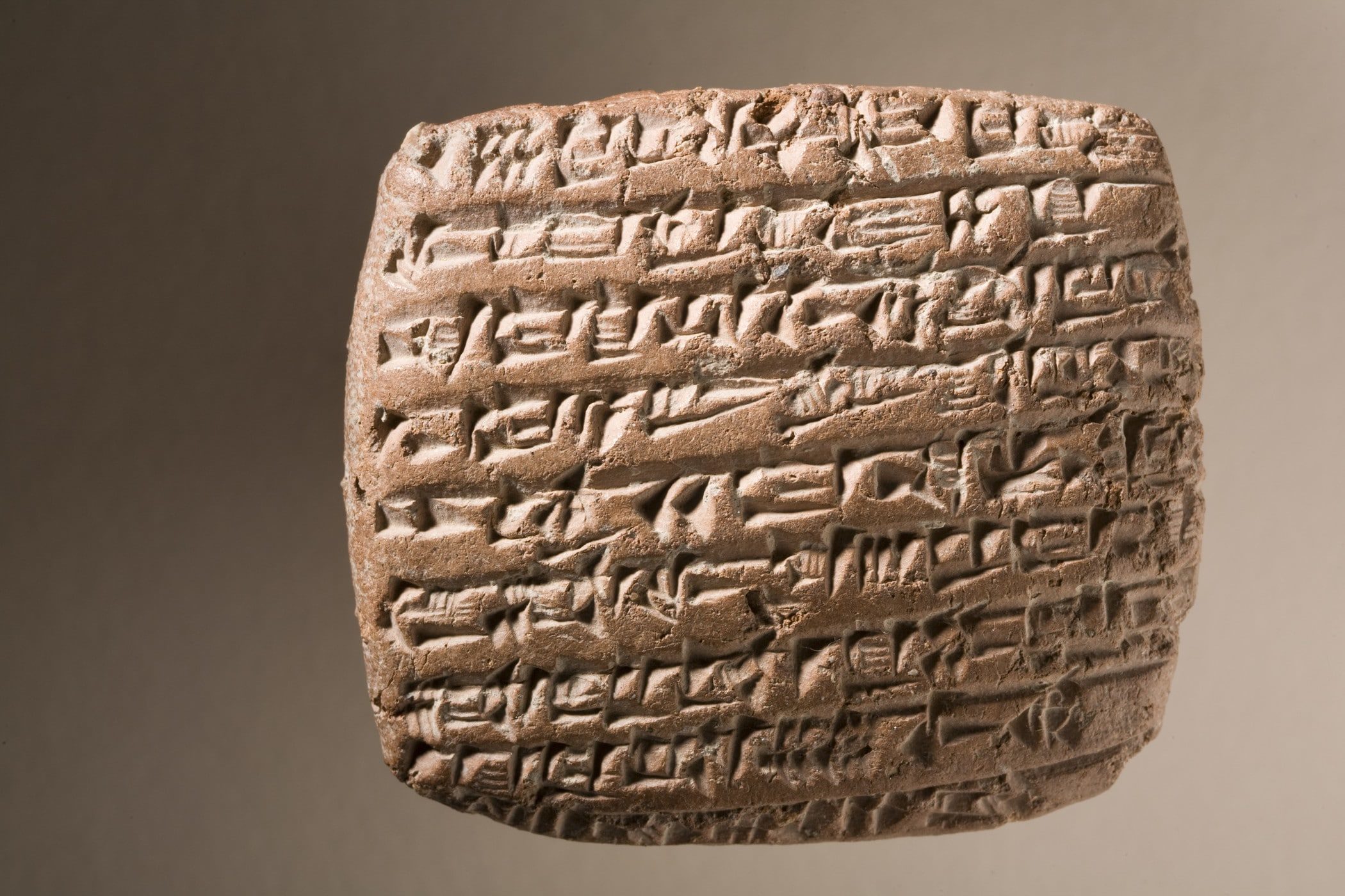
The ancient city of Kanesh, located in the middle of modern-day Turkey, was a hub of trade in the Anatolian region four millennia ago. Modern-day archaeologists have unearthed artifacts from the city, including more than 23,000 cuneiform texts, inscribed in clay by ancient Assyrian merchants.
The texts themselves are mostly "business letters, shipment documents, accounting records, seals and contracts," according to the working paper by Gojko Barjamovic, Thomas Chaney, Kerem A. Cosar and Ali Hortacsu. Barjamovic is an expert in the history of Assyria, the ancient Middle Eastern kingdom founded near the Tigris River in what is present-day Iraq. His co-authors are economists from, respectively, the Paris Institute of Political Studies, the University of Virginia and the University of Chicago.
A typical passage from the clay tablets, translated by the team, reads something like this:
From Durhumit until Kaneš I incurred expenses of 5 minas of refined (copper), I spent 3 minas of copper until Wahšušana, I acquired and spent small wares for a value of 4 shekels of silverMost tantalizing to archaeologists are the mentions in the tablets of ancient cities and settlements - some of which have been located, others of which remain unknown. In the record above, for instance, while Kaneš (Kanesh) has been located and excavated. Durhumit is, at present, lost to history.
Traditionally, historians and archaeologists have analyzed texts like these for bits of qualitative information that might locate a site - descriptions of landscape features, for instance, or indications of distance or direction from other, known cities.
But Barjamovic and his co-authors had a different idea: What if they analyzed the quantitative data contained in the tablets instead? In the passage above, for instance, you have a record of three separate cargo shipments: Durhumit to Kanesh, Kanesh to Wahshushana, and Durhumit to Wahshushana.
If you analyze thousands of tablets and tally up each record of a cargo shipment contained therein, you end up with a remarkably comprehensive picture of trade among the cities around Kanesh 4,000 years ago. Barjamovic did exactly that, translating and parsing 12,000 clay tablets, extracting information on merchants' trade itineraries.
What they had, in the end, was a record of hundreds of trade interactions among a total of 26 ancient cities: 15 whose locations were known and 11 that remain lost.
Here's where things get really interesting: In the ancient world, trade was strongly dependent on geographic distance. Moving goods from Point A to Point B was a lot more difficult at a time when roads were rough, goods had to be transported on the backs of donkeys and robbers lurked everywhere.
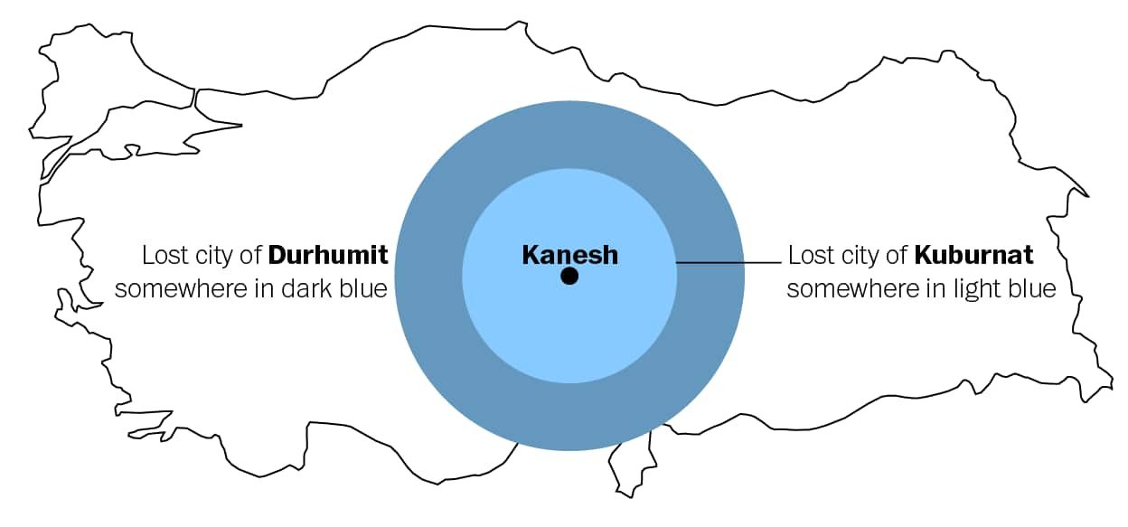
Cities located closer together traded more, while those farther apart traded less. This is the key insight driving the entire paper. Let's say we have an ancient city, such as Kanesh, that we know the location of. We also have two lost cities, Kuburnat and Durhumit. If we know Kanesh traded more with Kuburnat than with Durhumit, we can reasonably assume that Kuburnat is closer to Kanesh than Durhumit is.
The figure above is a conceptual illustration of this idea. Kanesh is in the center, Kuburnat is somewhere in the inner light-blue region, and Duhurmit is somewhere farther out, in the dark-blue area.
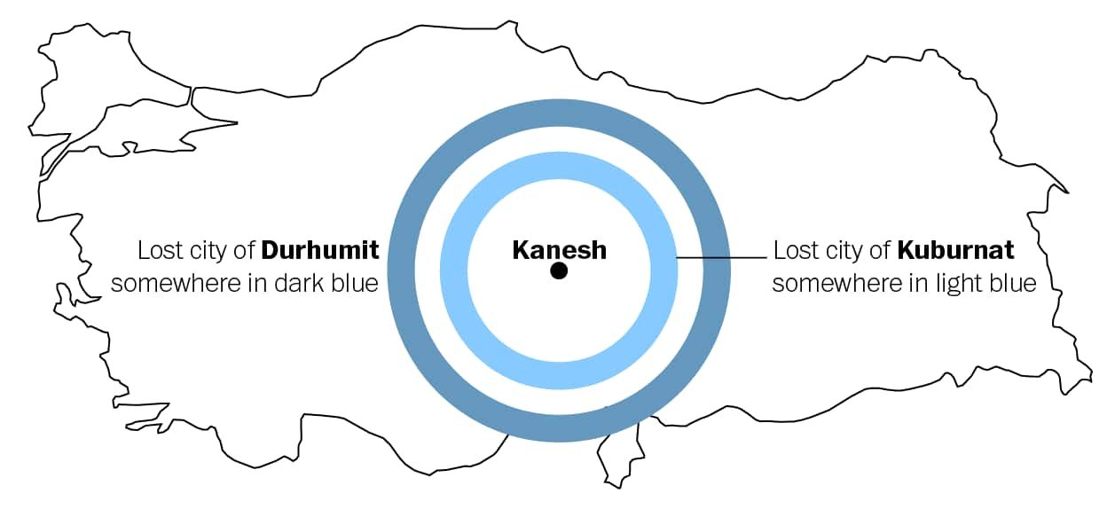
If you have decent data on trade volume (from, say, thousands of clay tablets), you can do one better than this: You can actually plug the trade data into an algorithm that uses other pieces of known data, such as commodity prices and population size, to estimate the distance between two given cities, given the volume of trade between them.
Updating our example illustration, you can see that if we know the rough distance between two cities, we can narrow our concentric circles down to concentric rings.
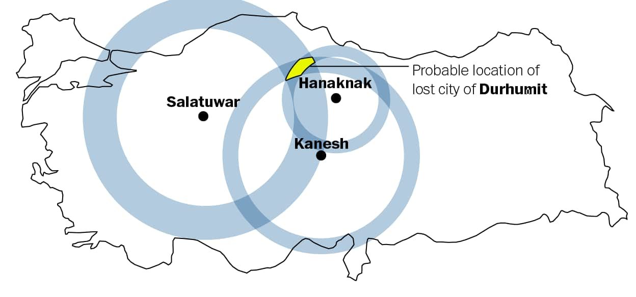
That still leaves a large area to search if we're trying to find these lost cities. But recall: the clay tablet data set includes trade volumes for 14 other known cities in addition to Kanesh. We can run our trade algorithm for any given lost city, such as Durhumit, against any other city we already know the location of. That gives us an estimate of the distance to Durhumit from each of those cities.
If a number of those distance estimates overlap in the same region, that's a pretty strong indicator that Durhumit would have been located in that region.
In the end, the trade data contained on 12,000 ancient clay tablets allowed Barjamovic and his co-authors to estimate the locations of the 11 lost cities mentioned therein. As a sanity check, they mapped their own estimates against some qualitative guesses produced by historians over the years. In some cases, the qualitative and quantitative estimates were in precise agreement. In others, the quantitative model lends credence to one historical assessment vs. another. In others, the model suggests that the historians previously got it completely wrong.
"For a majority of cases, our quantitative estimates are remarkably close to qualitative proposals made by historians," the authors conclude. "In some cases where historians disagree on the likely site of lost cities, our quantitative method supports the suggestions of some historians and rejects that of others."
As a final check, the authors ran the model against the location of known ancient cities to see whether its results matched the actual archaeological record.
One two out of three of the known cities they tested against, the model nailed it. But it whiffed on the third.
The authors suspect their algorithm performs better for cities located near the center of the Assyrian trade network. The "estimation of the location of lost cities is reliable for central cities, but less precise for peripheral cities," they write. Whether you're a Bronze Age merchant of a modern-day economist, long distances remain treacherous.
Still, the authors say their approach for finding lost cities can be used to supplement more traditional methods, helping historians fill in gaps of knowledge in the archaeological record. Beyond that, the paper is a fascinating illustration of how modern knowledge can breathe new life into numbers inscribed on clay tablets 4,000 years ago.



Reader Comments