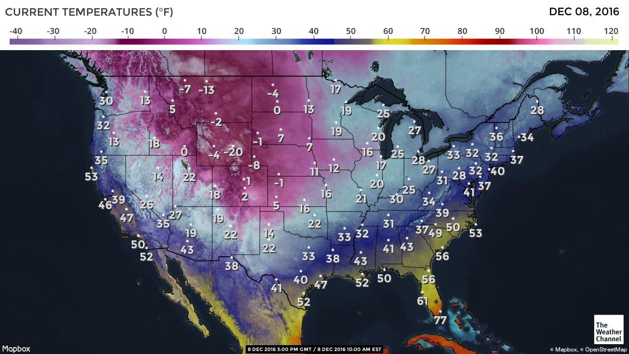
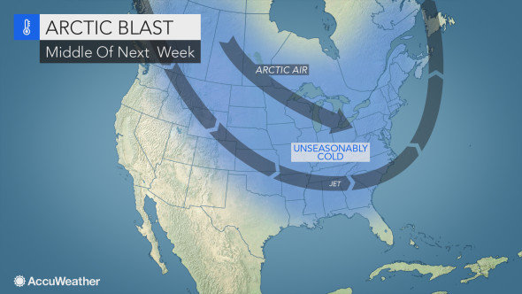
This next major push of arctic air will follow a series of snowstorms over part of the Northern states.
"The air mass on the way for the middle of December is likely to be substantially colder, when compared to that of this past week and this weekend," according to AccuWeather Lead Long-Range Meteorologist Paul Pastelok.
Temperatures from the northern and central Plains to much of the Midwest are likely to be 5 to 20 degrees Fahrenheit lower, on average, when compared to levels this week.
High temperatures from the plains of Montana to portions of North Dakota and northern Minnesota may be at or slightly below zero for one or more days during the first part of next week. The lower temperatures will follow this week's highs in the single digits and teens for the same region.
In Chicago, highs in the 20s and lower 30s this week will be replaced by highs in the teens by the middle of next week.

A substantial temperature dip is likely across the interior South and Appalachians during the latter part of next week.
"The magnitude of the cold air that reaches the Atlantic and Gulf coasts is unclear at this time," Pastelok said.
On one hand, the cold air may quickly thrust into the Deep South and Interstate 95 corridor. However, it is possible that the coldest air may be held back from these areas.
"Should the latter scenario occur, temperatures may be within only a few degrees of the lowest point reached this weekend," Pastelok said. "We will have more information on the extent of the cold in these coastal areas by early next week."
Highs are likely to be in the 30s along the Interstate 95 corridor of the mid-Atlantic during the latter part of next week. There may be a day or two where temperatures fail to reach the freezing mark from Philadelphia and New York City to Boston.
There is potential for temperatures to trend lower in the South later next week as well. Should the cold air blast right in, a day or two with highs in the 30s could occur in Atlanta. Should the sky become clear and winds diminish at night, then a freeze could occur along portions of the Gulf Coast.
Yet another arctic air blast may travel from the northern Plains to the Southern and Eastern states with the Central states bearing the brunt of the cold later during the third week of December.
"For much of the Central and Eastern states, regardless of the exact temperatures, the coldest overall weather this month will occur during the middle part," Pastelok said.
There may be some good news for people who don't want midwinter cold around the holidays.
"We expect arctic air to retreat northward around Christmastime," Pastelok said.
However, this does not mean the weather will be mild and sunny throughout the nation.
The pattern may remain unsettled within a few days of Christmas with areas of difficult travel due to storms with rain, ice, snow, fog and gusty winds.


It could easily be colder than expected also. Seeing as we are no longer in normal times, why would one expect the weather to be normal? It hasn't been acting normally lately so why would it change because it's winter?