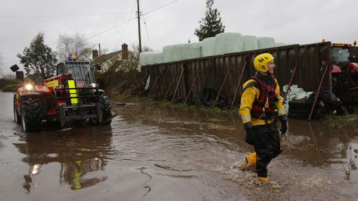
© SkynewsParts of England have been hit by severe flooding.
Forecasters have told Sky News the unsettled weather that has brought heavy rain, strong winds and flooding is set to remain until at least the middle of this month.
After that, conditions "may start to calm down and the second half of February could be slightly more settled", said a Met Office spokeswoman.
The relentless wet weather that has pummelled much of the UK for the past couple of months has been caused by a powerful jet stream, experts said.
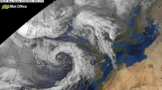
It pushed an "exceptional" succession of low pressure systems across the Atlantic Ocean, as powerful winds and a deluge of rain struck the country, especially southwest England.
There have been a number of major winter storms during December and January and the Met Office said it was the relatively short time between each one that has led to major flooding.
It said: "It was their rapid succession, with further rain falling on already saturated ground that caused the significant flooding problems."

A new storm will bring more wet weather over the weekend.
There are
amber severe weather warnings in place for southern parts of England until 11pm on Saturday due to another storm coming in from the Atlantic.
Forecasters warned people should be prepared for possible 60-70 mph winds on the coast and 50-60mph gusts inland on Saturday, and up to 3cm of rain.
Sky's weather forecaster Nazaneen Ghaffar said: "For the next few days we will see further wet and windy weather.
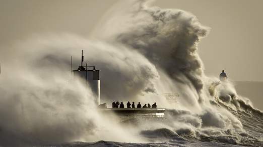
"This weekend will see a significant storm system bringing severe storm-force winds on Saturday, giving huge waves, especially across southwest Ireland where they could reach up to 12 metres.
"This deep area of low pressure will continue to bring further strong winds and heavy downpours through Sunday as well."
One of the reasons for the sustained wet weather is that the winds have been coming from the west.
Traditionally when they are from the east they can sometimes bring snow from Siberia at this time of year.
The Met Office also said another factor could be what is called the quasi-biennial oscillation (QBO).
This is a cycle, discovered in 1959, which involves a narrow band of fast moving winds like the jet stream which sits about 15 miles up over the equator.
The cycle sees these winds change from an easterly to westerly direction about every 14 months.
When the QBO is in its westerly phase, it tends to increase the westerly winds in the jet stream - meaning there is a higher risk of a stronger,
more persistent jet stream with more vigorous Atlantic storms.
It has been in its westerly phase since early 2013 and the Met Office expects it to decline over the next few months.
The Met Office also said it was the wettest December and January period in England and Wales since 1876/1877 and the second wettest since records began in 1766.
It has been one of, if not the most, exceptional periods of winter rainfall in at least 248 years.
Despite the rainfall being concentrated in the second half of the month it was the wettest December for southeast England since 1959.

© SkynewsThe strong winds have whipped up large waves.
January was the wettest for southern England since 1910.
The jet stream is a narrow band of very strong winds which tends to move from west to east across the Atlantic, bringing our weather systems with it. The position varies within the natural fluctuations of the environment.
It is caused by the temperature difference between tropical air masses around the equator and polar air masses.
Reader Comments
to our Newsletter