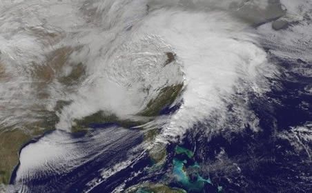
© NOAASatellite image of the storm in the early afternoon of 26 Dec.. Notice the circulation, and convection firing off along the cold front on the eastern side.
From a record Christmas Day tornado outbreak to today's heavy snows in the Ohio Valley, interior Mid-Atlantic and Northeast, the storm coming up the East Coast has left quite a mark.
On Christmas Day, more than 30 tornado reports were logged from eastern Texas to southern Alabama. That number easily exceeds the most previously recorded (12 in 1969) on December 25 (dating back to 1950). The twisters caused some damage, but there have been no reports of fatalities, fortunately.
Although no tornadoes have touched down so far today, a tornado watch is in effect for eastern North Carolina through 5 p.m. ET.
While tornadoes swarmed near the Gulf Coast, double digit snowfall totals were recorded in Arkansas, Illinois, Indiana and Missouri Christmas Day.
Heavy snows are blanketing parts of West Virginia, Pennsylvania, western Maryland, and Ohio on this Boxing Day - with strong winds creating near blizzard conditions in some areas.
Here are a few more impressive images and photos of the storm...
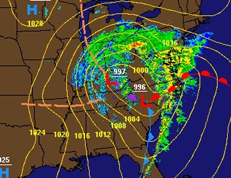
© National Weather ServiceRadar and surface map from midday yesterday showing double low pressure structure and huge swath of precipitation from Florida to Illinois.
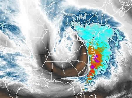
© NOAAWater vapor imagery shows another view of the storm yesterday afternoon. Dry air wraps into the middle of the storm, strong thunderstorms erupt southeast of the center, and a large “comma head” is seen on the west and southwest side of the storm.
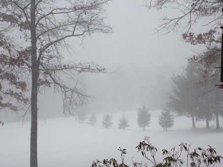
© Mark HoekzemaThe storm has dropped 8 to 10 inches of snow in Garrett County, Maryland, location of this photo, along with strong winds.


Reader Comments
to our Newsletter