- On same day Met Office reveal it's been the wettest summer ever, temperatures plunged to almost record summer lows overnight
- Braemar is Scotland was the coldest spot as it dropped to -2.1C
- There has only been one August night colder, August 21 1973, when Lagganlia in the Highlands suffered -4.5C
- It tops off a miserable summer, which has been the wettest in a century, causing flash floods only yesterday
- Traffic congestion as parents return from family holidays ahead of children going back to school next week with M25 delayed in both directions
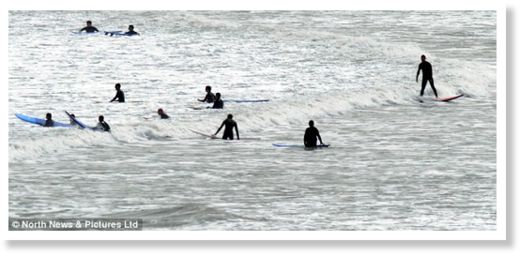
Despite some areas dropping to below -2C last night, surfers were out in force today, while children happily splashed around in the waves at Tynemouth Beach in North Tyneside.
The pre-school rush left roads busy this evening as parents travelled home from their holidays in preparation for their children returning to school next week.
It comes after a disappointing summer that has been the wettest in a century.
Braemar in Scotland was the coldest spot as it dropped to -2.1C (28.22 Fahrenheit), followed by Aviemore near Loch Ness on -1.8C and -0.7C in north-east England.
The only night that was colder came on August 21 1973, when Lagganlia in the Highlands dropped to -4.5C.
But outside the Highlands some weather stations are likely to have had record lows for their areas.
Bradford in West Yorkshire had its coldest August night since records began in 1908 at 2.8C.
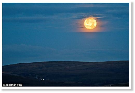
As this unseasonal chill swept across the UK it coincided with an astronomical phenomenon - a blue moon. This means there will be two full moons in a month, with one at the start of August and another today.
The temperatures, which reflect the country's cold and soggy weather over recent months, have proved this summer has been a complete write-off.
It came as it was revealed yesterday the summer has also been the wettest in England and Wales for a century.
Unusual cold winds have dragged down the temperature over night, experts said today.
'Last night saw northerly winds drag cold air from quite a long way north over the UK. This air was also dry, which meant there was very little moisture to help retain heat from the day,' a Met Office spokesman said.
'This, combined with clear skies caused by the high pressure sitting over the country, meant all the heat radiated into the sky - leaving very cold temperatures for the time of year.'
The miserable temperatures top off a terrible summer.
Data released by MeteoGroup, the weather division of the Press Association, showed that 14.25ins or 362mm of rain fell in June, July and August so far, outstripping the previous worst period in 1912.
MeteoGroup forecaster Nick Prebble said this summer is set to be the fourth wettest since records began in 1727.
June 2012 was the wettest since 1860, had the least sunshine since 1909 and was the coldest since 1991.
'July wasn't as wet as June but it was still wetter than average.
'We haven't quite got to the end of August yet but we're expecting rainfall to be a few millimetres above the average.'
MeteoGroup said 14.06in (357mm) of rain has fallen in Scotland during the summer so far, compared with an average of 11.42in (290mm).
The night of cold calm last night came after a Tornado, lightning, flash floods and landslides have wreaked havoc across Britain as Mother Nature struck with terrifying force.
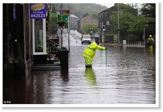
Homes and businesses were cleared and temporary shelters set up yesterday as more than two inches of rain fell in just a few hours across the North-West.
The Environment Agency issued 11 flood alerts across the country.
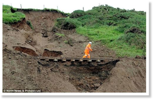
In St Bees, Cumbria's western-most point, almost an inch of rain fell in just an hour causing a landslide which later derailed a train in scenes akin to those wrought by Hurricane Isaac in Louisiana.
The 100 passengers on board, mainly workers heading towards the Sellafield nuclear plant, escaped without injury after the accident at 6.45am.
In Egremont, west Cumbria, up to 150 homes were hit by flash flooding with the Fire Service saying it had received 100 calls for help, mainly involving requests for sandbags.
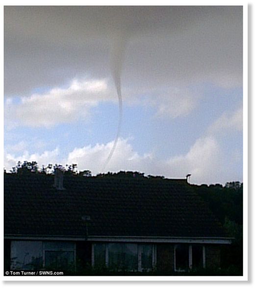
And in an illustration of the weather's powerful unpredictability, twisters were seen above Clevedon, Somerset.
His wife Alison, 43, said: 'If he had been stood at the car four seconds later he would almost certainly have been killed or maimed.'
A spokesman for the Met Office said the worst of the weather had passed and that the next three days are expected to be relatively dry with only scattered showers.
Temperatures will not beas cold this evening, experts have said.
'Cloud and any rain across southeast England will clear, becoming dry. Elsewhere, also becoming mostly dry and fine with showers dying away, but they will continue around Northern Ireland, western Scotland and some western coastal areas with a southwesterly breeze,' the Met Office said.
The turbulent weather will rekindle memories of the Jubilee weekend in June, when street parties across the country were sullied by drizzle.
The Thames river pageant also proved a nightmare for spectators, many of whom travelled to London only to be drenched by heavy showers.
Last weekend's Bank Holiday was also a complete washout, with torrential rain and massive thunder storms sweeping across much of the country.
Many of us had already rolled the barbecues back into the garden shed, resigned to the fact that the sunshine was over.
Then the heavens opened - and stayed open in some areas from first thing in the morning to well into the evening on Saturday and continued in some places on the Sunday.
Huge events like iconic British sporting events like Wimbledon were also badly hit by bad weather and only the Olympics escaped.
Senior forecaster at Meteogroup, Stephen Davenport said: 'It is hard to point the finger at any one cause for such a disappointing summer, or indeed for the fact that this has been pretty much the sixth in a row, with 2006 the last with any lengthy periods of dry and hot weather.
'We can say that the atmospheric circulation around the northern hemisphere has been rather weak for much of the time during those years, and this lends itself to what meteorologists call blocking, whereby a pattern of low and high pressure around the hemisphere becomes locked in for long periods as the jet stream that shapes and holds them loops lazily and extravagantly around the globe.
'It is unfortunate for those wanting to break out the flip-flops and shorts that the British Isles have found themselves under stagnant low pressure rather more often than high pressure.'

Reader Comments
to our Newsletter