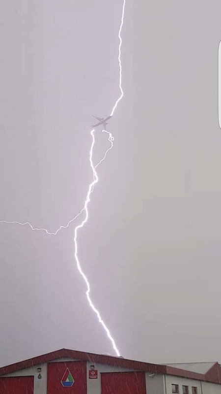
Flooding was also reported in Alda, Cushing, Dannegrog, Elba, Greely, Spalding, St. Libory, St. Paul and Wolbach.
At 5 p.m., the National Weather Service in Hastings reported that Grand Island had a record rainfall for Friday of 1.81 inches, with more rainfall expected through the evening. That broke the previous record of 1.32 inches set in 1957.
The heavy rain pushed Grand Island's precipitation to 4.81 inches for the month as of 5 p.m., but the heavy rain continued into the evening adding to that amount.
At 7:10, the NWS reported that the slow-moving thunderstorms had dumped as much as 3 inches of rain in areas extending from Grand Island northward to Spalding. The NWS reported 2.51 inches of rain at that time at the Central Nebraska Regional Airport.
The NWS issued a flood warning for Greeley and Howard counties. Northeastern Hall County was under a flood warning until 1 a.m. as a result of the heavy rain.
The NWS reported that there was heavy rain in Wolbach and a weather observer in Greeley reported 2.7 inches.
Also, the NWS reported that at 5:35 p.m., storm spotters sighted a possible landspout rope tornado northeast of Grand Island in extreme southwestern Merrick County.
The line of thunderstorms crossed western Merrick, eastern Hall, eastern Howard, western Nance and eastern Greeley counties.
As of 7, the NWS reported rainfall Friday for Hastings at .72 inch; Kearney, .6 inch; Ord, .29 inch; and Aurora, .88 inch.
Rain has come in abundance to areas of Central Nebraska in the last several weeks, along with cooler weather. State Climatologist Al Dutcher is concerned how much rain the state will receive this spring.
Along with the rainy weather, temperatures have been below normal for the last week in the Grand Island area. But so far, it has been topsy-turvy temperature-wise, with Grand Island having a high of 98 degrees on May 9 and low temperatures of 33 degrees on May 3 and 16.
And the NWS forecast has chances of showers and thunderstorms in the forecast through Wednesda,y except for a brief respite on Sunday, when it is forecast to be sunny and in the 80s.
Dutcher said models have shown an above-normal precipitation trend.
However, precipitation trends have been spotty as some areas have gotten a deluge of rain and other places just a few drops.
Prior to the heavy rain Friday, the NWS said Grand Island had 3 inches of precipitation for May and Hastings had 2.75 inches, while Kearney was at .89 inch, Aurora at 1.57 inches and Ord, 1.71 inches.
Cooperative observers for the NWS reported the following totals so far in May, Central City, 3.76 inches; Osceola, 3.79 inches; Fullerton, 3.34 inches; Ravenna, 3.29 inches; Loup City, 3.42 inches; and Greeley, 3.12 inches.
Many of those amounts have increased considerably with Friday's heavy rain as some areas may have seen rainfall amounts for the month climb to more than 6 inches of rain.
While Nebraska farmers have made headway in spring planting, Dutcher said heavy rains are always a concern for crops, especially during planting season, and producers are hoping rains hold off to get the remainder of the crop in the ground.
Corn planting has jumped from being 15 percent complete on May 1 to 84 percent complete as of Sunday. Soybean planting was 40 percent complete Sunday, compared to the five-year average of 35 percent.
"Rains are important, but we'd like to see them spaced out a bit," Dutcher said.
The recent rain has helped south Central Nebraska catch up on its subsoil moisture deficit, important for crop development as the warmer summer weather comes. Heavy rain, though, has flooded lowland crop fields throughout the area.
Dutcher said there were some very significant long-term deficits in soil moisture, especially in areas across south central and southeast Nebraska.
"We tend to forget how dry it was last fall and in March," he said.
While forecasts are showing above-normal precipitation, Dutcher cautions that there has been significant variance in forecasts so far this spring.
"It seems we'll get two- to four-week stretches with well-below-normal precipitation only to be followed by a wet period," he said.
Dutcher said precipitation balance is a major concern. However, May and June typically are the state's wettest months, representing one-fourth of the state's annual precipitation.
According to the NWS Grand Island's wettest months are: May 4.07 inches; June, 3.72 inches; and July, 3.14 inches, making up 42 percent of Grand Island's average annual precipitation of 25.89 inches. With Friday's heavy rain, Grand Island is now more than 5 inches above normal.
Dutcher said Nebraska needs to see normal precipitation during May and June.
"That can help alleviate lingering drought concerns in regard to long-term dryness impacting soil moisture reserves now that the majority of the state's corn crop is in the ground," he said.
With crop prices high for corn and soybeans and supplies tight, a good crop is vital this year or corn prices could climb even higher, especially as weather has delayed planting in a number of major corn-planting states.
State farmers indicated to USDA that they plan to plant 9.5 million acres of corn, the largest acreage since 1933, and 5.05 million acres of soybeans, the second largest on record.
Another concern this spring, Dutcher said, is La Niña. While the event is still expected to reach neutral status in June, he said it could happen within the May-July period.
"That being said, there could still be residual impacts even after sea temperatures return to normal," Dutcher said. "Because the atmosphere is still showing signs of moderate La Niña, it could take up to a month for the atmosphere to return to neutral conditions."


Reader Comments
to our Newsletter