That reminds me of the old Wendy's commercial from the 1980s. You know the one I am talking about...
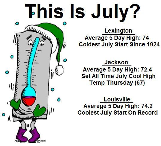
To put it all in perspective... most areas have not recorded a 80 degree temp since one week ago today. Many record low high temps have fallen over the past several days with Sunday seeing more added to the list. Take a look at this graphic I put together for you guys...
If you are not impressed with those stats... there is nothing I can do for you.
 The chill of the past week is something that will be talked about for years to come. It has truly been historic to see this kind of prolonged cool spell in Summer!
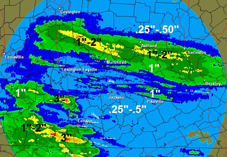
As we continue with a brief look back... we find that the weekend produced plenty of rain and some thunderstorms across the area. Heavy rains caused a lot of problems for a lot of outdoor plans on this 4th of July weekend. Here is a look at radar rainfall estimates from Saturday and Sunday...
The soggy Spring and Summer rolls on!
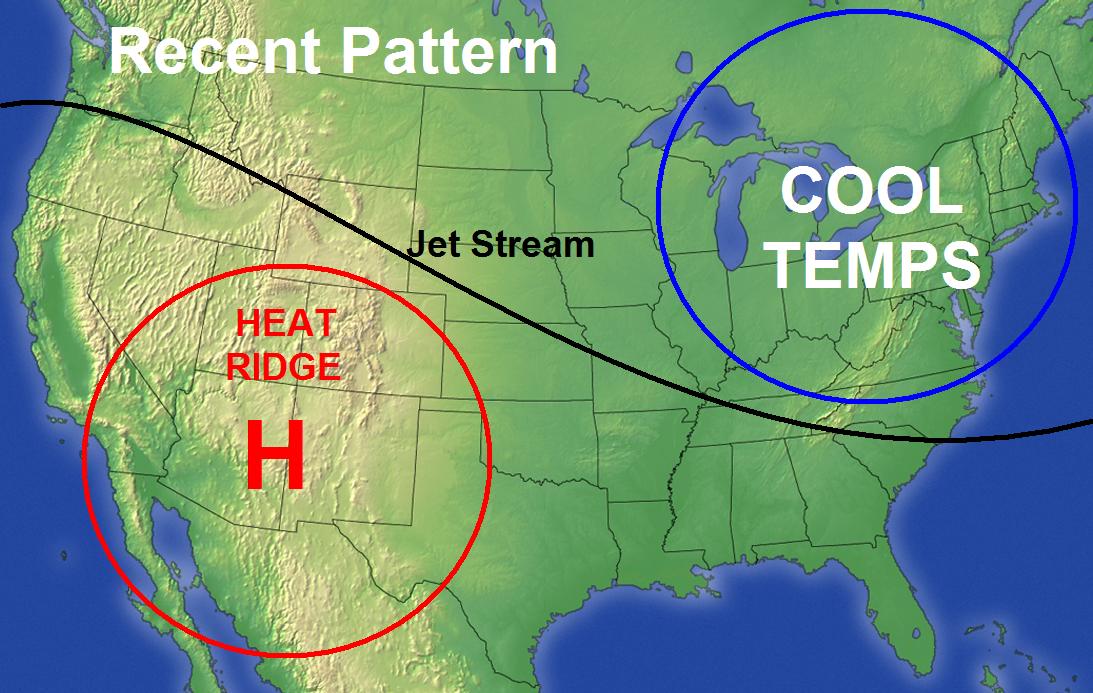
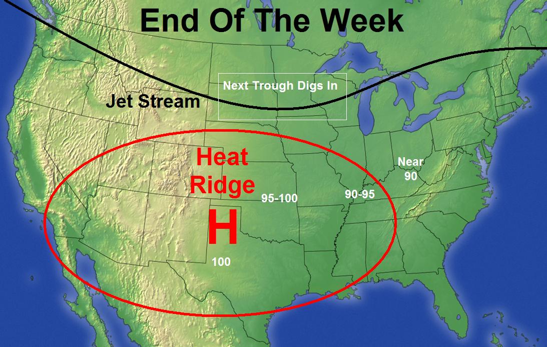
If you are looking for a pattern change... we have it coming up this week. Warmer temps are on the way and thermometers may even get a little toasty by the end of the week into the weekend. The big heat ridge across the southwestern US will try to nose in across the region by late week allowing for some true summer air for a change. Here are a couple of maps showing how the pattern will be changing this week...
You can see how the jet stream works northward with time allowing for the heat to progress slowly eastward. We should only be on the cusp of the real heat as the next trough digging in will send that heat core back to the southwest of us after it has a 2-3 day run at us. Here is a day by day breakdown of the next week...
Today: Dense morning fog gives way to partly sunny skies. Highs upper 70s southeast to low 80s elsewhere.
Tuesday: Partly sunny with a very small threat for a shower or isolated storm north. Highs in the low 80s.
Wednesday: More of the same. Partly sunny with temps in the low 80s for highs.
Thursday: Warmer with the threat for a thunderstorm rolling in from the northwest. Highs in the low to mid 80s.
Friday and Saturday: Hotter and more humid. Isolated popcorn storms possible. Temps near 90 for highs.
Sunday: Isolated storms with highs from 85-90.
How is that for a Monday blog post?
 Have a great day everyone and take care.



Reader Comments
to our Newsletter