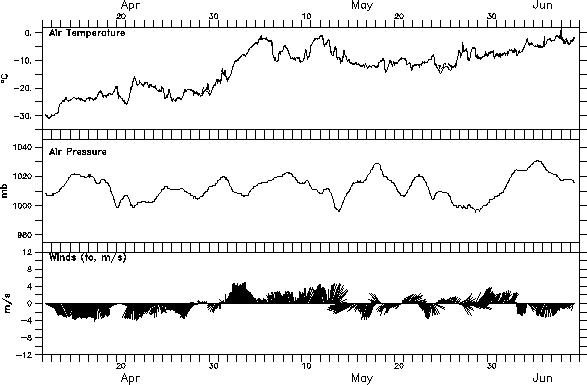
Latest data (updated approximately weekly)
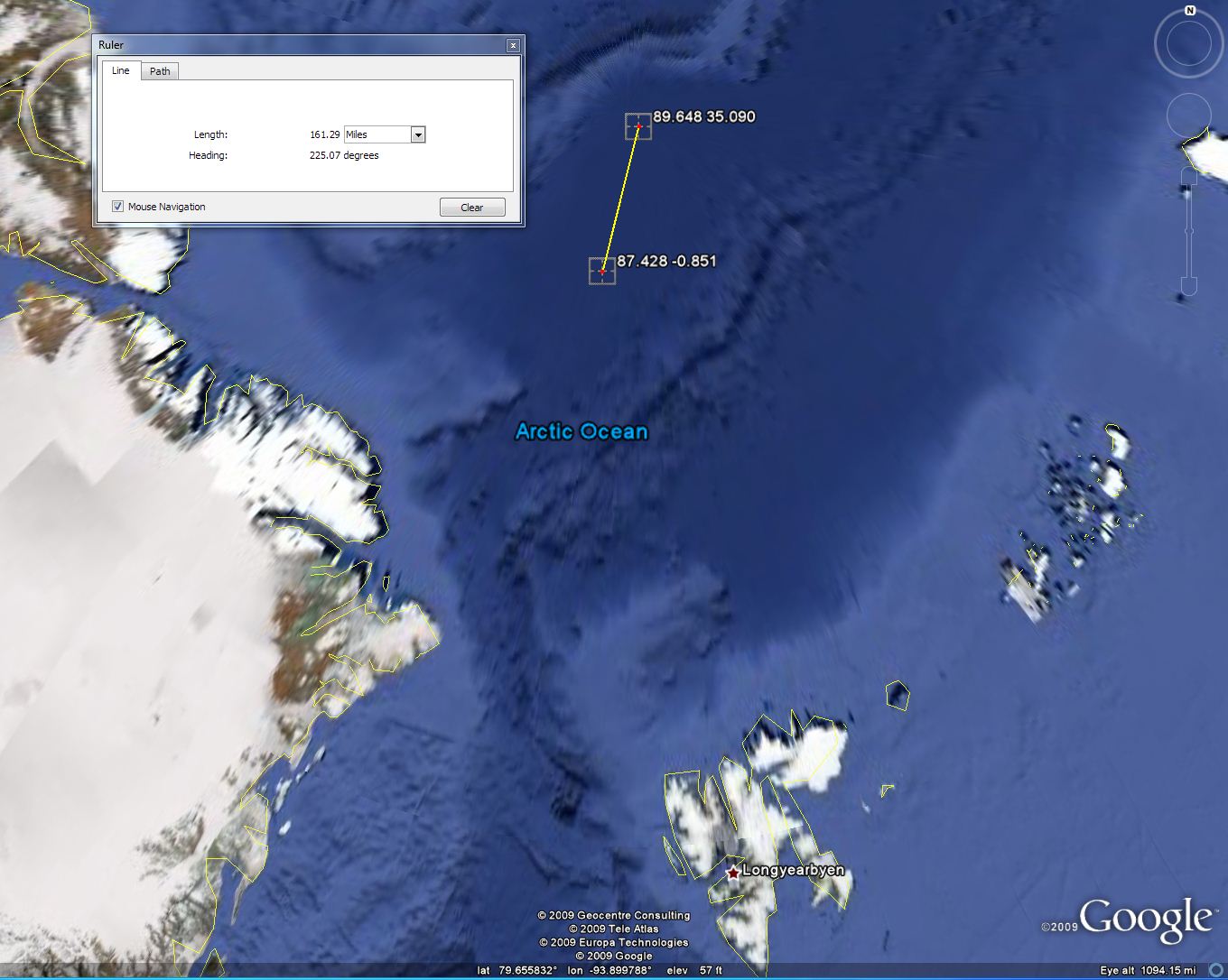
Readers should note that the station really isn't at the north pole anymore due to significant ice drift.
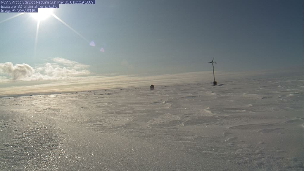
WUWT reader GlennB called attention to the webcam images today. A couple of weeks ago (5/31/09) it looked like this. You can see the weather station in the distance.
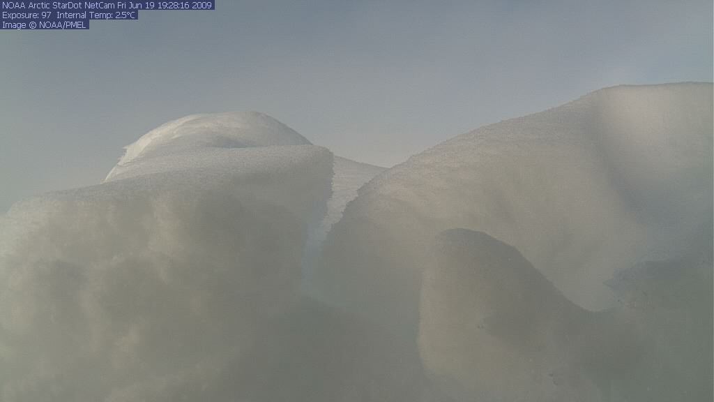
Now it looks like this:
It appears either a snow drift and/or pressure ridge has blocked the view of the weather station.
Here is what they say about it on NOAA/PMEL's web page:
Comment: NOAA/PMEL's North Pole web cam deployments began in April 2002. The web cams operate during the Summer warmth and daylight (April - October) and are redeployed each Spring. The images from the cameras track the North Pole snow cover, weather conditions and the status of PMEL's North Pole instrumentation, which includes meteorological and ice sensors (seen in the camera images). The instruments typically continue to transmit data for months after the solar-powered web cams stop.
Web Camera provided by Star Dot Technologies with technical support by Vance Kozik. System design by Oceantronics. Camera images are relayed via the Iridium satellite system.
Link is here: NOAA Arctic Gallery
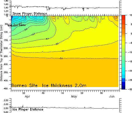
What I find most interesting is the ice/snow sounder graph.
Ice-temperature plot: Plots of air, ice, and ocean temperature as measured by Mass Balance buoys developed by CRREL. Final versions of files will be created by CRREL.
Download preliminary data: 07948.cplot (click for header information)
Not much change in the ice pinger distance, even though the station has drifted 161 miles to the SSE (lat lon data here). If I interpret the pinger graph correctly, the ice thickness has changed from ~2.75m to ~2.5m.
We'll see if there is any significant change in a couple of weeks, assuming it is still transmitting.



Reader Comments
to our Newsletter