Storms
S

Cloud Lightning

US, New York: Rockland storm downs trees, floods roads, cuts power to 4,000

Image
© Peter Carr/The Journal NewsCars are stranded on Mill Creek Road in New City after Friday's heavy rain.
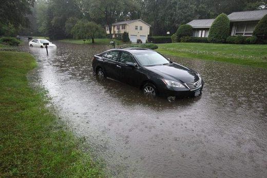
Another round of thunderstorms wreaked havoc in Rockland on Friday, downing trees, flooding roadways and causing damage to power lines and a utility substation that left about 4,000 homes and businesses without power.

The thunder could be heard and the lightening seen as early as 2:30 p.m. in some areas, but the brunt of the storm didn't move across the county until about 4 p.m.

Heavy rains caused flash floods in some places, and heavy winds downed trees in others. That left some county roads impassable.

Friday evening, hours after the rains eased and the flood waters receded, Melvin and Marilyn Israel stood at the entrance to their Mill Creek Road home in New City, listening as workers pounded nails into their roof to secure a tarp.

Beneath the tarp, a gash had been left by a massive tree that had fallen.

Cloud Lightning

US: Heavy Rains Soak Eastern Philadelphia, Strand Motorists

Image
© Unknown
Philadelphia - Heavy rains soaked eastern on Friday, washing out numerous roads as well as a fireworks display and a minor league baseball game.

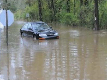
The National Weather Service warned of flash floods in Philadelphia and its suburbs for several hours following torrential midday downpours. The storm flooded streets and stranded motorists in Delaware County, where lightning split a large tree in Ridley Township, WPVI-TV reported.

Two inches of rain fell within an hour during the late afternoon in Bechtelsville, according to the weather service.

A weekly fireworks show in New Hope was postponed because of the weather, as was the Scranton/Wilkes-Barre Yankees game against the Buffalo Bison.

The rain delayed the start of the Philadelphia Phillies game against the Atlanta Braves by nearly two hours.

PECO reported scattered power outages in Philadelphia and its suburbs.

In northeastern Pennsylvania, reports from western Wayne County indicated flooding west of Honesdale near campsites. The weather service said up to 5 inches of rain may have fallen since early Friday afternoon.

Some communities in Monroe County were still cleaning up from a strong storm Thursday that downed trees and left more than 10,000 people without power.

Most customers had their electricity restored by Friday, the Pocono Record reported.

Cloud Lightning

Calvin Expected To Weaken Over The Weekend

Hurricane Calvin 2011
© UnknownCalvin has become the third hurricane of 2011
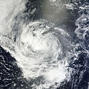
Hurricane Calvin, the third hurricane of the 2011 eastern Pacific hurricane season, continued to pick up strength as it neared the west coast of Mexico late on Friday.

At 4 p.m. GMT, Calvin's maximum sustained winds had already grown to 70 mph, just 4 mph under hurricane strength. By 9.30 p.m maximum sustained winds had reached 75 mph (120 kph).

The National Hurricane Centre confirmed at 9 p.m. GMT that Calvin had achieved the minimum strength to be classified a Category One hurricane on the Saffir-Simpson Scale. However, the system is expected to weaken during Saturday. Calvin is then forecast to weaken further as it passes over slightly cooler water and dissipate to a remnant low on Monday, July 11, 2011.

The centre of Hurricane Calvin is located about 210 miles southwest of Manzanillo, Mexico, and is moving toward the west near 14 mph.

Cloud Lightning

US: Lake Hauto, Pennsylvania storm uproots trees, knocks out power

Lake Hauto storm
© Eric Conover/Staff Photo Crews work to restore power Friday on Route 54 near Lake Hauto. The storm knocked out power to more than 700 PPL customers.
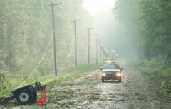
Ermano Agosti described the storm as sounding "like a train" blasting through his Lake Hauto neighborhood Thursday night.

The wind uprooted trees with root bags 6 feet tall - some of which landed on homes and power lines - cut a path about 50 feet wide into a wooded area, and knocked out electricity that won't be completely restored until late this afternoon.

The storm brought heavy winds and hail into the lake development, which straddles the Schuylkill-Carbon County border and is partially in Rush Township and partially in Nesquehoning, but injured no one.

While the storm had characteristics of a tornado, it likely would not be designated as one, according to Pete Young, a meteorologist for the National Weather Service office in State College.

"We didn't get any indications of a tornado on the radar last night, or any indications from people there this morning," he said. "It was probably a strong line, what we call a downburst. There was severe, localized damage, and winds probably were between 60 and 80 mph, considering the way the trees were damaged."

While most residents in the development have electric service restored, some don't.

Paul Canevari, a spokesman for PPL, said crews will be working into today, as they did Thursday into Friday, to get all customers back on line.

"The outage affected 700 customers," he said. "We have restored approximately 530 customers as of 2 p.m. (Friday). The remaining 170 will be restored by 5 p.m. (today)."

On Friday, trees were either uprooted or split along nearly every street in the development. The scene looked like a log-cutting contest, with sawdust and the sound of chain saws everywhere.
Cloud Lightning

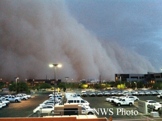
US: More on the Haboob dust storm that covered Phoenix, Arizona

Arizona Haboob
© NWS
The National Weather Service and AccuWeather both have post-mortems on the massive dust storm that swallowed Phoenix on July 5, 2011.

AccuWeather says, "The dust storm was estimated to reach a peak height of at least 5,000 to 6,000 (about a mile) with an aerial coverage on the leading edge stretching nearly 100 miles, according to the National Weather Service. The storm traveled at least 150 miles, much farther than the average 25 to 50 miles that dust storms typically travel." (See report and videos here. and another report and videos here.)

The National Weather Service provides a report and charts here. Some excerpts:

Igloo

SOTT Focus: Freak Arctic Weather Precursor to the Coming Ice Age?

As regular readers of SOTT are aware, we collect weather reports from around the world which often point to weird weather occurring in locations experiencing unseasonable weather. This week there has been an especially weird spike in reports of sudden cold and snow affecting many areas of North America and Europe! We think this dramatically illustrates the alarming speed with which the weather can change from stable, warm and dry conditions to turbulent, cold and wet conditions. Global news networks are churning out endless reports on the UK election, the financial shockwaves hitting Europe and the Times Square hysteria over some fireworks left in a car. What is not being reported prominently are the unprecedented freak weather events happening around across the northern hemisphere: hail, sleet and snow slamming southern California, deluges devastating the central cities of Nashville in the US and Hunan in China, the Korean Peninsula shivering with a record-low spring chill and reports of snow in Mexico and France.

Are these just unseasonal conditions, an immediate knock-on effect from the recent volcanic eruption in Iceland perhaps? Or are we on the brink of entering an ice age as SOTT has been predicting for a number of years? Was the sudden flip this week - "as though a switch had been thrown" - a taster of the Ice Age to come? Is this 'mini Winter rebound' pointing out how suddenly glacial rebound can develop? When will we approach the tipping point as more volcanoes erupt and magma comes up from the ocean floor? Laura Knight-Jadczyk explains the mechanism that can precipitate sudden climate change towards an Ice Age:

That's the hard science. There's going to be the day. It's already happening. The magnetic field is degenerating. That means magma is going to start welling up under the oceans. It's already happening because it's heating the oceans up.

When the oceans start heating up, that means more evaporation. When that happens at the same time that the planet is being clouded by volcanic eruptions, which is cooling the atmosphere, you have precipitation that comes down as snow.

The geological record shows that the onset of every ice-age was so sudden as to be unbelievable. In other words, next winter could be the winter when a lot of undersea volcanoes begin to erupt and dump magma into the oceans. A lot of evaporation takes place.

If it happens in the winter time that means that snow can fall in amounts that are beyond your wildest imagining. It's happened! It's geologically a fact. It's happened repeatedly. Can you imagine 9 stories of snow in a single day?

Cloud Lightning

South Carolina, US: Melvin Roberts Survives Being Struck By Lightning For Sixth Time

Melvin Roberts of South Carolina has been struck by lightning an unbelievable six times.

He believes that his record with lightning is connected to his record with marriage: "I've married five time and I've been hit by lightning five times. But [his sixth wife] says this is the sixth time and I'm not leaving my wife, so I'm going to have to do something different."


Cloud Lightning

New Zealand - Tornado hits Kapiti Coast

A tornado has hit just north of Waikanae on the Kapiti Coast, North of Wellington.

Trees have fallen across roads and onto houses, power lines are down and a car has been blown off the road.

A person had to be rescued from their house amidst the storm this afternoon, after a tree fell on it.

Emergency services rushed the person to hospital with moderate injury levels.

Cloud Lightning

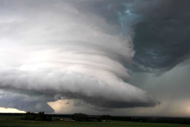
Canada: Tornadoes Hit Southern Alberta

Image
© QMI Agency / Darren MakowichukA massive thunderstorm that dropped a tornado near Sundre, Alta., hovers just west of Olds causing strong winds that knocked over numerous trees before heading north towards Red Deer on Thursday July 7, 2011
Edmonton- Several tornadoes swept through southern Alberta Thursday, causing significant damage from Sundre to Red Deer.

A tornado warning was in effect for the area from just after 5 p.m. until around 9:15 p.m. when the main storm began to dissipate over Red Deer.

It was still a tornado as it moved towards Red Deer, but it dissipated quickly over the area," said Stuart McKay with Alberta Environment. "There were several fairly thin tornadoes, but we have received reports of damage, including significant wind and hail damage across the area.

Bizarro Earth

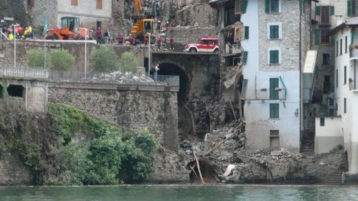
Italy: Eighty Evacuated as Landslides Hit Picturesque Lake Como

Image
© stillthelovely.com
Como - Firemen evacuated 80 residents late Thursday after after a series of landslides hit Italy's picturesque northern Lake Como, where movie star George Clooney has a holiday villa. The cause of the landslides was not immediately clear.

The residents were removed by boat after roads were blocked by no less than seven landslides. The biggest occurred in the Brienno area of the lake, where passengers inside a bus and a car escaped unharmed after a landslide hit their vehicles causing them to veer off the road.

An ancient Roman bridge and an abandoned house were reduced to rubble by the landslides and another dwelling and several vehicles were reported to have been damaged.

Authorities closed a local highway in both directions after the landslides, causing tailbacks over 10 kilometres long.