Which is why, when researchers started scouring the ocean floor immediately surrounding the volcano, they expected to find a gnarly landscape. Surely it would be reshaped by the blast and littered with debris. Scientists believe that the explosion was the result of an incendiary recipe: hot, gaseous magma meeting cold, salty sea water. But how exactly did those two ingredients come together with such force? Some of the leading theories centered on the idea of a landslide or other collapse of the volcano's slopes that helped water intrude into the magma chamber. That would also help explain the tsunami that killed three people on nearby Tongan islands. A massive shift in submarine rock also means displacing a massive amount of water.
A team of scientists from New Zealand's National Institute of Water and Atmospheric Research, or NIWA, recently observed something different. Using ship-mounted acoustic instruments to map the seafloor, they found the terrain has indeed changed — it's now covered with at least enough ash to fill 3 million Olympic swimming pools. But apart from that, it's not all that different. The slopes of the underwater volcano are still largely as they were before the eruption; the same features still contour the surrounding seafloor. Within 15 kilometers of the volcano, some of those features are even still teeming with life, with starfish and corals clinging to rocky seamounts. "The first thing we did was a circle around the volcano, and I'm going, 'What the hell?'" recalls Kevin Mackay, a marine geologist at NIWA who led the expedition. "It just defied expectations."
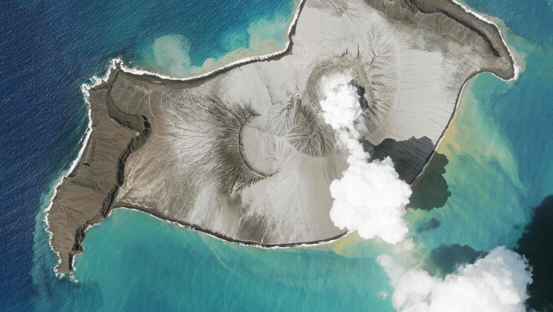
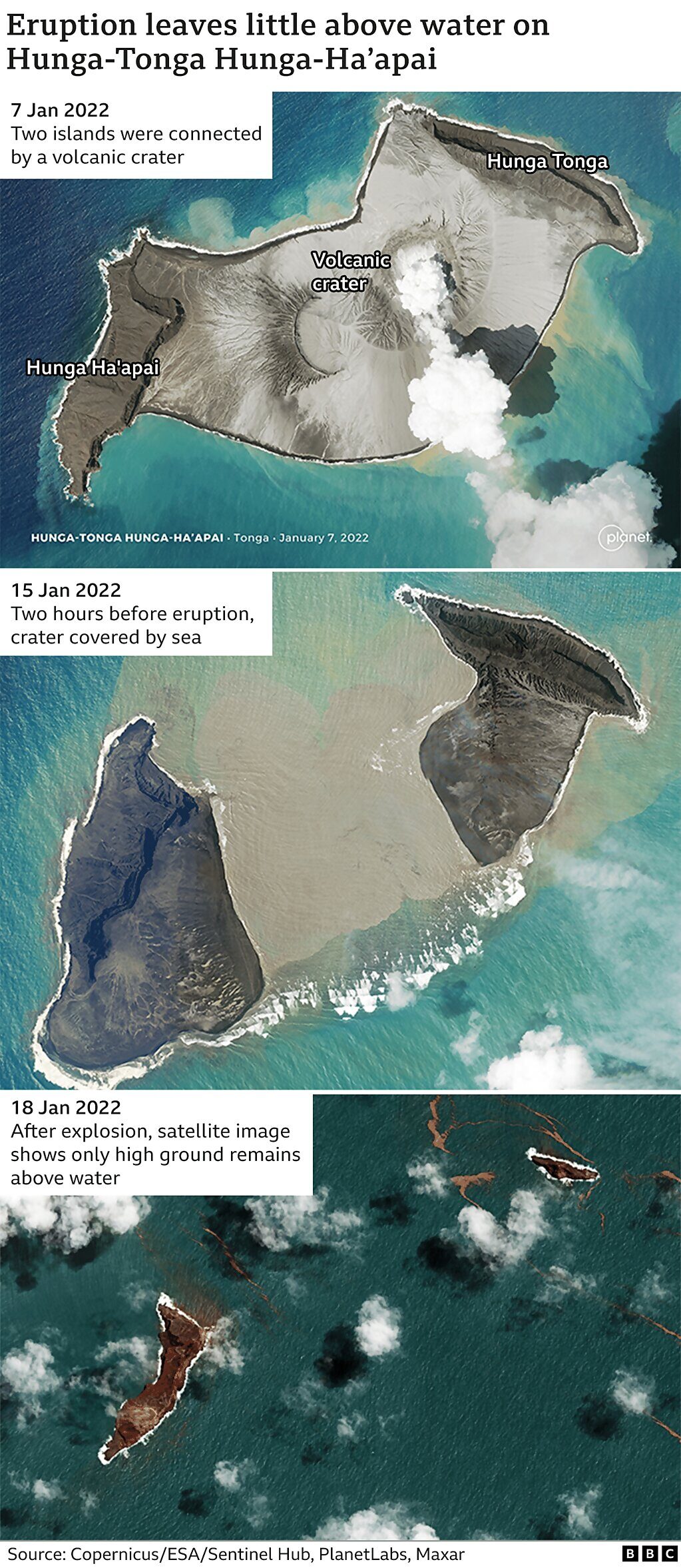
One area where they didn't venture was just right above the caldera, the depression left behind when the volcano blew. Mackay's large research vessel full of scientists and crew had not dared sail there — not because of the risk of large explosions, but because of smaller burps of gas that might rise up from the eruption site. "Those gas bubbles can down ships, and they've done it before," he says. But they suspected total destruction. Islands that had risen out of the sea just before the eruption had been torn asunder by the blast, suggesting a crater beneath the surface.
A day after the NIWA team released their findings, a second group of researchers at Tonga Geological Services and the University of Auckland helped fill in the map. Using a smaller ship that was less at risk from the bubbles, the team went out over the caldera with a similar set of acoustic instruments. Yep, it was a hole alright. The gash is 4 kilometers wide and 850 meters deep, and surprisingly constrained, hemmed in by the volcano's original slopes. "What we have here now is a very large, very deep hole in the ground," Shane Cronin, a volcanologist at the University of Auckland, explained at a press conference in Tonga. "It helps us understand why the explosion was so very, very large."
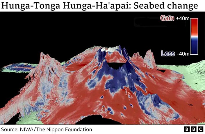
That may help explain the deadly tsunami. The blast sent millions of tons of rock into the air, which soon came crashing down onto the surrounding seafloor, creating pyroclastic flows — hot mixtures of the rock, gas, and ash — that raced outward and likely pushed along the waves. The researchers hope chemical data from rocks and water gathered from within the caldera will help give a better picture of what was responsible for the explosion's extreme force.
Both groups also found evidence of ongoing volcanic activity within Hunga. But despite these rumbles, the findings don't suggest that the volcano remains an imminent danger to people living nearby. The caldera was so brutally emptied of magma that it has likely been reset to the state it was in 1,000 years ago, Cronin suggested, based on the dating of rocks from past eruptions. That's a relief for Tongans still reeling from the eruption. But the region is pockmarked by similar volcanoes emerging from the sea.
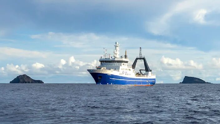
The NIWA team set sail in April aboard the Research Vessel Tangaroa for four weeks of experiments. They worked in alternating 12-hour shifts as they raced to understand as much as they could in about a 22,000-square-kilometer region. They were lucky to have a point of comparison for the seafloor; in 2016, the area was mapped when a team aboard a research ship abandoned another mission nearby due to a broken piece of equipment, sailed for repairs in Tonga, and decided to stop by to map the area around Hunga — which had just begun the eruption sequence that would lead to the January blast.
Comparing the two maps was vital to see how little the surrounding terrain had changed, Mackay says. "Not only was the volcano intact, but we could see from the 2016 map that here's a ridge and here's a valley and here's a knoll," he says. "I'm seeing the same ridge, the same valley, the same knoll." The team tallied up more than 6 cubic kilometers worth of ashy material layered on the seafloor, and suspects there's more to find. (Tonga's broken undersea internet cable was buried under 30 meters of it.)
Throughout their voyage, the researchers dipped instruments into the sea to collect samples of sediment and water at various depths. Taking cores from the seafloor was difficult; the material was still settling months after the explosion, and it was so fine it would waft out of the tubes as they pulled the samples to the surface. "I could imagine if I was down there you would just be sinking the seafloor," says Sarah Seabrook, a biogeochemist at NIWA. "It's not a stable surface you can stand on."
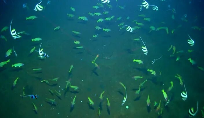
As they expected, the researchers didn't observe the usual signs of life on the seafloor itself, like tracks and burrows. But they did encounter surprises — rocky arks rising above the ash-covered landscape. Corals, starfish, and mussels were still clinging to these areas, called seamounts. It's likely that as the pyroclastic flows raced along the ocean's bottom, they encircled the elevated outcrops, sparing the life on top, Seabrook says. It's unclear why they weren't buried under the thick ash that fell later, but one idea is that unique currents around the seamounts protect them, like umbrellas.
Seabrook cautions that it's too soon to know how well life will recolonize the area — a key question for Tongan officials worried about the future of the region's fisheries. The team plans to go out twice more in the next four years to study how the ocean ecosystem repairs itself.
One factor in that recovery is the ongoing volcanic activity, first identified when the NIWA ship passed over a plume of apparently fresh ash wafting to the north of the caldera. That suggested a source within the volcano, which was later confirmed by the imagery of growing volcanic features captured by the Tongan team. Next month, the NIWA team plans to map the area over the caldera again, this time with an autonomous boat that will be guided by engineers nearly 10,000 miles away in Essex, England. The two maps will allow the scientists to capture changes over time.
The Tongan team and Cronin also spent 10 weeks traveling around the scattered islands, collecting ash samples, mapping tsunami water lines, and gathering eyewitness accounts to piece together the timeline of the blast and its impacts on land. Their goal is to inform government decisions about safer building plans and practices that can protect the islands, like planting trees that act as dams when a wave hits. The risk of destructive activity is low at Hunga, where the floor of the caldera is now buried by deep enough water to suppress another big explosion. But according to Cronin, it's important to stay vigilant, given the other volcanoes in the region. "Believe me, we have similar volcanoes in the Kingdom of Tonga," Cronin said. "We would expect the same behavior from some of them."


Reader Comments
I am busy checking for mantle plumes under Ottawa...
That surge pulled our atmosphere out of a low charge state very quickly and it is possible the energy had some impact on magma viscosity.
S ee Ben Davidson's site; spaceweathernews.com for the tables.
I visit Ben Davidsons site often now mainly due to frequent links here, but too much of it remains over my head, not helped by these interesting times.
Nucleosynthesis is the process underlying Cold Fusion. Characteristically, the cult of scientism denies Cold Fusion per se, despite acknowledging the irrefutable process of nucleosynthesis...a word game to keep the masses in the dark and enslaved to existing sources of energy production.
Nucleosynthesis is an all-pervasive nuclear fusion reaction. In the case of volcanic eruptions, the parallels are undeniable. In calculating the explosivity of eruptions comparisons are made to the energy released in an atomic bomb blast, further emulated by the mushroom cloud that towers over an eruption. The scientismists cut off their noses in spite of their phony faces. Although Nucleosynthesis is a fundamental process throughout the universe, the scientismists automatically exclude its applicability in the case of volcanism. Instead, they rely on the lame theory of frictional forces between subducting tectonic plates, or the even more ludicrous notion of a sea of incandescent magma seething below that without explanation forces its way to the surface along tectonic plate boundaries, both theories being utterly simplistic and without supporting evidence.
A fusion reactor could be constructed using 'rods' composed of igneous basaltic rock that would be exposed to deuterium in a controlled manner to produce unlimited energy without the dire threat of radioactive emissions. Basaltic rock is doped with platinum and palladium crystals which when combined with deuterium and an initiating electrical charge nucleosynthesis commences. It is well documented that volcanic eruptions are accompanied by extreme lightning discharges which further substantiates the process.
The pasteboard mask is coming off the deceivers. [Link] [Link]