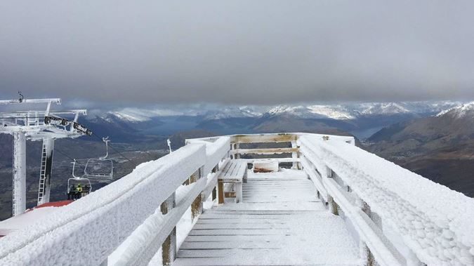
It may be spring in New Zealand, the weather is still stuck in a wintry rut.
A blast of polar weather is battering the country, bringing torrential rain, damaging winds and heavy snow.
The rain has already triggered two minor landslides in the Wellington area with more downpour expected.
Snow has been falling to as low as 500m on the South Island and blizzards have forced the closure of Canterbury ski fields, with some locations expecting well over 50cm of snow.
Stormy weather hits New Zealand during spring https://t.co/ZRphURTyVu pic.twitter.com/SSkIyhreiW
— Al Jazeera News (@AJENews) September 3, 2018
Severe weather at this time of year is not unusual for New Zealand. In spring, the weather to the north of the country warms fairly quickly and this contrasts starkly with the bitter cold to the south of the islands.
This conflict in temperature can produce some fairly explosive weather, and strong winds are a frequent problem.
During the current severe weather outbreak, damaging winds are again the main threat, with New Zealand's MetService warning that the winds in the Wellington area could gust up to 120kmph in the coming hours.
Heavy rain warnings are also in force for the lower half of the North Island.
On Tuesday, the area of low pressure responsible for the damaging weather will gradually move offshore, allowing the weather to gradually improve.
However, the rest of the week will remain unsettled, with plenty of wet and windy weather on the cards.


Reader Comments
to our Newsletter