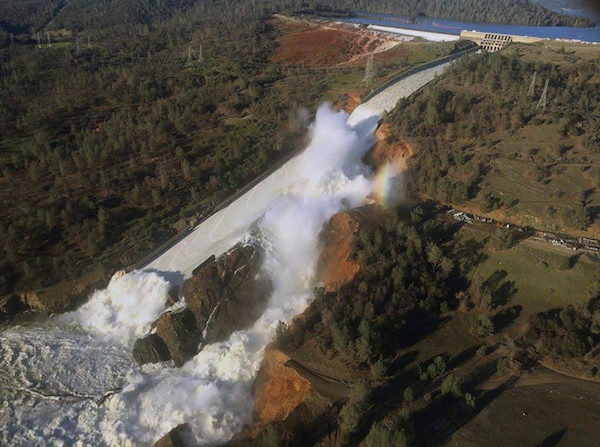
RUNNETH OVER
This week, 188,000 Californians were evacuated because an emergency spillway was damaged at Lake Oroville.
With more rain coming and a massive snow pack piling up, the state's reservoirs and dams are being pushed to their limits
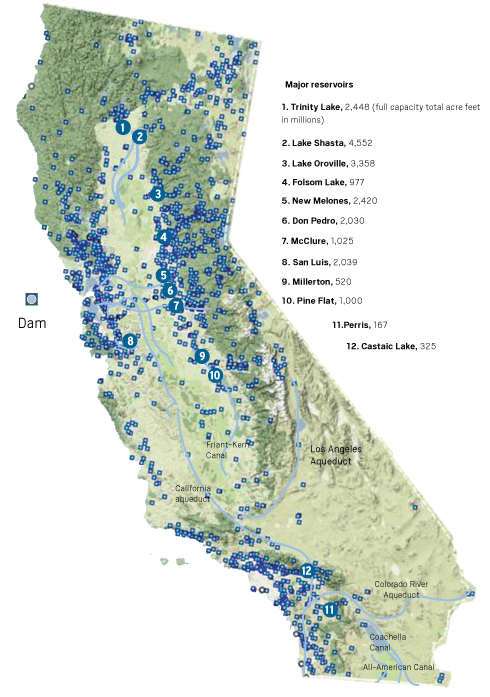
DAMS AND RESERVOIRS
According to the U.S. Army Corps of Engineer's National Inventory of Dams, there are 1,585 dams in California.
At 770 feet tall the Lake Oroville Dam is the tallest in the U.S. It was finished in 1967.
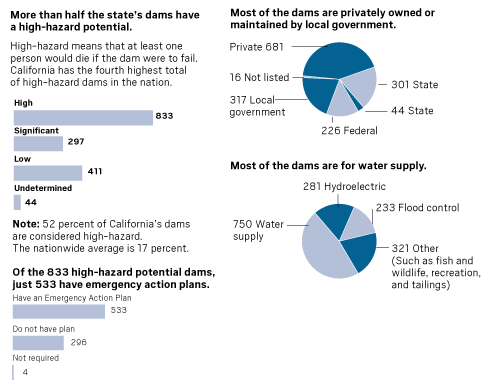
Here is a profile of dams in California from the National Inventory of Dams.
Southern California dams and reservoirs are not in danger of overflowing. The greatest threat has been flash floods in canyon and desert areas.
IMPACT OF THE SNOW PACK
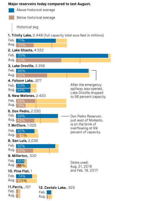
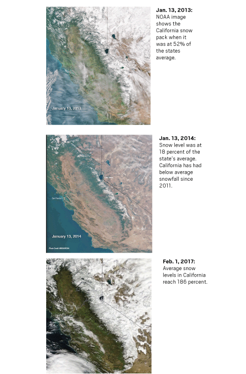
Some reservoirs are already at emergency heights and the massive snow pack continues to build. This could have dangerous repercussions for flooding in the spring.
Snow-to-water level
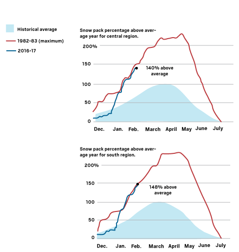
California Department of Water Resources calculations show the snow pack is near - and in some places exceeds -its highest level, recorded in 1983. Several major floods occurred in the spring of 1983 after the water levels in reservoirs, rivers and levees overflowed.
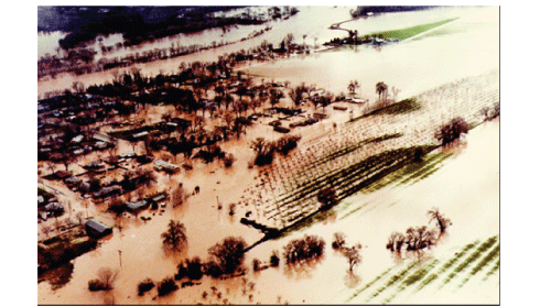
In 1983, flooding throughout California from Bakersfield north to the Sacramento Valley caused damage of more than $1.95 billion in today's dollars.
Sources: California Department of Water Resources, U.S. Army Corps of Engineers, American Society of Civil Engineers, United States Drought Monitor


Reader Comments
to our Newsletter