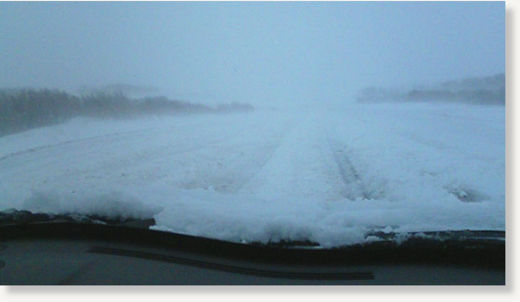
It may be spring, but it appears winter isn't finished with the Prairies just yet as a blizzard threatens to dump between 10 and 50 centimetres of snow on parts of Saskatchewan and Manitoba.
Winter storm and snowfall warnings were in effect Saturday for southeastern Saskatchewan, as well as much of western and central Manitoba, as a late-season storm system over North Dakota moved into the region.
Environment Canada warned of a combination of strong northerly winds gusting up to 90 kilometres per hour and falling snow "producing blizzard conditions over much of southeastern Saskatchewan...Travel is not advised over much of the area and residents should adjust travel plans accordingly. In addition the combination of heavy snow and high winds are producing power outages in some areas."
According to the agency, between 10 and 20 centimetres of snow may fall in some areas, with as much as 30 cm forecasted at higher elevations, before the storm moves out of the region Saturday evening.
Temperatures are expected to remain below normal for the remainder of the weekend. In Yorkton, for example, temperatures dipped to -4 Celsius, or -14 C with the windchill. A normal temperature for this time of year is 14 C.
The storm was still expected to pack a punch as it moved into Manitoba, with Environment Canada warning that between 10 and 20 centimetres of snow could be expected over much of the central and western part of the province by Sunday morning. Between 30 and 50 centimetres of snow are forecasted for higher elevations in the western part of the province.
"In addition, the strong northerly winds, which have gusted at times as high as 90 km/h, are resulting in near-zero visibility in snow and blowing snow, primarily in west-central Manitoba," the agency warned. "Highway travel has become difficult over much of the region and residents should be prepared to adjust travel plans accordingly. The combination of heavy snow and strong winds may also cause power outages."
Saturday's snow followed heavy rainfall that dropped as much as 40 millimetres of rain on parts of the province late Friday, said Steve Ashton, the province's emergency measures minister.
"It's important to note that we have extensive flood defences built up in terms of dikes, and one of the key things we're watching is to make sure that we can maintain the integrity of those dikes," Ashton told CTV News Channel on Saturday in a telephone interview.
"Because we're still before crest levels on the Assiniboine and we still haven't reached crest levels on parts of the Red River as well, and there are many other rivers that are only beginning to crest as well. So we're very much in the middle of spring flood season in 2011."
Both the Assiniboine and Red rivers are expected to crest next week, possibly on Wednesday.
According to Ashton, the Red River Valley is on target to experience the third most significant flooding since 1852. And officials anticipate the Assiniboine River will grow in volume to 50 per cent more than its last record.
"That will mean that we will have significantly high water levels well into the end of May and many of our major lakes will have significantly high levels well into the summer," Ashton said.
Provincial officials also warn that high winds and ice breaking up on Lake Winnipeg, Lake Manitoba, the Shoal Lakes and Lake Winnipegosis will lead to piles of ice on the shorelines.
And officials said Saturday that water levels will continue to rise as the new dumping of snow melts.
Provincial flood forecaster Steve Topping told reporters Saturday that officials "don't know the full impact of this storm yet." He said he would give an update on Sunday.
Manitoba Premier Greg Selinger said the province has had to ramp up its flood control efforts, which has so far cost the province $50 million. Selinger said he had been assured of federal government assistance.
"This storm reminds us that while we've been very lucky with the weather, things can change very quickly. We can't be overconfident," Selinger told reporters Saturday.
Conditions in the region are expected to improve as the low moves into northwestern Ontario into Sunday, although temperatures will remain below normal.


Reader Comments
to our Newsletter