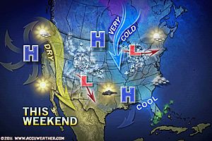
Lake-effect snow is already under way across the western Great Lakes, and will continue to develop downwind of lakes Erie and Ontario as today progresses and frigid air invades the Northeast.
The AccuWeather.com Winter Weather Center is expecting up to several inches of snow to accumulate to the lee of the Great Lakes today.
Snow-covered, slick roadways will create travel hazards for motorists. Bitterly cold winds will worsen the situation by blowing and drifting the snow.
Poor visibility is an added danger where the most intense bands unleash a heavy burst of snow.
One of these intense lake-effect bands will continue to develop in the vicinity of Syracuse, N.Y., today. The heaviest totals from this band will approach a foot into tonight north of the city.
As the lake-effect snow machine cranks up, an Alberta clipper will continue to deliver snow to the northern and central Plains today.

The snow will remain relatively light, accumulating a fresh coating to an inch or two. That amount of snow, however, can still cause a nuisance to motorists by turning roads slick.
The clipper and its light snow will spread eastward across the Midwest and Great Lakes into this weekend. The snow is expected to reach Green Bay, Wis., Chicago and St. Louis tonight, then Detroit and Buffalo, N.Y. on Saturday.
Snow will even press far enough east of the Great Lakes Saturday night to make an appearance in Albany, N.Y. The snow, however, should diminish before reaching the Interstate 95 corridor from Portland, Maine to New York City to Washington, D.C.
Diminishing snow is definitely not in the forecast for the Northeast next week. Instead, the region may become the target of a major snowstorm around midweek.


Reader Comments
to our Newsletter