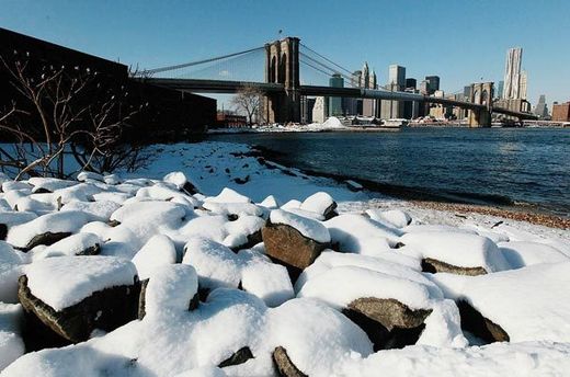
Judging by the weather, the world seems to have flipped upside down.
For two winters running, an Arctic chill has descended on Europe, burying that continent in snow and ice. Last year in the United States, historic blizzards afflicted the mid-Atlantic region. This winter it is the Deep South that has endured unusual snowstorms and severe cold, and a frigid Northeast is bracing for what could shape into another major snowstorm at midweek.
Yet while people in Atlanta learn to shovel snow, the weather 2,000 miles to the north has been freakishly warm the past two winters. Throughout northeastern Canada and Greenland, temperatures in December ran as much as 15 or 20 degrees Fahrenheit above normal. Bays and lakes have been slow to freeze; ice fishing, hunting and trade routes have been disrupted.
Iqaluit, the capital of the remote Canadian territory of Nunavut, had to cancel its New Year's snowmobile parade. David Ell, the deputy mayor, said that people in the region had been looking with envy at snowbound American and European cities. "People are saying, 'That's where all our snow is going!'" he said.
The immediate cause of the topsy-turvy weather is clear enough. A pattern of atmospheric circulation that tends to keep frigid air penned in the Arctic has weakened during the past two winters, allowing big tongues of cold air to descend far to the south, while masses of warmer air have moved north.
The deeper issue is whether the pattern is linked to the rapid changes that global warming is causing in the Arctic, particularly the drastic loss of sea ice. At least two prominent climate scientists have offered theories suggesting that it is. But many others are doubtful, saying the recent events are unexceptional, or that more evidence over a longer period would be needed to establish a link.
'Fence of Air'
Since satellites began tracking it in 1979, the ice on the Arctic Ocean's surface in the bellwether month of September has declined by more than 30 percent. It is the most striking change in the terrain of the planet in recent decades, and a major question is whether it is starting to have an effect on broad weather patterns.
Ice reflects sunlight, and scientists say the loss of ice is causing the Arctic Ocean to absorb more heat in the summer. A handful of scientists point to that extra heat as a possible culprit in the recent harsh winters in Europe and the United States.
Their theories involve a fast-moving river of air called the jet stream that circles the Northern Hemisphere. Many winters, a strong pressure difference between the polar region and the middle latitudes channels the jet stream into a tight circle, or vortex, around the North Pole, effectively containing the frigid air at the top of the world.
"It's like a fence," said Michelle L'Heureux, a researcher in Camp Springs, Md., with the National Oceanic and Atmospheric Administration.
When that pressure difference diminishes, however, the jet stream weakens and meanders southward, bringing warm air into the Arctic and cold air into the middle latitudes -- exactly what has happened the last couple of winters. The effect is sometimes compared to leaving a refrigerator door open, with cold air flooding the kitchen even as warm air enters the refrigerator.
That has happened intermittently for many decades. Still, it is unusual for the polar vortex to weaken as much as it has lately. Last winter, one index related to the vortex hit its lowest wintertime value since record-keeping began in 1865, and it was quite low again in December.
James E. Overland, a climate scientist with NOAA in Seattle, has proposed that the extra warmth in the Arctic Ocean could be heating the atmosphere enough to make it less dense, causing the air pressure over the Arctic to be closer to that of the middle latitudes. "The added heat works against having a strong polar vortex," he said.
But Overland acknowledges that his idea is tentative and needs further research. Many other climate scientists are not convinced, saying that a two-year span, however unusual, is not much on which to base a new theory. "We haven't got sufficient insight to make definitive claims," said Kevin Trenberth, head of climate analysis at the National Center for Atmospheric Research in Boulder, Colo.
Possible Siberia Link
Judah Cohen, director of seasonal forecasting at a company called Atmospheric and Environmental Research in Lexington, Mass., has spotted what he thinks is a link between increasing snow in Siberia and the weakening of the polar vortex. In his theory, the extra snow is creating a dense, cold air mass over northern Asia in the late autumn, setting off a complex chain of cause and effect that ultimately perturbs the vortex.
Cohen said in an interview that the rising Siberian snow may, in turn, be linked to the decline of Arctic sea ice, with the open water providing extra moisture to the atmosphere -- much as the Great Lakes produce heavy snows in cities like Buffalo and Syracuse, N.Y.
He is publishing seasonal forecasts based on his work, supported by the National Science Foundation. Those forecasts correctly predicted the recent harsh winters in the mid-latitudes. But Cohen, acknowledges, as does Overland, that some of his ideas are tentative and need further research.


..."Scientists perplex by their inability to perceive weird weather patterns as normal in the course of cosmic events"