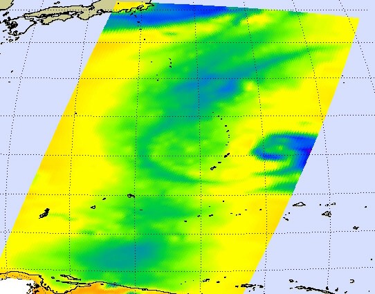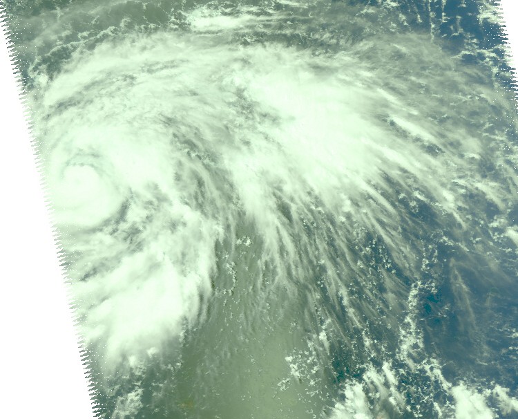
Microwave imagery from NASA's Aqua satellite revealed extremely high thunderstorms in Typhoon Choi-Wan as it began passing the island of Sai-Pan in the Western Pacific Ocean. The U.S. National Weather Service has already issued a tropical storm warning and a typhoon watch for Tinian, Saipan and Agrihan in the Northern Mariana Islands.
Saipan is the largest island and capital of the U.S. Commonwealth of the Northern Mariana Islands. The Northern Marianas are a chain of 15 tropical islands belonging to the Marianas archipelago in the western Pacific Ocean. In the year 2000, the island chain was home to more than 62,000 residents. The National Weather Service issues advisories for them, because they are a U.S. Commonwealth.
NASA satellite imagery showed that the tops of the thunderstorms are so high they reached the tropopause, the level of atmosphere between the troposphere and stratosphere. Those high thunderstorms mean very heavy rainfall for the area underneath. The cloud tops extended to the 200 millibar level in the atmosphere where temperatures are as cold or colder than -63 Fahrenheit.
Microwave images are created when data from NASA's Aqua satellite Atmospheric Infrared Sounder (AIRS) and Advanced Microwave Sounding Unit (AMSU) instruments are combined. These microwave images indicate where there is precipitation or ice in the cloud tops and the latest microwave image revealed Choi-Wan had cold, high thunderstorms.

Residents of Saipan is already experiencing gusty winds and rains as the Choi-Wan passes to the northeast, and dangerous surf is expected along the shorelines. For a look at local radar from Andersen Air Force Base, Guam visit here.
Storm surge and inundation of 3 to 5 feet above high tide is possible as Choi-Wan passes with hazardous surf of 8 to 12 feet along west facing reefs this evening...building to 13 to 16 feet tonight. High tide is expected around 6 p.m. local time on Tuesday.
The National Weather Service also expects locally heavy rainfall through early Wednesday Morning with totals of 3 to 5 inches on Tinian and Saipan and as much as 6 to 10 inches possible on Agrihan and Alamagan.
The National Weather Service issued a special bulletin at 10:09 p.m. local time (CHST) today, September 14: "The 24 hour pressure fall at Saipan airport was 7.5 millibars. Pressure falls are likely even larger at islands north of Saipan. This shows not only the continuing approach of Choi-Wan but also its continuing trend for intensification. It has been several years since a significant typhoon has struck the Marianas.
Especially for Alamagan...beware of a sudden drop in winds. This may be the eye rather than the end of the storm. In this case winds will return just as suddenly from the opposite direction. Choi-wan will pass very close to Alamagan Tuesday afternoon."
Choi-Wan is the fifteenth tropical cyclone in the western Pacific Ocean this season. The sixteenth, Tropical Storm Koppu is poised to make landfall in China in the next day or two.
For local weather forecasts and updated weather watches and warnings, visit the National Weather Service forecast page for Saipan.


Reader Comments
to our Newsletter