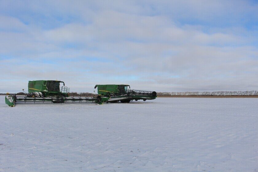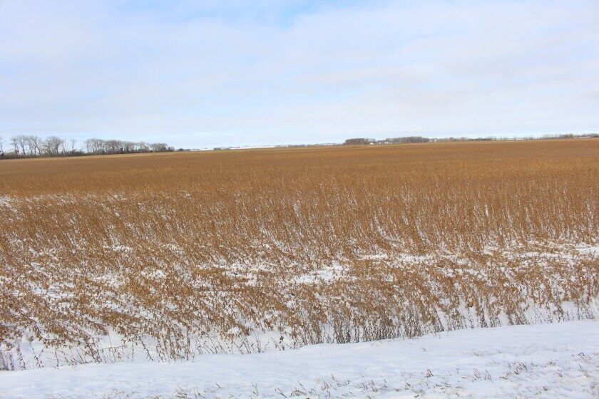
A winter storm that moved across the northern Plains on Oct. 26-27 dumped as much as 18 inches of snow in the Walsh County, North Dakota, town of Lankin, according to the National Weather Service office in Grand Forks, North Dakota.
Other double digit amounts were 14 inches in Washburn and Harvey and 11 inches, in Minot and Williston. Further east, Leeds reported 8 inches and Larimore and Grafton reported 8.5 inches.
Low temperatures plummeted into the teens in the snow-covered areas after the storm and daily highs remained below freezing for several days the next week.
Meanwhile, some areas of North Dakota and northwest Minnesota in which temperatures were too warm for snow to develop, received rain, delaying harvest of the row crops.
The sunflower harvest in North Dakota was less than half completed when the storm system passed through the state.
As of the week ending Oct. 29, 2023, 38% of the state's sunflowers were harvested, according to the U.S. Agriculture Department National Agricultural Statistics Service. In 2022, 59% of North Dakota's sunflowers were harvested. On average, 47% of sunflowers were harvested by Oct. 29, the agency said.
It's not unusual to harvest sunflowers after a snowfall, but because the snow was wet it stuck to the heads and will have to melt before the crop can be combined, said John Sandbakken, National Sunflower Association executive director. However, if temperatures climb too high, that could result in muddy conditions that would make it difficult for farmers to navigate their combines, trucks and grain carts through fields.
"It's going to slow down things this week, for sure," Sandbakken said on Oct. 31, 2023. "It's one of those things, you hope for warm weather, but you don't want it too warm," he said.
Though, the scenery where it snowed looks like winter, it's still fall, which means that there's time to get the sunflowers harvested.
"It's still early and hopefully we don't get more snow ... . As long as we can get the ground firm and get the snow off the heads we'll be in good shape," Sandbakken said.
In the town of Langdon in northeast North Dakota, 1.5 inches of snow fell on Oct. 31, adding to the 5.5 inches from the storm the previous week.
Some sunflowers, corn and soybeans fields were unharvested when the first snow fell, said Randy Mehlhoff, North Dakota State University Langdon Research Extension director.
"With corn and sunflowers they've got at least half left. They were working on soybeans when it hit," Mehlhoff said on Oct. 31. "Some of them may have to wait until next spring."
"The forecast was for another storm system to hit the Langdon area the weekend of Nov. 4-5, and if that occurred it would end the harvest season, he said
"I think we're in it for the long haul, now," Mehlhoff said.
In Ramsey County, North Dakota, from 6 to 8 inches fell during the Oct. 26-27 snowstorm, estimated Lindsey Overmeyer, NDSU Extension agriculture agent for Ramsey County.
About half of the corn was left in the county's fields before the storm, Overmeyer said. Most of the canola and soybeans in the county were harvested.
If the crops stay in the field until spring there may be damage as a result of deer eating them, Mehlhoff said. The snow also could cause soybeans to bend and be difficult to harvest, he noted.
Snow also put a wrench into fall fieldwork, such as cultivating and applying fertilizer for the 2024 crop.
In Minnesota, 75% of the corn was harvested as of the week ending Oct. 29, 2023. That was a day behind 2022, but five days ahead of the 5-year average, NASS-Minnesota said. Moisture content of the corn that was being harvested was 18%. The Minnesota soybean harvest was 94% completed as of the week ending Oct. 29, six days behind last year, but five days ahead of the five-year average.
Areas that had snowfall during the Oct. 26-27 storm were Karlstad, where 5.6 inches fell, Warroad, which reported 5 inches and Warren, which got 3 inches, according to the National Weather Service office in Grand Forks.
Another winter storm struck on the evening of Oct. 30 and continued into Oct. 31 for portions of central Minnesota. Areas around Detroit Lakes, Wadena and Fergus Falls received 3-5 inches of snow during this event, according to the National Weather Service.


Reader Comments
to our Newsletter