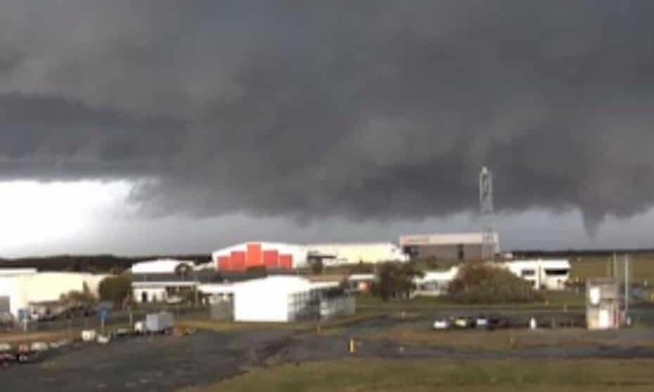
The Bureau of Meteorology confirmed a tornado formed near the airport at about 10am on Friday, with video footage showing it touching down for only a minute or two.
The storm cell hit about 11am, with footage taken at the airport showing catering pods being blown around on the tarmac near a boarding gate.
The Brisbane Airport Corporation (BAC) said there was some damage, mainly centred on the international terminal.
"We have teams assessing exactly what damage has happened. I've seen some video suggesting things on the apron have flown about," a BAC spokesperson told AAP.
The Bureau of Meteorology issued a severe-weather alert for the Redland and Gold Coast local government areas.
It comes as the bureau forecasts potentially severe thunderstorms across much of Queensland.
The bureau meteorologist Helen Kirkup told reporters some thunderstorms had the potential to grow into supercell events.
"We have already seen a number of thunderstorms develop, including one that was particularly severe and travelled past the Brisbane airport and across the bay.
"This was a very dangerous storm and there have been reports of either a tornado or a water spout within this.
With the storm that went through Brisbane airport, we've already had a report of 101mm in 60 minutes.
"It's also a possibility that some (storms) could develop into super cells and bring higher end phenomena such as giant hail or destructive wind gusts. During the afternoon, it's also possible that we might see severe thunderstorms around north-western Queensland."
Kirkup said the bureau was forecasting damaging wind gusts, with "large to giant hail" and intense rainfall that may lead to flash flooding, warning residents to take precautions.
"As is the case with severe thunderstorms, always take precautions - secure loose outdoor items, never drive, walk or ride through flood waters and seek shelter, preferably indoors but never under trees."
Storms were also expected to continue into Saturday, with the bureau saying they would likely hit the state's south-eastern interior.
It comes only days after the state reported a seperate record-breaking weather event, when hail 16cm wide pelted central Queensland on Wednesday.
"A particularly dangerous thunderstorm impacted the Yalboroo area north of Mackay yesterday afternoon and brought with it multiple reports of giant hail about 16cm. This is a new Australian record, beating the previous hail record set last year," the bureau said in a statement at the time.
The storms come after the bureau had earlier this month announced that the chance of La Niña forming in next few months had increased from 50% to 70%.
La Niña events increase the chances of heavy rainfall and storms for northern and eastern Australia during the summer.
It would be the first time in a decade that Australia has faced two La Niña events in a row.
Additional reporting by Australian Associated Press.


My grandmother is 94. She can count the number of tornadoes in Brisbane as zero.
And this is just the beginning of summer.
More to come!