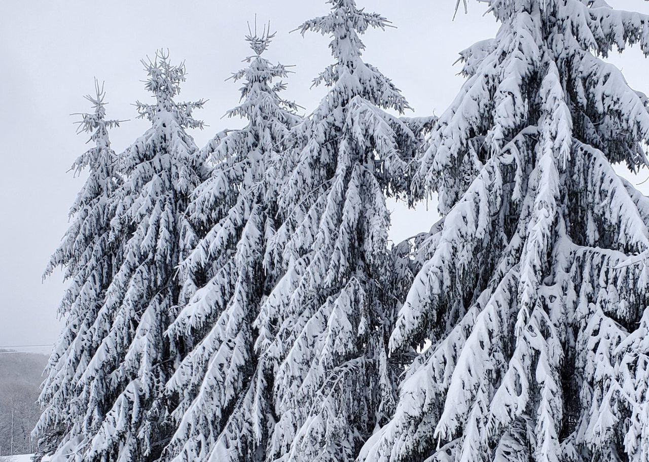
Snow began falling in southern New York on Sunday afternoon as photos emerged from areas such as Binghamton of accumulated snow on yards.
From there, the mix moved northeastward and left higher-elevation areas with a mess to clean up. In Otsego County, WKTV Meteorologist Jill Reale measured 14 inches of snow in Cherry Valley.
Looks like Cherry Valley in Otsego County takes the cake for most snow. Clocking in at 14" this morning. Photo from Robin Rouse. #cnywx #aprilsnow #winterinspring pic.twitter.com/cx8Xz0w9uq
— Jill Reale (@TheRealeDeal) April 27, 2020
Over a foot was also recorded in the mountainous region of the Adirondacks in upstate New York. In the Mohawk Valley region, located between the Adirondacks and the Catskill Mountains, some counties received over 8 inches of snow while others got only rain in lower-elevation areas, according to WKTV.com.
"Typically this late in the year, accumulating snow is limited to the higher terrain, with most valley locations remaining a plain rain. That was the case with this storm, with most places at lower elevations staying as a chilly rain," AccuWeather Meteorologist Jake Sojda said. "The exception was the eastern Mohawk Valley, where some locales as low as 500 feet above sea level got some light snow accumulation. For most of the region, snow levels stayed around and above 1,000 feet. The heaviest snow was mainly above 1,500 feet in the Cooperstown and Cobbleskill areas of New York."
In towns around Albany, snow totals of 4 to 7 inches were recorded, according to the National Weather Service (NWS). While Sojda said snowfall this late into the spring isn't unheard of, it certainly isn't common.
However, while some residents have seen such late snowfall in the past, it certainly isn't a sight to expect every year.
"A look back at Albany's snow records reveal that the last snow occurs in late April in the region generally every seven to 10 years, and the latest last snow date ever in Albany was May 18, 2002," he said. "The average last snow date in Albany is April 5."
This is about a foot of snow at my parents house in the #adirondacks !
— Callihan Marshall (@cmarshallnews) April 27, 2020
It's the end of April!!!! @WKTVWeather @BillKardas @TheRealeDeal @VScibior pic.twitter.com/WUzrDodHrn
From New York, the precipitation moved eastward into northern New England. Outside of New York locations, the towns of Randolph, New Hampshire, and Carrabassett Valley, Maine, got the most accumulation from the storm, with 6 inches recorded in each area, according to NWS offices.
The springtime winter wonderland covered much of Vermont, including the area of Warren, where footage depicted snow-covered trees and roads. Snow blanketed shrubs and flowers that appeared far more ready for summer warmth than a winter freeze.
Much of Vermont received 1 to 4 inches of snow, with the towns of Ludlow, Landgrove and Woodford receiving the most at over 4.5 inches.
According to the NWS office in Gray, Maine, eight different areas received at least an inch of snow as of Monday morning. That snow is expected to continue into Tuesday.
AccuWeather meteorologists anticipate areas of the Northeast to continue receiving wet weather through midweek as stormy weather shifts eastward.
"Rain will arrive in western Pennsylvania and western New York by Wednesday afternoon, spreading through parts of the Northeast on Wednesday night and into Thursday," AccuWeather Meteorologist Courtney Spamer said. "Instead of being able to do socially distant activities outdoors, the rain and wind may force quarantined residents during the COVID-19 pandemic to stay indoors."


Reader Comments
to our Newsletter