And the dip in the mercury comes in stark contrast to the April heatwave.
A polar plunge is set to bring the coldest May Day Bank Holiday Monday for almost 40 YEARS.
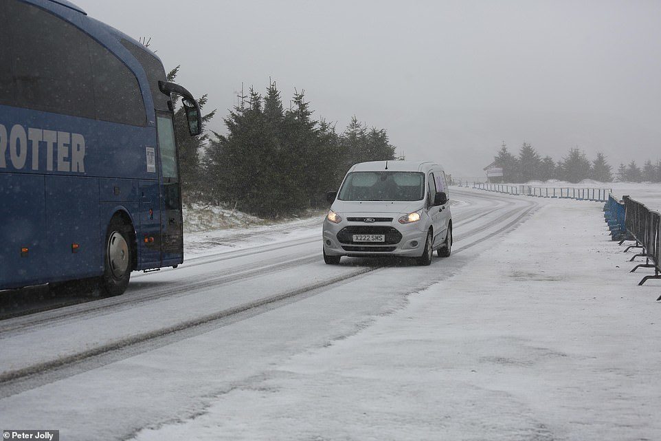
But some parts of Scotland have already seen some of the white stuff this morning.
Punters took to social media in Aberdeen and parts of the Highlands to show the snow falling.
Sam Banister took to Twitter to post pics of some wintry weather.
She said: "This morning in the #Highlands #Scotland.
"We have snow! Where did that come from?"
This morning in the #Highlands #Scotland. We have snow! Where did that come from? Wishing you all a wonderful #FF pic.twitter.com/VKZVdGgkFF
— sam banister (@sambubbly) May 3, 2019
Meanwhile Paul Collier shared images from Aberdeen - with heavy cloud cover and snow falling over the hills.
He said: "Morning #aberdeen and we have #snow falling at the coast blowing in the gusty wind."
Morning #aberdeen and we have #snow falling at the coast blowing in the gusty wind #ukweather @WindyWilson88 #loveukweather #scotland pic.twitter.com/T4aa8b3hBJ
— Paul Collier (@PaulCol56316861) May 3, 2019
This mornings drive to Inverness...snow?? Are you having a fricking laugh Scotland! Today's van load is going to be fun...not! 🙈 #haddohousemarket pic.twitter.com/Ih6r910WC9
— North Hop Michelle (@northhopboss) May 3, 2019
We told you earlier how temperatures are set to plummet today, with the mercury hovering at around 4C across most of Scotland and 7C in York and Peterborough.
Met Office forecasters warned a band of cloud and showery rain over a central swathe of the UK will edge slowly south.
There will be further showers overnight, especially along North Sea coasts.
"Some frost will form in sheltered, inland spots," a Met Office forecaster warned.
Meteogroup added: "It will be very cold in northern Scotland with scattered wintry showers."
Temperatures will plummet to -6C in Scotland with snow and frost forecast over the weekend.
The coldest early May Bank Holiday temperature recorded since the holiday began in 1978 is -5.9C on May 7, 2012, at Kinbrace, Sutherland, Scotland, Met Office records show.
Met Office forecaster Mark Wilson said: "Cold air of Arctic and polar origin will arrive from Friday and through the Bank Holiday weekend.
"Forecasts can change. If high pressure had been over Scandinavia, we'd have had a southerly flow - but high pressure being to the west of the UK means a northerly flow, as winds blow clockwise around high pressure.
"Snow and sleet could be seen on Friday and Saturday on the highest ground of the Peak District, Pennines and Scotland, with a small chance on the Chilterns.
"Widespread frost could be seen with -5C possible on Friday night and Saturday night in the North, with a low chance of -6C, with Sunday night a bit less cold with frost in places.
"Highs will be 11-12C in Scotland, but Sunday and Monday will be dry and sunny spells and will feel pleasant enough in the sunshine out of the breeze."


Reader Comments
to our Newsletter