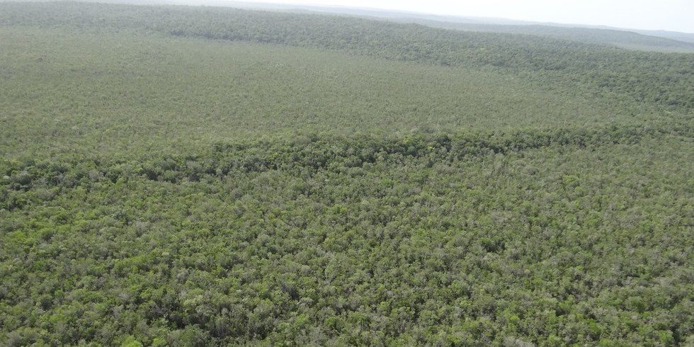
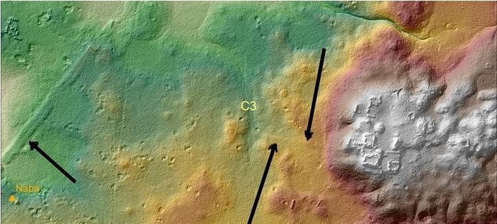
Used by the Maya for travel and transporting goods, the causeways were identified in the Mirador Basin, which lies in the far northern Petén region of Guatemala, within the largest tract of virgin tropical forest remaining in Central America.
Also known as the Kan Kingdom, El Mirador is considered the cradle of Mayan civilization. Prior to its abandonment in 150 A.D., it was the largest city-state in the world both in size — 833 square miles — and population. It boasted the largest known pyramid in Central America, and was home to at least one million people.
Researchers have known about the presence of these roads since 1967, when British Mayanist Ian Graham published a map of Mirador showing causeways crossing the swamp regions. Now laser-based remote sensing has been used to map the area, providing new insights into the massive system of superhighways.
The Light Detection and Ranging tool, known as LiDAR, is capable of penetrating the thick jungle vegetation at a rate of 560,000 dots per second, producing detailed images that mimic a 3-D view of the scanned areas.
"LiDAR uses laser pulses that bounce from the Earth's surface through leaves and back to a computer mounted in a plane," said Arlen Chase, an archaeologist at the University of Nevada, Las Vegas, who is working on the project. "While most people felt the technology would not be successful based on past experiments in Central America, we became convinced by 2006 that it could be used to determine what was on the ground in terms of Maya sites under the jungle canopy."
Researchers with the Mirador Basin Project, which is led by archaeologist and anthropologist Richard D. Hansen of the University of Utah, have so far scanned and analyzed more than 430 square miles of the basin.

LiDAR-derived images accurately portrayed structures, agricultural terraces, pyramids, canals, corrals and a network of 17 roads.
Hansen, who has been excavating causeways since 1990, has found detailed evidence of the roads' construction, destinations and locations.
"With the LiDAR technology, we have been able to investigate the incredible size and complexity of these causeways," he said, revealing that the Maya rivaled the ancient Romans in road construction skills.
"These causeways are 130 feet wide, up to 20 feet high and in some cases they extend as far as 25 miles," Hansen said.
The first building of the causeway between Mirador and Tindall and Mirador and Nakbe dates to 600 and 400 B.C., while other causeways date from 300 BC to 100 A.D.
"The creation of these causeways allowed unification of what appears to be the first state-level society in the Western Hemisphere," Hansen added.
According to Hansen and colleagues, the sophisticated system of corrals, or animal pens, that was identified through the LIDAR scans may have been established first by the inhabitants of Mirador.
This would suggest that meat production in the Mirador Basin existed at an industrial level, with transportation relying on the superhighways.
"The causeways allowed transport of food, materials, tribute, rulers, armies and all the trappings of political, economic and social complexity," Hansen explained. "The system is similar to the autobahn system in Germany, or the freeway system in the U.S., and allows unification, homogeneity of society and permits the administration of centralized government."
The discovery of the ancient network of roads will provide the Cuenca Mirador researchers with more Maya sites to investigate. Hansen and his colleagues believe the new findings may help to understand why the Mirador Basin civilization declined after 150 A.D.
The collapse is being investigated by a variety of researchers from 34 universities and institutions from around the world.
The Mirador Basin is currently being considered for protection by the Congress of the Republic of Guatemala as a wilderness area. The site lies in the heart of the Maya Biosphere Reserve, which is considered one of the environmental and cultural lungs of the Americas.


The same, no evidence, only speculation.