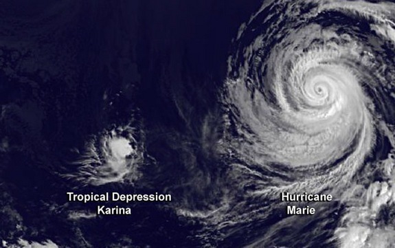
Newly released photos from NASA show the big and little storms swirling side by side. The images were taken by the National Oceanic and Atmospheric Administration's (NOAA) Earth-watching GOES-West satellite yesterday (Aug. 26) at around 8 a.m. EDT (5 a.m. PDT).
But Karina may not be such a substantial snack by the time Marie devours her. With winds that slowed to 30 miles per hour (48 km/h), Karina weakened from a tropical depression into a remnant low-pressure system last night, after roaming the Pacific for two weeks, the National Hurricane Center (NHC) announced.
Marie, meanwhile, is already sending strong waves to California shores. Swells as big as 15 feet (4.6 meters) pummeled Los Angeles-area beaches yesterday, and one surfer was pronounced dead in Malibu after he was pulled from the rough waters, according to the Los Angeles Times. Hurricane Marie will likely produce life-threatening surf conditions and rip currents in Southern California and Mexico's Baja California peninsula through tomorrow (Aug. 28), according to the NHC.
Marie is currently about 810 miles (1,300 km) west of the southern tip of Baja California. The storm is packing winds up to 85 mph (140 km/h) but is expected to weaken as it moves into colder waters over the next few days, NHC officials said in their latest update.
NOAA's GOES satellites are geostationary, which means they are perched in the same location above Earth all the time, orbiting in tandem with the planet's rotation. The satellites capture images of clouds that are used by NOAA's National Weather Service to monitor storms. The GOES-West satellite provides coverage for much of western North America and the eastern Pacific.


Reader Comments
to our Newsletter