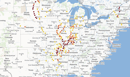
On Sunday, Justice Samuel Alito of the U.S. Supreme Court rejected a request by Missouri to stop the Corps from blowing a two-mile-wide hole in a levee at Birds Point, Mo. The move would send a wall of water over 130,000 acres of prime farmland and the homes of about 200 people. Residents were ordered to evacuate last week.
Also Sunday, Army Corps engineers were ordered to begin pumping explosives into pipes inside the levee.
The Corps said sending water through the Birds Point-New Madrid Floodway for only the second time since 1937 would act as a relief valve, handling about a quarter of the Mississippi's flow. The Corps said it would drop water levels at Cairo, at the confluence of the Ohio and Mississippi rivers, and other towns by three to four feet.
Monday afternoon, the Ohio River gauge at Cairo read 61.18 feet, nearly two feet higher than the record of 59.51 feet set in 1937. Before the storm, the river had been expected to crest in a few days at 60.5 feet, six inches below a 61-foot-level that had been the trigger point for activating the floodway in the Corps' operating plan.
Maj. Gen. Michael Walsh, commander of the flood flight in the region, has said he's monitoring river levels hourly and hadn't made a final decision about blowing up the levee. But he has also noted that Cairo is facing numerous and one extremely large sand-boil - signs that water is seeping under the levee and carrying sand that could eventually undermine the levee walls there.
If the levee wall is breached at Cairo, the city of about 3,000 residents could be inundated with 18 to 20 feet of water, Illinois officials said.
The Birds Point-New Madrid Floodway measures 35 miles long by as much as 12 miles wide. The floodway is a mix of public and private lands with easements giving the government the right to let water pass through.
It is one of four floodways that the Corps has developed since the great flood of 1927 to minimize damage to people and property and maintain the integrity of the Mississippi River's navigation system.
Gen. Walsh said Saturday that all four floodways might be needed to handle the volume of water coursing through the river system this spring as the crest makes its way downstream to the Gulf of Mexico.


Reader Comments
to our Newsletter