© News.com AustraliaDate/Time: 2011:02:02 13:29:18
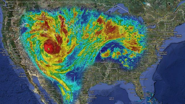
IF you're struggling to grasp the magnitude of Tropical Cyclone Yasi, consider this: it is so large it would almost cover the United States, most of Asia and large parts of Europe.
Most of the coverage about the scale of Yasi has tried to compare it with storms of the past - it's bigger than Larry, more powerful than Tracy.
But just as powerful is this comparison, showing this storm is continental in size. The main bloc of the cyclone is 500km wide, while its associated activity, shown above in a colour-coding to match intensity, stretches over 2000km.
The storm's scale of destruction is as shocking as it is inevitable. In the map above, the United States from Pennsylvania in the east to Nevada in the west, from Georgia in the south to Canada in the north and well into Mexico would be battered with 300km/h winds and up to one metre of rain.
The economic impact would be felt around the world.
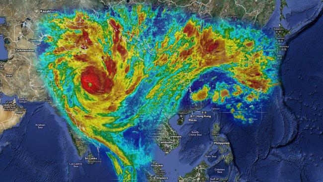
This map shows the impact if the storm was attacking Asia:
© News.com Australia
Again, the scale is unthinkable - taking in an area from Japan, the Koreas and China all the way through southeast Asia, around through India and the Himalayas and threatening large parts of central Asia.
This would have billions of people directly in the path of the category 5 storm, creating a human tide of displaced cyclone "refugees".
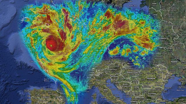
This map shows the storm over western and central Europe:
© News.com Australia
Just as we saw in our visualisation of the Queensland floods, the whole of Britain would be overwhelmed.
But this time, France and Germany would also be catastrophically affected, delivering another body blow to the European economy at the least and also disrupting the lives of hundreds of millions of people.
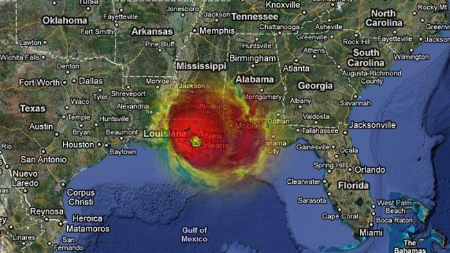
Even the eye of Yasi is as big as a city. This next map shows the heart of the storm over New Orleans, covering Louisiana and neighbouring states.
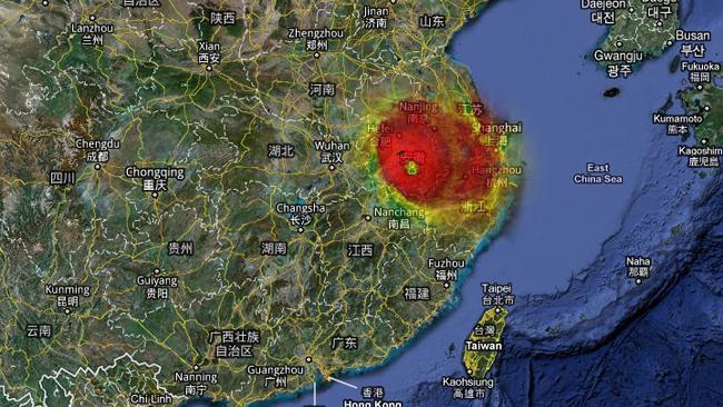
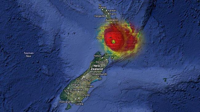
The eye itself, at 35km across, would stretch over all of the Katrina-ravaged city's centre. In the maps below, you can see Shanghai and New Zealand's north island bearing the brunt of category five.
© News.com Australia
© News.com Australia
© News.com Australia
These maps are merely visualisations of relative scales and are not meant to suggest storms of this level would form anywhere in the world.
Instead, they illustrate an annual threat that is, if not uniquely Australian, at least so much a part of our summer that we speak of "cyclone season" as though it is on a par with "cricket season".
But every so often, we are forced to confront the raw power of our country and its dangers.
...that movie "The Day After Tomorrow", no? You know, with those giant storm systems enveloping the Northern Hemisphere and everything...
And while this is happening Down Under, the US is getting Snowed Under. With maximum temperatures well below the average - and wind chill factors at unbelievable levels.
Those folks could sure use some of that global warmin' right about now. It won't be long before the ugly truth is going to become impossible to hide.