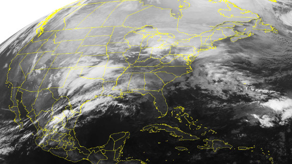
"This major winter storm is quite large in size and will have a major impact on travel, especially tonight and on Wednesday," Environment Canada said in a warning issued Tuesday.
It will be "the strongest storm of the season" for urbanized areas like Toronto that are outside the Ontario snowbelt.
The weather agency had upgraded a winter storm watch in southern Ontario, stretching from Windsor to Kingston, to a winter storm warning.
Environment Canada added the blizzard warning for London, St. Catharines, Sarnia and Hamilton just after 3:30 p.m. ET on Tuesday.
A warning is typically issued between six and 24 hours before the start of severe weather.
By the time the storm finishes Wednesday, large swaths of southern Ontario could have snowfall accumulations of between 20 and 30 centimetres, the agency predicted.
Heavy snow is expected to hit southwestern Ontario on Tuesday evening and the Toronto area around midnight. It is then predicted to move into eastern Ontario on Wednesday morning.
The snow will be accompanied by gusting winds of 50 to 70 km/h at their strongest, Environment Canada said. The high in Toronto is forecast to be - 5 C on Wednesday, and the low will dip to - 9 C.
Plenty of people in Toronto were dashing out to stores on Tuesday to stock up on storm supplies.
Fraser Perkin was doing a brisk trade in salt and shovels at the Home Hardware location he manages at Highway 7 and Woodbine Avenue in Markham, Ont., Tuesday afternoon.
"As the weather becomes worse, our sales become better," he joked. "It will take maybe one storm but after they finish shovelling, then they want the snow blower for the next one."
Canadian Automobile Association spokeswoman Silvana Aceto said 3,000 assistance calls are normal on a typical winter day. However, that total can more than double during a storm as severe as the one predicted to hit Tuesday night. During a snowstorm in 2008, the Toronto CAA fielded close to 10,000 calls in one day, Aceto said.
"It's going to be messy on the roads," said Aceto. "Drivers need to plan ahead, be prepared and check that weather forecast."

"Earlier this year we've primarily done salting," Currie told CBC News. "With 30 centimetres expected, it will be a plowing operation for us."
Currie said plow crews will first focus on expressways, before turning to arterial roadways along streetcar lines followed by side streets.
Travel plans disrupted
The storm is hitting the U.S. Midwest before bearing down on the Great Lakes later Tuesday. Although the front has yet to reach Toronto, the effects of the severe weather are already impacting travel plans.
More than 200 flights at Toronto's Pearson International Airport to and from the U.S. Midwest and East Coast were cancelled Tuesday and early Wednesday. Flights between Toronto and Cleveland, Columbus, Dallas, New York and Boston were the most commonly affected.
The Greater Toronto Airports Authority said 17.4 per cent of all flights to and from Pearson Tuesday through Wednesday morning at 9 a.m. ET were cancelled.
There were also numerous cancellations at Billy Bishop Toronto Airport on flights to and from Boston, Chicago and Newark Airport, which services New York City and New Jersey. Both Air Canada and Porter Airlines issued travel alerts warning people to check the status of flights to and from both major Toronto airports.
Via Rail Canada, meanwhile, warned travellers to expect heavy demand in the Ontario-Quebec corridor, although it did not expect any cancellations. GO Transit says it will be running an adjusted schedule because of the storm and is advising commuters to check its website for details.
Neither the Toronto District School Board nor the Toronto Catholic District School Board would say if there would be cancellations to schools and school bus routes.
Humber College and Centennial College have closed all of their campuses on Wednesday in anticipation of the storm.
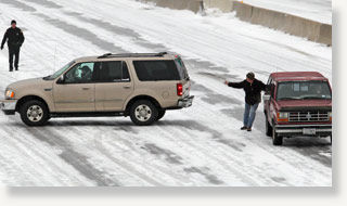
The storm had wreaked havoc on large parts of the U.S. Midwest Tuesday. Eight states had blizzard conditions, with Texas, Missouri and Oklahoma the hardest hit. There were warnings, watches and advisories in 30 other states.
Kansas, Oklahoma, Missouri and Illinois declared emergencies. National Guard troops were called out in Missouri. Airlines cancelled thousands of flights and Dallas-Fort Worth International Airport closed due to an ice storm.
Chicago is bracing for as much as 60 centimetres of snow.
"Major winter storms originating in Texas usually have a fairly large band of heavy snow in areas on the cold," Environment Canada said.
"The public should be prepared to change plans accordingly to avoid unnecessary travel during the storm as travelling conditions will be dangerous at times."
The Canadian Automobile Association advises motorists to avoid the roads or give themselves extra travel time on Wednesday.
It also suggests they carry:
- A fully charged cellphone.
- A winter survival kit.
- Extra clothing, blankets.
- Non-perishable food.
- Candle, in case they become stranded.


Reader Comments
to our Newsletter