© 9news.com
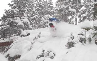
Denver - While the ski resorts across the state will be measuring snow in feet over the next few days, conditions along the Front Range will be mild and relatively snow-free through Christmas Day. The Colorado weather forecast calls for several feet of snow for some parts of the Colorado high country through the middle of the week.
9NEWS Meteorologist Marty Coniglio says a few flurries may fly in Denver are possible on Thursday, but measurable snowfall is not expected in the city before Christmas. You will need to head west for a white Christmas.
Tuesday, the winter solstice occurs at 4:38 p.m. and the Solstice coincides with the only complete eclipse of the full moon in 2010. Cloud cover held off just long enough to make for beautiful views of the eclipse overnight along the Front Range.
The last winter solstice full moons were in 1999 and 1980.
Winter is already in full swing in the Colorado high country as a WINTER STORM WARNING remains in effect through Tuesday night for nearly all mountain areas in Colorado, there are wide variations in the amount of snowfall that different mountain areas will receive.
The mountains surrounding Vail, Aspen, Snowmass, Crested Butte, Telluride and Silverton should see 1 to 3 feet of snow by Tuesday evening, with the heaviest snow on west-facing slopes.
The mountains of Summit County, the Winter Park area and the Rocky Mountain National Park region could see up to 2 feet on west-facing slopes, while valley locations such as Silverthorne, Frisco and Fraser will generally see less than 12 inches.
In addition, southwest winds will gust over 40 mph at times causing blowing and drifting snow and leading to limited visibility.
Anyone planning travel through the high country through early Wednesday should be prepared for the possibility of severe winter driving conditions, especially over mountain passes and along the approaches to the Eisenhower Tunnel.
Another wave of moisture will move in from the west Wednesday through Thursday. Snow showers will intensify, once again, making travel through the high country extremely difficult, if not impossible at times Wednesday afternoon.
It is possible that by Thursday afternoon, mountain locations above 9,000 feet could see 3 to 8 feet of snowfall accumulate. Locations near Crested Butte, Silverton and the Grand Mesa may be hardest hit from these systems. In general, mountain locations facing west and southwest will see the most snow.
Locations between 8,000 and 9,000 feet could see 1 to 3 feet of snow by Thursday afternoon, while areas between 7000 and 8000 feet could see 6 to 12 inches of total snowfall.
As the latest fall storm rages on in the high country, Denver and the Front Range can look forward to a couple of warm dry days with above average temperatures in the mid-50s.
Warmer drier weather returns just in time for the Christmas holiday, with sunshine and a high near 50 on Saturday.

Reader Comments
to our Newsletter