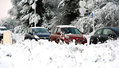
Motorists battled with hazardous conditions on the roads today as the widest-spread November snowfall for 17 years gripped the country. Parts of the UK were blanketed in white as many woke to wintry scenes and freezing temperatures following a bitterly cold night.
The Met Office issued severe weather warnings, flagging up drifting snow for the eastern side of the country as well as parts of Wales and Northern Ireland, while North Yorkshire County Council said six village primary schools were forced to close. Worst-hit were the Scottish Highlands, with up to 8ins (20cm) of snow forecast to settle in Grampian - along with Yorkshire, north east England and East Anglia.
But the rest of Britain did not escape unscathed and snow ploughs and gritters were out in force. A heavy dump of snow caused havoc for commuters in north east Scotland and northern England where up to to 4ins (10cm) had settled today. Drivers also struggled on the North York Moors, which have been hit by bad weather and sub-zero temperatures.
The A170 at Sutton Bank was particularly affected, as was the B1249 at Staxton Bank near Scarborough. The A165 Reighton bypass was partially blocked this morning, with slow traffic around the Sands Road junction.
Snow was also falling in Pickering, Thirsk and York while motorists reported problems on the main routes into Tyneside, where drivers complained some roads were not gritted. The AA reported a dramatic surge in breakdowns and had received 3,000 call-outs by 9.30am, largely in the northern and eastern areas.
Spokesman Gavin Hill-Smith said: "We are expecting another busy day and a particularly hazardous commute for people this evening. People should try and stick to the main routes where possible and, when they can, avoid the more rural roads where black ice can be particularly treacherous."
The AA rescued a "handful" of cars stuck in snow in the Aberdeenshire and Moray areas yesterday while call-outs were up significantly in North Yorkshire and Newcastle. This morning they were coming in at about 1,400 every hour, it said, predicting this figure could increase by half in the worst-hit areas.
Meanwhile, forecasters said the cold snap would tighten its grip further in the coming days, with lows of minus 5C in some regions. The mercury is not expected to rise much above 2C-5C by day, remaining lower in the more exposed, rural areas. Diving temperatures are also likely to affect the capital, plummeting to minus 3C or minus 4C overnight, and Londoners were warned to prepare for a dusting of white in what is expected to be the earliest major snowfall since 1993.
Alison Cobb, a forecaster with MeteoGroup, the weather division of the Press Association, said: "The cold conditions are well below average for this time of year and they are set to stay for the rest of the week. Ice will be the main concern on the roads and we advise people to drive carefully."
By the weekend, a moderate covering of snow is expected across the country, though it will remain heaviest in Scotland, Orkney and the Shetland Isles.

Reader Comments
to our Newsletter