From NOAA/NCDC
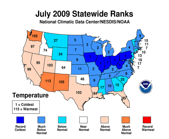
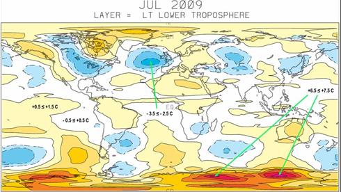
The July 2009 temperature for the contiguous United States was below the long-term average, based on records going back to 1895, according to a preliminary analysis by NOAA's National Climatic Data Center in Asheville, N.C.
The average July temperature of 73.5 degrees F was 0.8 degrees F below the 20th century average. Precipitation across the contiguous United States in July averaged 2.90 inches, which is 0.14 inches above the 1901-2000 average.
- An abnormally strong, persistent upper-level pattern produced more than 400 record low minimum temperatures and 1,300 record low maximum temperatures (lowest high temperature) across the nine-state area that make up the Central region.
- Ohio, Iowa, Illinois, Indiana, West Virginia, and Pennsylvania experienced their coolest July on record. Kentucky, Missouri, Wisconsin, and Michigan each had their second coolest July on record, while Minnesota and Tennessee had their third coolest July on record.
- Death Valley, California, set a new monthly average maximum temperature at 121.3 degrees F. Temperatures in Death Valley reached 120 degrees F or higher for 22 days, beating the old record of 19 days.
- Several western locations recorded their all-time warmest July. Seattle-Tacoma Airport had an average July temperature of 69.5 degrees F, which was 4.2 degrees F above average. Seattle's high temperature of 103 degrees F on July 29 is an all-time record. Alaska posted its second warmest July, Arizona had its third warmest, while New Mexico and Washington had their ninth warmest.
- Based on NOAA's Residential Energy Demand Temperature Index, the contiguous U.S. temperature-related energy demand was 13.3 percent below average in July. Much of this can be attributed to cooler-than-average conditions in the heavily-populated Northeast.


Reader Comments
to our Newsletter