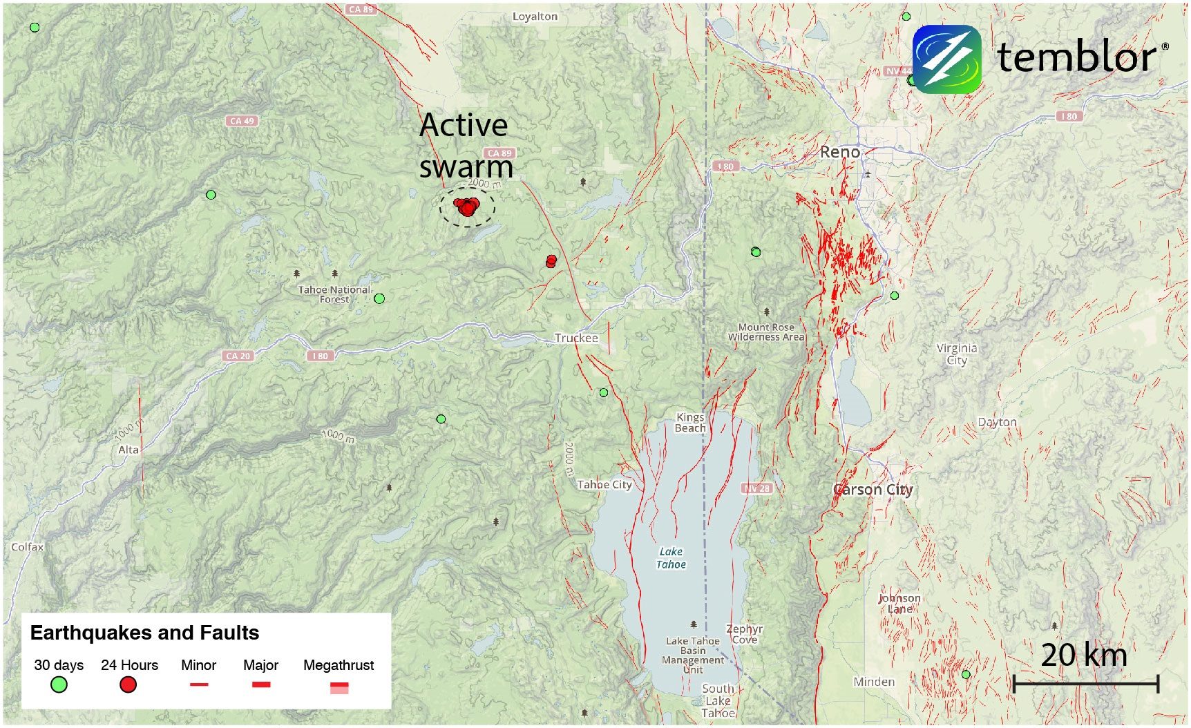
This part of the Western United States, in between the Sierra Nevada Microplate and the Basin and Range Province, is what is known as Walker Lane. This shear zone, together with the San Andreas Fault, accommodates the majority of plate motion between the Pacific and North American plates. Walker Lane is predominantly made up of discontinuous sets of right-lateral strike-slip faults. In the area around this morning's swarm, there are several mapped faults, including the Polaris Fault and East Truckee Fault Zone.
While these are known right-lateral faults, consistent with the predominant motion in the area, the sense of slip on today's earthquakes is ambiguous. One of the reasons why this is the case is because due to the small magnitudes, the quakes may have occurred on smaller antithetic faults rather than structures associated with the large northwest-southeast-trending right-lateral faults.

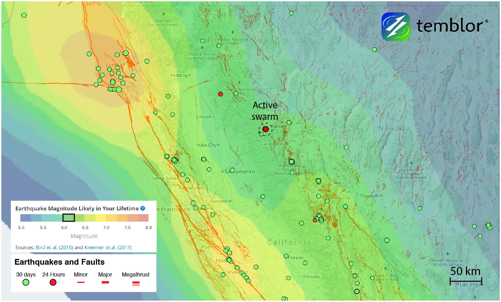
While this may seem like an unlikely event, such a quake is not out of the question. Based on the Global Earthquake Activity Rate (GEAR) model, which is available in Temblor, a M=6.0+ quake is likely in your lifetime in this region. This model uses global strain rates and seismicity since 1977 to forecast the likely earthquake magnitude in your lifetime anywhere on earth. To view the model, click here.
References
California Integrated Seismic Network: Northern California Seismic System (UC Berkeley, USGS Menlo Park, and Partners)
Nevada Seismological Laboratory
Gold, R. D., R. W. Briggs, S. F. Personius, A. J. Crone, S. A. Mahan, and S. J. Angster (2014), Latest Quaternary paleoseismology and evidence of distributed dextral shear along the Mohawk Valley fault zone, northern Walker Lane, California, J. Geophys. Res. Solid Earth, 119, 5014 - 5032, doi:10.1002/2014JB010987
L. E. Hunter, J. F. Howle, R. S. Rose, and G. W. Bawden, LiDAR-Assisted Identification of an Active Fault
near Truckee, California, Bulletin of the Seismological Society of America, Vol. 101, No. 3, pp. 1162 - 1181, June 2011, doi: 10.1785/0120090261


Reader Comments
to our Newsletter