Storms
S


Tornado2

Rare tornado outbreak hits northern parts of Turkish Cyprus causing widespread damage

Damaged buildings and vehicles are seen in the aftermath of a tornado, in the Girne district, the Turkish Republic of Northern Cyprus (TRNC)
© IHADamaged buildings and vehicles are seen in the aftermath of a tornado, in the Girne district, the Turkish Republic of Northern Cyprus (TRNC), Nov. 21, 2020.
Tornadoes hit the Girne (Kyrenia) district of the Turkish Republic of Northern Cyprus (TRNC) late Friday, inflicting significant damage on businesses, homes and the power grid.

Coastal settlements of Ozanköy, Çatalköy, Karşıyaka and Lapta Hotels Region were particularly damaged with strong winds ripping off rooftops, trees and power lines. Three people were slightly wounded due to falling objects.

The Teknecik Power Plant, the main electricity plant of the TRNC, was also affected as a transformer blew up, causing blackouts in the town of Girne and adjacent settlements.


Comment: As well as tornadoes in this region, medicanes are becoming part of the new normal, but not as a result of 'climate change' (formerly referred to as 'global warming' by the MSM).

See main comment on this article: Unusual Mediterranean cyclone 'Ianos' hits Western Greece

Other rare or late-season tornadic activity elsewhere includes:


Snowflake

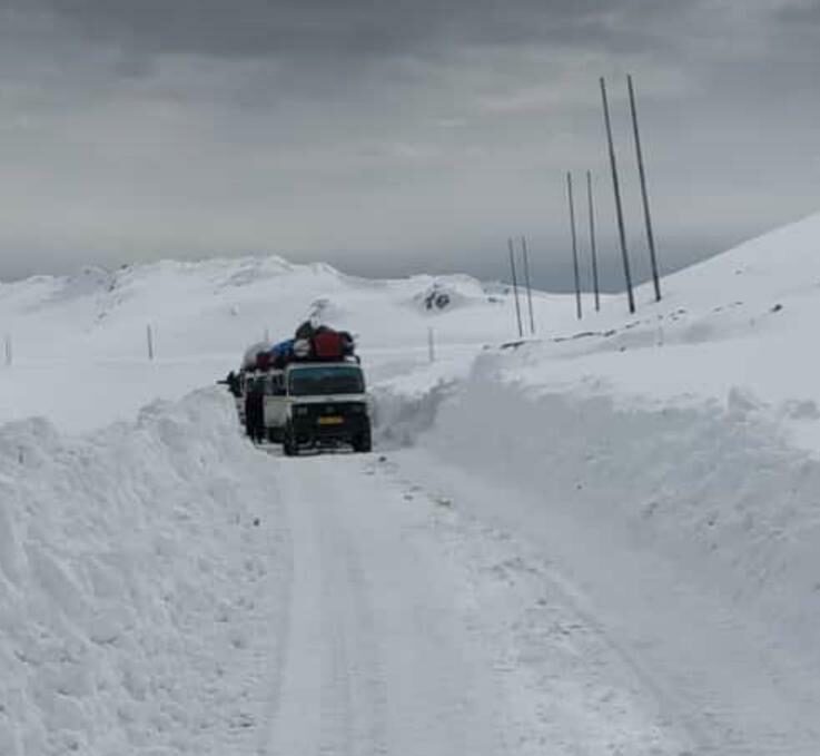
86 km long road closed after foot of fresh snow fall in Kashmir

Razdan Top, Gurez
Razdan Top, Gurez
The 86 km long Gurez Bandipora road closed for traffic, after Razdan top received 12 inches fresh snow which led to the slippery condition of the road.

Officals told that Boder Roads organization is on job to clear snow on Gurez bandipora road, adding that Gurez recived 5 inches snow at Dawar and adjoining areas, how ever mechanical engineering department has deployed two snow cates to clear interior roads.

Sub divisional magistrate,Gurez Mudasir Ahmad told KNS that they have dumped food and supplies and the DG set fuel, which will suffice till May while medicines have also been stocked up in the Gurez Valley.


Cloud Lightning

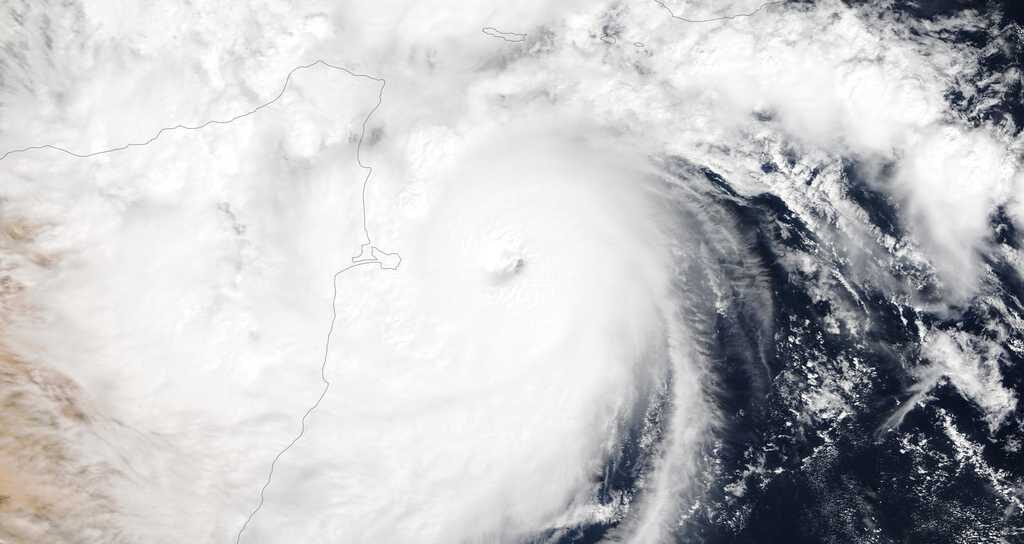
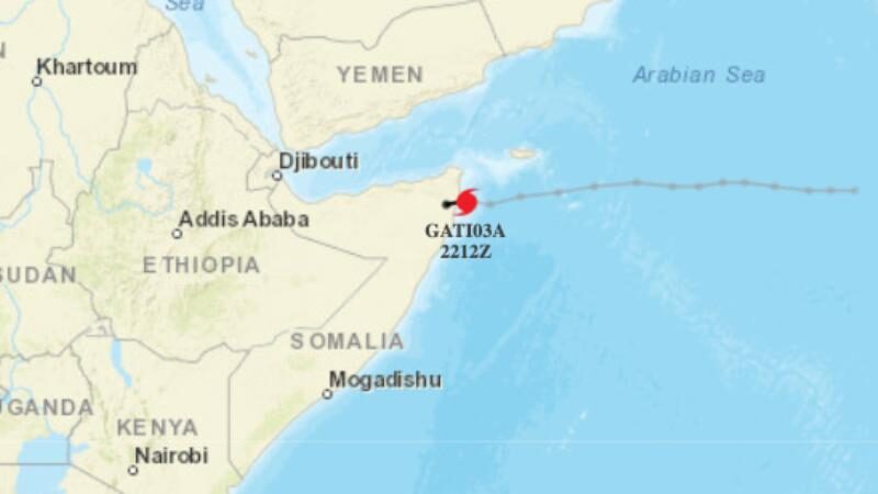
Cyclone Gati hits Somalia as country's strongest storm on record after explosive intensification - at least 4 dead

Tropical Cyclone Gati
The system's winds increased by nearly 70 mph in just 12 hours.

Tropical Cyclone Gati struck the arid nation of Somalia on Sunday as the equivalent of a Category 2 hurricane with 105 mph winds, making it the strongest storm on record to hit the country. The cyclone made landfall after undergoing an extraordinary period of rapid intensification, at one point attaining the strength equivalent to a Category 3 storm, with 115 mph maximum sustained winds.

Its landfall was farther south than any major hurricane-equivalent cyclone on record in that part of the world as well.


Comment: Somalia's strongest tropical cyclone ever recorded could drop 2 years' rain in 2 days


Ice Cube

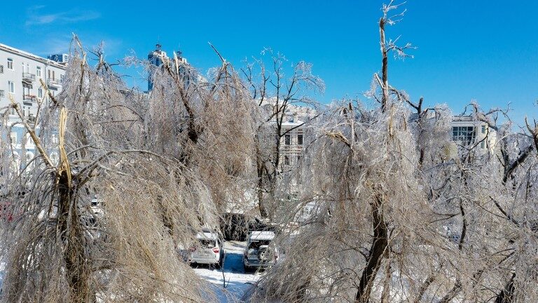
Extreme freezing rain storm cripples Vladivostok infrastructure, 5 days later residents still without electricity and heat

vladivostok
© Sputnik / Tatyana Meel
Some residents of Vladivostok are now on their fifth day without power, after devastating freezing rain fell last week. Many have been moved to temporary accommodation, while others complain of no water or heat.

Vladivostok, Russia's Far Eastern capital, is no stranger to extreme weather, but the latest situation has caught even its residents by surprise. In certain districts, where electricity and water have not yet been restored, the military is handing out food and water from temporary field kitchens. As of Sunday, despite power being returned to most homes, around 60,000 residents still remain without electricity. Other nearby cities, such as Artyom, are also affected.

Comment: SOTT logged this event when it occurred 5 days ago but to see that Vladivostok - a region that is used to extremely low temperatures - is still struggling to cope, gives us an idea of just how unusual this event was.

And it's not just Russia that is extraordinary cold:


Tornado2

Rare late-season tornado confirmed in Ontario, Canada

Ontario storm damage
© westernuNTP | Twitter
The tornado damaged several properties as it tore through the northern part of the community, though no injuries were reported.

The strong storms that rolled through southern Ontario last weekend have produced at least one tornado, a rarity in November.

The tornado happened in the early afternoon on November 15th, cutting a path through the northern GTA community of Georgetown, with downed trees and some roof damage reported, though no injuries.

The Western University-based Northern Tornadoes Project confirmed the tornado on Friday, estimating the twister had EF1 winds of 135 km/h and a damage track of 3.7 km and a width of more than 300 metres.


Comment: Record-breaking winds shake ground, send debris flying in Ontario


Windsock

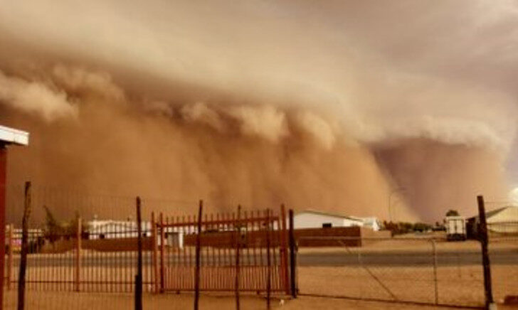
Large scale dust storm covers Upington, South Africa

storm
For several days now, a zone of active convection has dominated South Africa. Somewhere it becomes the cause of thunderstorms with hail and downpour, and in the city of Upington, South Africa, November 21, 2020, it caused a large-scale dust storm of the "hubub" type. The passage of a dust storm ended with a powerful downpour.


Cloud Precipitation

Somalia's strongest tropical cyclone ever recorded could drop 2 years' rain in 2 days

Tropical Cyclone Gati
© NOAA Hurricane Weather Research and Forecast SystemTropical Cyclone Gati, which made landfall in Somalia on Sunday, is the region's strongest cyclone ever recorded.
The strongest tropical cyclone ever measured in the northern Indian Ocean has made landfall in eastern Africa, where it is poised to drop two years' worth of rain in the next two days.

Tropical Cyclone Gati made landfall in Somalia on Sunday with sustained winds of around 105 mph. It's the first recorded instance of a hurricane-strength system hitting the country. At one point before landfall, Gati's winds were measured at 115 mph.

"Gati is the strongest tropical cyclone that has been recorded in this region of the globe; further south than any category 3-equivalent cyclone in the North Indian Ocean," said Sam Lillo, a researcher with the National Oceanic and Atmospheric Administration's Physical Sciences Laboratory.

Its intensification from about 40 mph to 115 mph was "the largest 12-hour increase on record for a tropical cyclone in the Indian Ocean," Lillo added.

Comment: In Earth Changes and the Human-Cosmic Connection Pierre Lescaudron explicates the drivers behind wind vortices of all kinds:
The accumulation of cometary dust in the Earth's atmosphere plays an important role in the increase of tornadoes, cyclones, hurricanes and their associated rainfalls, snowfalls and lightning. To understand this mechanism we must first take into account the electric nature of hurricanes, tornadoes and cyclones, which are actually manifestations of the same electric phenomenon at different scales or levels of power. Because of this similarity, we will refer to these three phenomena collectively as 'air spirals' in the following discussion.

McCanney [in his book Planet-X, Comets and Earth Changes] describes the electric nature of hurricanes in these terms:
A simple model showed that these [tropical] storms formed when electrical currents connected between the ionosphere and the top of the clouds. [...] the reason hurricanes lost power when they approached land was that the powering electrical current from the ionosphere to the cloud tops and to the Earth's surface had no connection (anode) while over the ocean so it drew up vast surface areas of ionized air from the ocean surface and sucked them up a central column (the spinning vortex was caused by the moist air rising 'up the drain')  whereas the land provided a 'ground' for the current and therefore it shunted out the storm's power source. [...] I also calculated that the warm water theory for hurricane development lacked sufficient energy to account for the energy in these massive storms. We later witnessed hurricanes on Mars where there is no water at all. Clearly, the warm water concept did not work [...]1
From this perspective, air spirals are simply the manifestation of electric discharges between the ionosphere and the Earth's surface. The image above shows a waterspout and a lightning bolt occurring in the same place at the same time, suggesting that indeed electric potential difference between the clouds at the top of the picture and the ground at the bottom is what powers both the lightning and the tornado.This additional feature of dust particles - their ability to carry an electric charge - means that dust accumulation enables any given area of the atmosphere to carry potentially massive electric charges, which can differ from the charge of adjacent regions, from the charge of the ionosphere and from the charge of the Earth's surface.
See also: And check out SOTT radio's: Behind the Headlines: Earth changes in an electric universe: Is climate change really man-made?


Galaxy

Wellington set for cloudiest November ever, Seoul breaks rainfall record - 'Cosmic ray flux' explained

cosmic rays


Cloud cover is increasing across the planet as the Sun's magnetic field continues to weaken, decreasing the outward pressure of the solar wind and allowing more cosmic rays to penetrate Earth's atmosphere.


This year's record start to the Northern Hemisphere snow season is due to two factors: 1) falling temperatures across the mid-latitudes, and 2) an increase in cloud cover.

Both of these factors are linked to low solar activity, and while each impacts the other, factor 1 is mainly due to a weakening of the jet stream, with factor 2 predominantly the result of an influx of cloud nucleating cosmic rays.

Very briefly, Galactic Cosmic Rays are a mixture of high-energy photons and sub-atomic particles accelerated toward Earth by supernova explosions and other violent events in the cosmos. Solar Cosmic Rays are the same, though their source is the sun. Both Galactic and Solar Cosmic rays hitting Earth's atmosphere create aerosols which in turn seed clouds (Svensmark et al) — making them an key component in our weather and climate. Recent balloon flights by spaceweather.com and Earth to Sky Calculus reveal that cosmic rays are intensifying:

Comment: See also:


Snowflake Cold

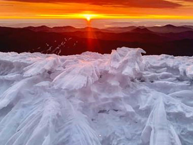
Winter is coming: The top of Mount Washington in New Hampshire looked like a frozen wasteland

froze
© Patrick Hummel
Holy cow! It's a bit cold on top of Mount Washington State Park.

Check out these pictures below of sheer frozenness. It looks like everything has been dusted in powdered sugar but if only it were that sweet.

Temperatures at the summit on Wednesday, according to the New Hampshire State Parks Facebook page, were at 2 degrees but with the windchill, it was really like -30 degrees.

According to the New Hampshire State Parks, this winter wonderland was 3 inches of snowfall and wind gusts of 50-70 miles an hour.

Park Manager Patrick Hummel braved these incredible conditions to bring us these photos.

Snowflake

Flights grounded, highways closed as snowstorms hit northeast China

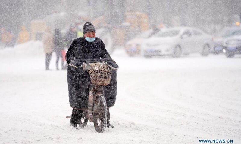
A man rides an electric vehicle in snow on Zhongshan Road in Harbin, northeast China's Heilongjiang Province, Nov. 19, 2020.
Snowstorms in China's northernmost province of Heilongjiang have grounded more than 100 flights and forced expressways and schools to be closed, local authorities said Thursday.

The province's meteorological center has issued a red alert for heavy snow, the highest in China's weather warning system, and upgraded the emergency response to the second-highest level.

Snowfall of up to 25.8 mm was recorded in cities including Harbin and Mudanjiang, bringing a blanket of snow 17 cm deep in some places, according to the center.

Educational authorities in Harbin, the provincial capital of Heilongjiang, said primary and middle schools and kindergartens in the city would be closed on Thursday due to heavy snowfall.