Extreme Temperatures
S


Snowflake

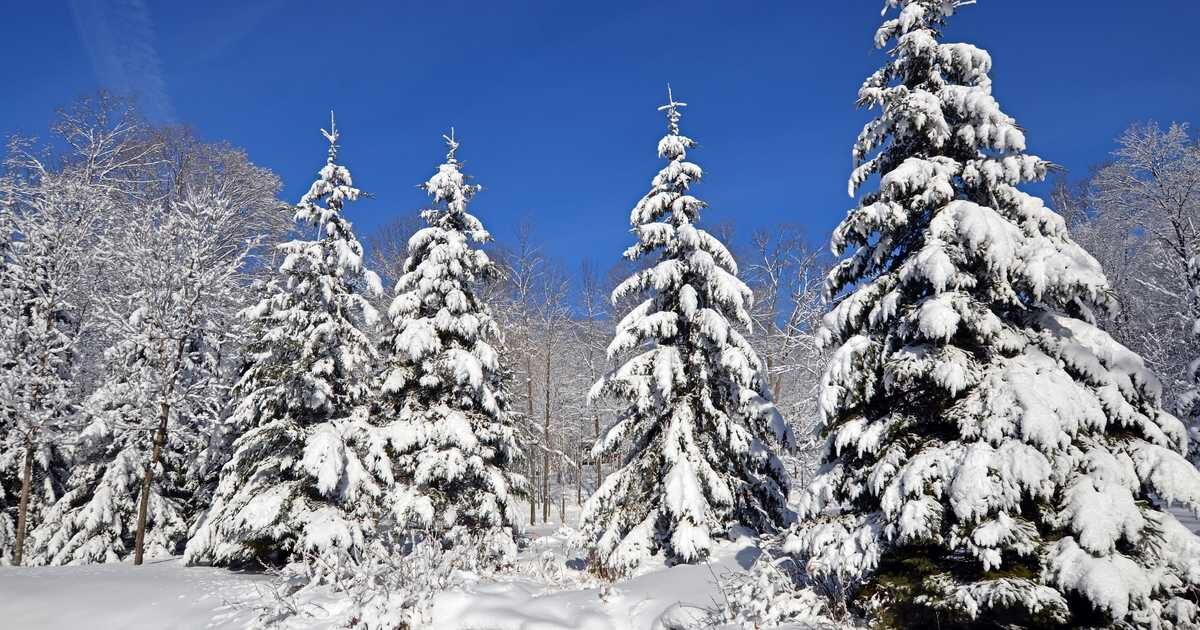
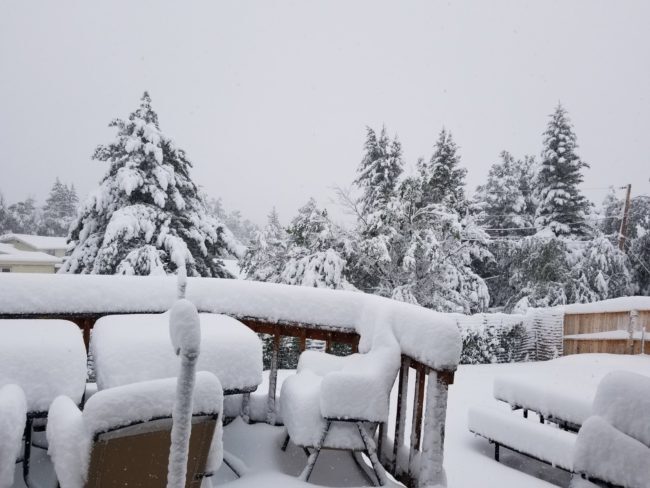
Snow has already made its way to parts of Quebec... and it's only September

photo was used for illustrative purposes only.
Photo used for illustrative purposes only.
On September 14, Environment Canada issued frost advisories for certain southern parts of the province, predicted for the following days. But frost seems like a blessing when you find out that some of Northern Quebec got snow dropped on it this Saturday.

Yes, snow... in September. Which means it may just be time to pull out your hats, scarves and mittens.

A meteorologist for MétéoMedia, Sophie Colombani, tweeted "Snow this morning on the side of the Réserve faunique des Laurentides" on Saturday, September 19. She also noted that Montreal's temperature dropped to 2 C the previous night.


Snowflake

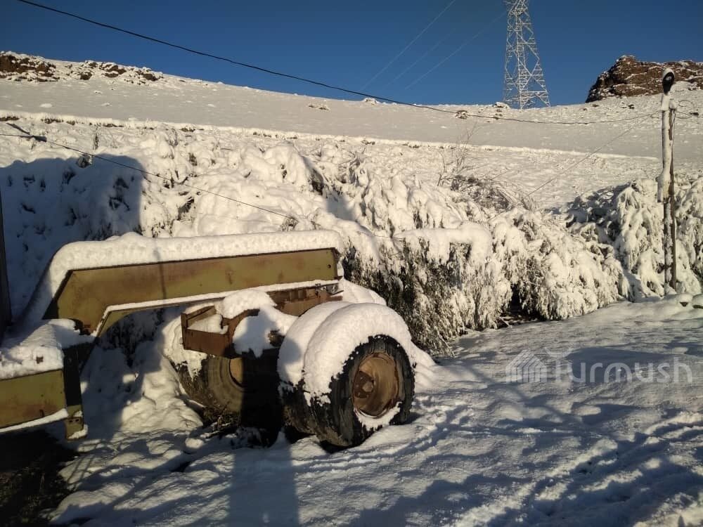
Up to 6 inches of early snow hits Kyrgyzstan

snow
Snow has fallen in Talas district.

It fell in the night of September 18, district governor Zamir Sydykov said.

The local authorities and farmers estimate the amount of crops covered by snow.

"Snow has fallen in Taldy-Bulak and Kopuro-Bazar. Herders managed to drive cattle from pastures. Crops remained unharvested however. The rural municipalities are evaluating the caused damage," the governor said.


Comment: Additional details from the same source later on in the day:
The Too-Ashuu, Ala-Bel, Kok-Bek and Otmok passes on Kyrgyzstan's major roads were cleared from snow allowing resumption of traffic, the Ministry of Transport and Roads announced.

The snow fell overnight on those passes. The snow cover reached 10-15cm in some places, causing traffic jams.

The passes were cleared from snow and the roads were treated to prevent icing.

snow


Snowflake

Heavy snow and high winds shut down French ski resorts as Storm Eleanor reaches the Alps

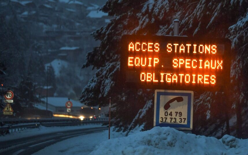
A sign on the road to Les Menuires and Val Thorens reads
© JEAN-PIERRE CLATOTA sign on the road to Les Menuires and Val Thorens reads "Special equipment required"
Many resorts in the French Alps were only open for limited skiing on Thursday, and some were closed completely, as Storm Eleanor reached the mountains this week.

As well as high winds causing chairlifts and gondolas to be closed for safety reasons, heavy precipitation - both snow and rain - raised the avalanche warning to level 5, denoting the highest level of risk, in many French destinations.

The linked resorts of Tignes and Val d'Isère were among the worst affected. With the avalanche risk at 5, visitors to Tignes were asked to stay indoors until around 11am on Thursday morning until given the all-clear. The ski area for both resorts was closed all day, with no lifts running, and the road to Bourg St Maurice was closed until late afternoon.

Binoculars

Weary warblers: Birds seen acting strangely after cold snap in Colorado

Locals have reported seeing birds around their house — and sometimes inside their house — like this juvenile Wilson's Warbler, still learning how to fly.
© GettyLocals have reported seeing birds around their house — and sometimes inside their house — like this juvenile Wilson's Warbler, still learning how to fly.
Those weary Wilson's warblers.

Area residents have been noticing the little yellow and green birds in their yards — sometimes acting punch-drunk — following the cold snap and snowfall last week.

While it seems logical that the behavior is due to the cold snap, there may be two separate things going on simultaneously.

A large number of dead birds in the Fryingpan Valley was reported by residents Wednesday on the Roaring Fork Road and Weather Facebook page.

The event might not be exclusive to the Roaring Fork Valley — on Saturday, the Las Cruces Sun News reported that migratory birds are dying in "unprecedented" numbers throughout New Mexico.

Comment: Related: Growing number of dead birds in southern New Mexico raise alarm for wildlife experts


Snowflake

Spring storm brings up to 15.7 inches of late snow to skifields in New Zealand

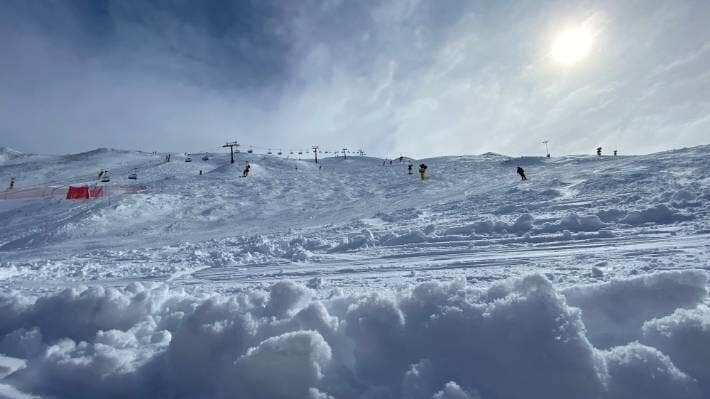
Coronet Peak is in the midst of a three-day spring snow storm with 15cm of fresh snow on Tuesday morning.
Skiers and snowboarders booking flights to Queenstown could be in for a cracker weekend with the region in the midst of a three-day snow storm.

Treble Cone had up to 40 centimetres of fresh snow dumped at the saddle on Monday night while Coronet Peak and Cardrona skifields​ had 15cm.

Metservice meteorologist Lewis Ferris said more snow was forecast.


Wednesday would bring showers and snow down to 1200 metres, and cold air would drop the snow level to 700m on Thursday, he said.

Snowflake

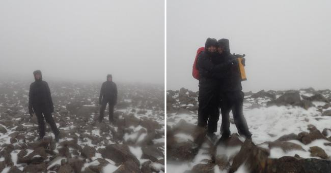
Scotland weather: Early snow on Ben Nevis summit as summer ends

Winter is coming: Scotland's first snow of the season grazes summit of Ben Nevis as summer officially ends
The first snow of the season has fallen in Scotland just weeks after summer officially ended.

Keen climbers took to Ben Nevis on Saturday afternoon to find snow on the ground at the summit.

Pictures from the Abacus Mountain Guides team show the tell-tale signs of a chilly, Scottish winter on the tip of the UK's highest mountain in Lochaber.

And one member of the group even appears to be wearing shorts while experiencing the country's first snow of the season.

Snowflake

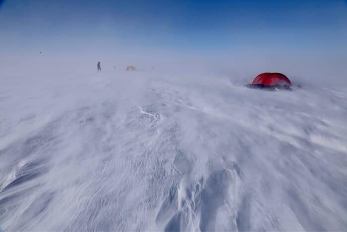
Storms, deep snow hinder 3 Greenland expeditions

All three Greenland teams faced storms this week.
© Matthieu TordeurAll three Greenland teams faced storms this week.
Despite unfavorable conditions, the three Greenland expeditions are progressing across the Inland Ice.

Norwegian sisters Aase and Hanne Seeberg are performing strongly on their east-to-west traverse. After 22 days, they are due to arrive at DYE II, an old radar station about three-quarters of the way along their 600km route.

"They have found deep snow but have skied a regular 20km every day," reports expedition liaison Lars Ebbeson. "They cleared the Summit [the apex of the Ice Sheet] before the last storm on the east side, so have been able to progress over the last few days."

Boat

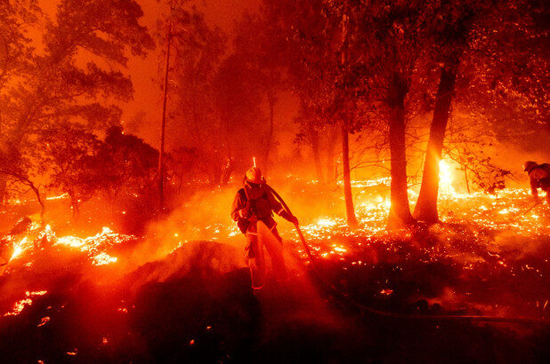
Think 2020's disasters are wild? Worse is yet to come say experts

Creek Fire
© APA firefighter battles the Creek Fire as it threatens homes in the Cascadel Woods neighborhood of Madera County, California.
A record amount of California is burning, spurred by a nearly 20-year mega-drought. To the north, parts of Oregon that don't usually catch fire are in flames.

Meanwhile, the Atlantic's 16th and 17th named tropical storms are swirling, a record number for this time of year. Powerful Typhoon Haishen lashed Japan and the Korean Peninsula this week. Last month it hit 130 degrees in Death Valley, the hottest Earth has been in nearly a century.

Phoenix keeps setting triple-digit heat records, while Colorado went through a weather whiplash of 90-degree heat to snow this week. Siberia, famous for its icy climate, hit 100 degrees earlier this year, accompanied by wildfires. Before that Australia and the Amazon were in flames.

Comment: While former NASA chief scientist Abdalati is wrong about a number of things, it is obvious to anyone paying attention that there are great changes afoot on our planet. And so for a more compelling answer as to what's driving these changes and that also explains the increase in extreme and unusual events, across the board, from sinkholes; extreme temperature swings; global cooling; the meandering jet stream and stalling gulf stream; the unusual electrical activity in our skies; the rise in fireballs and comets; the increase in volcanic and seismic events - and much more - check out Pierre Lescaudron and Laura Knight-Jadczyk's book Earth Changes and the Human-Cosmic Connection, as well as the following SOTT podcasts:


Snowflake Cold

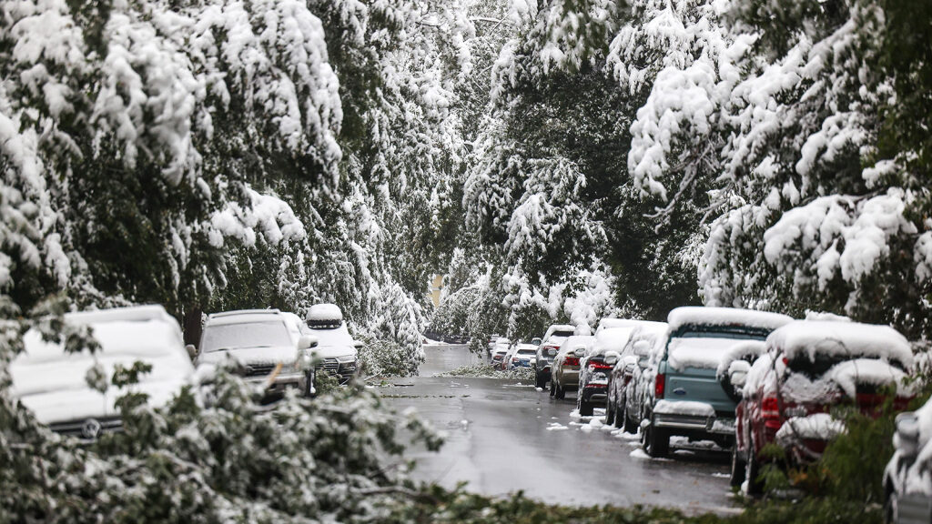
Temperature extremes: Colorado shatters multiple records as wild weather continues

Fallen tree limbs block a street during an early season snow storm on September 9, 2020 in Boulder, Colorado.
© Michael CiagloFallen tree limbs block a street during an early season snow storm on September 9, 2020 in Boulder, Colorado.
A wild week of weather continues to unfold in Colorado that started with 100+ degree temperatures and transitioned into more than a more than a foot of snow in parts of the state.

Here's a look at some of the weather records that were set in the Centennial State during this tumultuous time.


Snowflake Cold

September snow blankets parts of 4 US states - up to 17 inches deep

casper wyoming snow
Casper Wyoming snow
Seventeen inches of snow, 70-degree temperature drops and the earliest snowfall on record were just part of a record September winter blast.

Seventeen inches of snow in Wyoming, the earliest snowfall on record for New Mexico and the earliest flakes in decades for parts of Colorado — these are just a few of the astonishing weather reports coming out of a record-setting September week.

On Wednesday morning, snow was falling over parts of Colorado and 5 million people remained under winter weather alerts across portions of the Northern and Central Rockies. Those in the Denver area woke up to 1 to 4 inches of snow coating trees and grassy surfaces.

A few more inches of snow was possible, mostly at the highest elevations, before the snow was expected to end by afternoon.