Extreme Temperatures
S


Snowflake

Snow falls in South Africa as temperatures plummet

Snow had blanketed the landscape at Lake Naverone by Tuesday afternoon.
© Southern Drakensberg/FacebookSnow had blanketed the landscape at Lake Naverone by Tuesday afternoon.
Snow lovers have been delighted with yet another winter wonderland scene in the KwaZulu-Natal Drakensberg on Tuesday.

Snow fell in the Southern Drakensberg, Lesotho and parts of the Eastern Cape on Tuesday leading to a flurry of photographs of the latest snowfall being shared on social media.

SA Weather Services Forecaster Lehlohonolo Thobela told the South African that the snow had started falling earlier on Tuesday but it was expected to be short-lived and to clear up overnight. He said snow had fallen in the Southern Drakensberg, parts of the Eastern Cape and in the Lesotho highlands.


Snowflake

Rare snowfall recorded on several roads in Ecuador

A heavy snowfall was registered this Monday, September 6 in some localities of the country.
A heavy snowfall was registered this Monday, September 6 in some localities of the country. The unusual meteorological phenomenon caused the closure of roads and the consequent paralysis of the circulation of vehicles.

The Quito-Papallacta road was one of those affected by the snowfall, from 03:05, and for safety reasons it was closed to traffic, reported ECU-911. The same happened on the Guaranda-Ambato highway.

According to the report of the emergency service, several units and relief teams were deployed in order to coordinate traffic control and safety actions and thus avoid any accident.


Comment: Some context to illustrate just how unusual this snowy situation is for the country:
Where is there Snowfall in Ecuador?

Conditions are not suitable for snow across most of Ecuador. In the west, the coastal lowlands are generally warm and enjoy year-round average temperatures of 77 degrees Fahrenheit (25 degrees Celsius). Even on higher ground in the capital city of Quito, the year-round average temperature sits at 64 degrees Fahrenheit (18 degrees Celsius).

The seasons in Ecuador can broadly be divided into the dry season (between June and September) and the wet season (from October to May). Give the year-round ambient temperatures, snow is almost unheard of across the vast majority of Ecuador's landmass. Even at higher altitudes into the Andes, it is simply too warm for snow to form and fall.

The only glimpse of snow travelers can look forward to is at the peaks of Ecuador's highest mountains. At over 20,000 ft (6,096 km) above sea level, the summits of these mountains are capped with snow throughout the entire year.


Snowflake

Mount Fuji's first snowcap of the season comes almost a month early

Mount Fuji
Mount Fuji
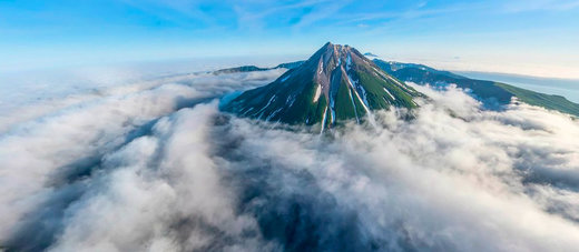
Mount Fuji's first snowcap of the season has arrived one month early.

Japan's 3,776m mountain was capped with white snow 25 days earlier than normal and 21 days earlier than last year.

Aerial footage captures the iconic mountain's symmetrical cone lightly dusted in fresh snow while its basaltic rock face remains clear.

A Kofu Local Meteorological Office staff member noticed a slightly blanketed white top in the early hours of this morning (September 7).

Local governments had received reports of snow on the summit since the day before, but clouds blocked meteorological observations from taking place.


Igloo

Texas cold snap linked to 40 years of increasing snowfall in Arctic & disruptions in stratospheric polar vortex - increase in extreme cold events likely - study

Arctic air mass global cooling ice age
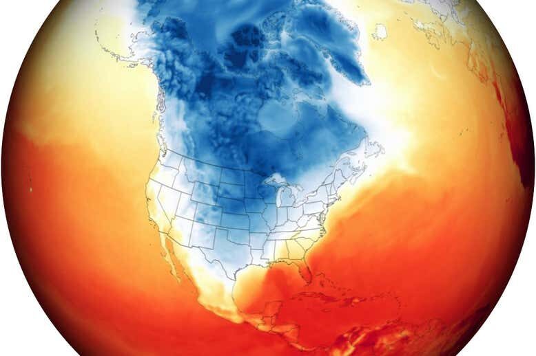
© Goddard Earth Observing System/NASAMap showing the extreme cold associated with the Arctic air mass, with the darkest blue regions indicating surface temperatures of -35°C
The extreme cold snap that left millions of people in Texas without power last winter appears to have been made more likely by melting Arctic sea ice thousands of kilometres away, research suggests.

For the past decade, evidence has been building in support of the counterintuitive idea that some of the recent cold winter spells at mid-latitudes in North America and Eurasia are linked to the Arctic warming faster than the rest of the world due to climate change.


Comment: In 2019, snowfall in the Arctic reached record levels and then devastated wildlife because it failed to melt by summer, and in 2018 Arctic and Antarctic sea ice also reached record levels; this, and a wealth of other data, demonstrate that, overall, the Arctic is not 'warming'.


Comment: What is important to note is that scientists appear to be no longer able to ignore the global cooling occurring on our planet. As for what's causing it: The rise in polar vortex events - a term unknown to most people 20 years ago - appears to be related to the increasingly meandering jet stream, the stalling Gulf Stream, Earth's weakening magnetosphere, and all of this and more is thought to be connected to our quieting Sun: For more on the shift occurring on our planet, check out SOTT radio's:


Snowflake

High peaks in Himachal Pradesh, India receive fresh early snow

snow
The high peaks of Kullu, Lahaul-Spiti, Chamba and Kangra districts received fresh snow on Friday, leading to sharp dip in temperature. While there has been intermittent rain in the lower regions, mountain peaks above 16,000ft height have been getting fresh snow since Thursday night.

The falling snow has raised the hopes of hoteliers, who expect higher footfalls to Rohtang pass and other tourist destinations in the state. As most visitors head to the hills to see snow, hoteliers believe Manali will witness a surge in tourist inflow after snowfall at Rohtang pass. However, apple growers in Lahaul are worried as fruit harvesting season in the valley starts in October.

Meteorological centre, Shimla, has predicted rain in mid and low hills and snowfall in high hills of the state in the next seven days. There is heavy rain warning with thunderstorms in mid and lower parts of the state.


Snowflake

August snowfall at ski hills in British Columbia

It was looking like a winter wonderland at Silver Star Tuesday morning.
© Silver Star Mountain ResortIt was looking like a winter wonderland at Silver Star Tuesday morning.
Yes, there was snow falling on the Coquihalla and some BC Interior ski hills, but that does not mean summer is over.

It does mean things are cooling down a lot.

From a record heat wave in June that lead to one of the worst fire seasons on record, a cold front has a brought a drastically different climate to the region.

Lisa Erven, Environment Canada meteorologist, said the cool temperatures on the last day of August resulted in flurries in certain areas including Silver Star, Whistler and parts of the Okanagan Connector, but as the day progressed, things warmed up and the snow disappeared.

Snowflake

Early snowfall recorded in high mountains of Uttarakhand, India - a fortnight earlier than normal

This season's first snowfall has occurred on the hills of Badrinath. There has been a lot of snowfall here on Neelkanth and Nar Narayan mountain.
Due to the rain in the hilly areas of Uttarakhand for the last few days, the cold has gradually started increasing in the mountains.

Along with this, snowfall has also started in the higher Himalayan regions.

The first snowfall of the season occurred on the peaks of Badrinath on Tuesday morning.

Until now, Nandashtami (September 13) was considered to be the beginning of winter.

But this year snowfall has started in the high Himalayan regions already a fortnight earlier.


Snowflake

Ski areas open in September after August snowfall in the Alps

Zugspitze
Zugspitze
Only four glacier ski areas are currently open as we enter September, but there should be nearer a dozen operating by the end of the month.

Last year the autumn openings of glaciers happened ass usual after the first wave of the pandemic, and there were actually huge early snowfalls up high. However already-open ski resorts in Austria, France and Italy were forced to close from late October due to the second wave of the virus and although Austria re-opened in January, and Swiss and Scandinavian ski centres stayed open throughout, travel bans meant few people made it on to the slopes. Those who skied or boarded in September and October 2020 were therefore among the lucky few.

So far there have been several August snow dustings on glaciers in the Alps, the good news is the snowfall has been getting heavier in recent days.

Pictured top is snowfall at the Zugspitze Glacier, Germany's highest ski area, last weekend. It is hoping to open for its 21-22 season on November 18th after missing last season entirely.


Snowflake

South Africans frolic in heavier than usual snowfall - up to 50cms

snow
South Africans frolick in the snow

DW's Adrian Kriesch drove just outside of Cape Town, an area that's currently seeing massive snow fall - much to the pleasure of both young and old.


Ice Cube

Sharp uptick in Arctic Sea ice: Extent on course to be the highest in 15 years

arctic
Arctic Sea Ice Extent has been holding exceptionally well during the 2021 summer melt season.

Throughout August, higher volumes than usual have survived due to cold conditions and favorable wind patterns.

As a result, Arctic Sea Ice Extent is now the highest in 8 years,
and, if this year's trajectory continues for another week or two (which is expected), 2021 will achieve the 'healthiest' extent of the past 15 years (since 2006).

Only 2014, 2013, and 2009 remain in its way - though the gap is narrowing, fast: